MyTopo
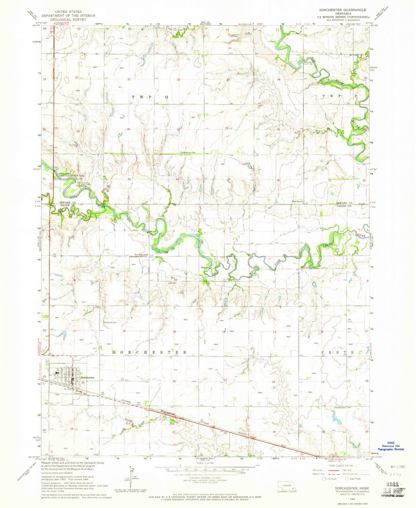
Classic USGS Dorchester Nebraska 7.5'x7.5' Topo Map
Couldn't load pickup availability
Historical USGS topographic quad map of Dorchester in the state of Nebraska. Map scale may vary for some years, but is generally around 1:24,000. Print size is approximately 24" x 27"
This quadrangle is in the following counties: Saline, Seward.
The map contains contour lines, roads, rivers, towns, and lakes. Printed on high-quality waterproof paper with UV fade-resistant inks, and shipped rolled.
Contains the following named places: Blue Bluffs Dam, Blue Bluffs Reservoir, Blue River State Recreation Area, Blue Valley School, Detention Dam 1-A, Detention Dam 2-A, Detention Dam 3-A, Detention Dam 4-A, Diamond Public School, Dorchester, Dorchester Cemetery, Dorchester City Park, Dorchester Election Precinct, Dorchester Farmers Co-op Elevator, Dorchester Post Office, Dorchester Public Library, Dorchester Public Schools, Dorchester Reservoir 4-A, Dorchester Volunteer Fire and Rescue, Election Precinct O, Goldhammer Cemetery, Johnson Creek, Reservoir 1-A, Reservoir 2-A, Reservoir 3-A, Saline County Museum, Siedhoff Dam, Siedhoff Reservoir, Star School, Township O, Township of Dorchester, United Methodist Church, Village of Dorchester, West Blue Church