MyTopo
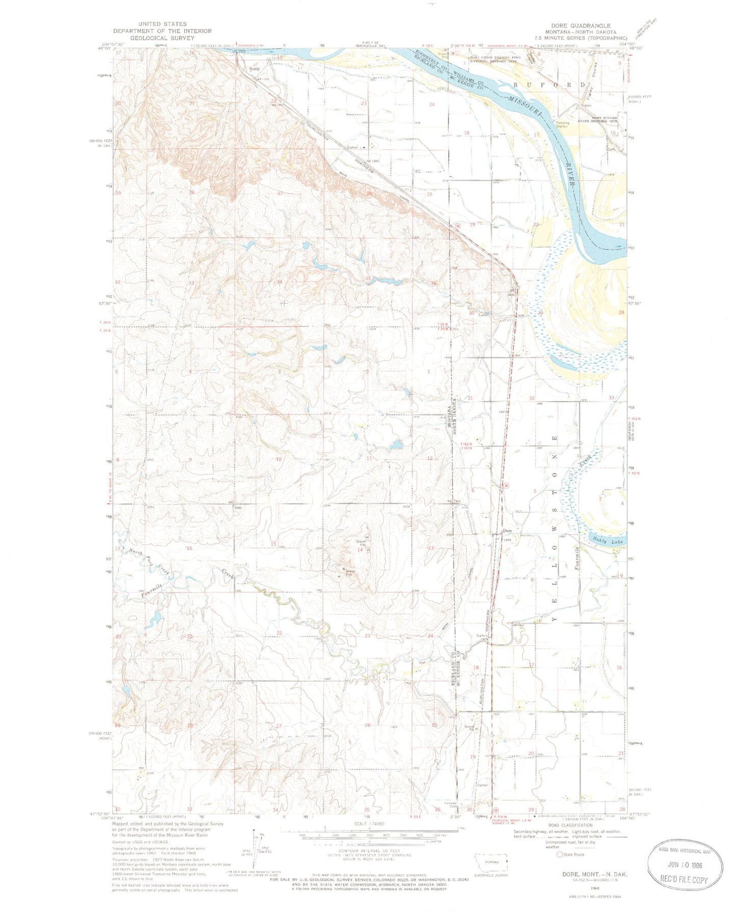
Classic USGS Dore North Dakota 7.5'x7.5' Topo Map
Couldn't load pickup availability
Historical USGS topographic quad map of Dore in the states of North Dakota, Montana. Map scale may vary for some years, but is generally around 1:24,000. Print size is approximately 24" x 27"
This quadrangle is in the following counties: McKenzie, Richland, Roosevelt, Williams.
The map contains contour lines, roads, rivers, towns, and lakes. Printed on high-quality waterproof paper with UV fade-resistant inks, and shipped rolled.
Contains the following named places: 25N59E24CCDC01 Well, 26N59E11BADB01 Well, 26N59E22AD__01 Well, 26N59E22DBDD01 Well, 26N59E23ABCA01 Well, 26N59E23BBDA01 Well, 26N59E26CADC01 Well, Candee Dam, Dore, Fairview Cemetery, Figley Coulee, Flecher Reservoir Dam, Fort Buford, Fort Buford Cemetery, Fort Buford State Historic Site, Fort Union, Garden Coulee, Java Post Office, La Bonte Dam, Lars Borg Dam, Main Canal, Nohle, Nohly, Nohly Lake, Nohly Post Office, Nohly School, North Fork Fourmile Creek, Simon Spring, Township of Yellowstone