MyTopo
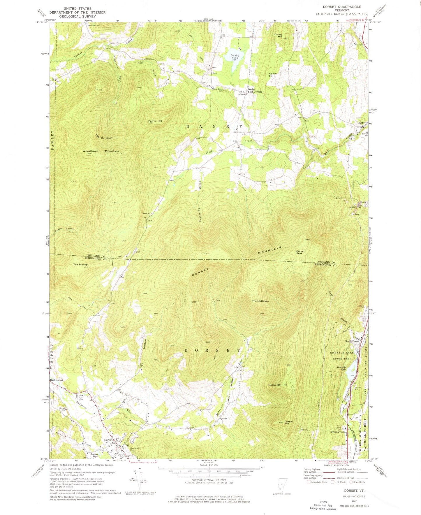
Classic USGS Dorset Vermont 7.5'x7.5' Topo Map
Couldn't load pickup availability
Historical USGS topographic quad map of Dorset in the state of Vermont. Typical map scale is 1:24,000, but may vary for certain years, if available. Print size: 24" x 27"
This quadrangle is in the following counties: Bennington, Rutland.
The map contains contour lines, roads, rivers, towns, and lakes. Printed on high-quality waterproof paper with UV fade-resistant inks, and shipped rolled.
Contains the following named places: Colvin Hill, Danby Four Corners, Danby Hill, Danby Pond, Dorset, Dorset Hill, Dorset Hollow, Dorset Mountain, Dorset Peak, Emerald Lake, Emerald Lake State Forest, Emerald Lake State Park, Fall Brook, Freedleyville, Gulf Brook, Kirby Hollow, Maple Grove Cemetery, Maple Hill Cemetery, Mountain Brook, Netop Mountain, North Dorset, Parris Hill, Prentiss Brook, Prentiss Pond, The Mettawee, The Ox Bow, The Scallop, Weatherby Brook, Woodlawn Mountain, Green Mountain National Forest, Town of Danby, Town of Dorset, Campground A, Campground B, Campground C, Dorset Historical Society Building, Dorset Historical Society Museum, Dorset Post Office, Emerald Lake Natural Bridge, Freedley Quarry (historical), Gifford Cemetery, Hazelton Cemetery, Maple Hill Cemetery, Maynard Sawmill (historical), Maryville Campground, North Dorset Cemetery, North Dorset Farms (historical), School Number 12 (historical), Blackner - Hazelton Cemetery, Corner Church, Danby Marble Quarry (historical), Dillingham Cemetery, Otis Cemetery, Quaker - Staples Farm Cemetery, Read - Old Four Corners Cemetery, Red School House Cemetery, Danby - Mount Tabor Volunteer Fire Department Station 2, Mountain View Christian Academy, Long Trail School, Dorset Census Designated Place