MyTopo
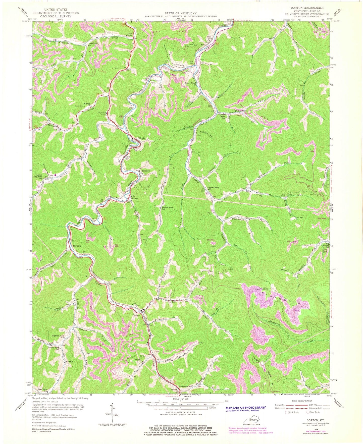
Classic USGS Dorton Kentucky 7.5'x7.5' Topo Map
Couldn't load pickup availability
Historical USGS topographic quad map of Dorton in the state of Kentucky. Map scale may vary for some years, but is generally around 1:24,000. Print size is approximately 24" x 27"
This quadrangle is in the following counties: Pike.
The map contains contour lines, roads, rivers, towns, and lakes. Printed on high-quality waterproof paper with UV fade-resistant inks, and shipped rolled.
Contains the following named places: Adkins Branch, Andy Akers Branch, Arnold Fork, Bear Fork School, Beatrice Post Office, Beefhide Creek, Belcher Cemetery, Bethel Freewill Baptist Church, Bethlehem Church, Big Branch School, Big Card, Blaze Branch, Booker Fork, Booker Fork School, Booker Hollow, Branham Branch, Bratten Hollow, Brushy Fork, Brushy Fork School, Burk Branch, Cabin Fork, Cane Branch, Caney Creek, Caney Creek Old Regular Baptist Church, Coal Branch, Community Hospital, Dameron Post Office, Deadening Fork, Doc Bell Branch, Doc Sanders Cemetery, Dorton, Dorton Creek, Dorton Division, Dorton Post Office, Dorton School, Dorton Volunteer Fire Department, Elimer, Ellwood, Elmer Station, Elswick Branch, Elswick Railroad Station, Elswick School, Elwood Railroad Siding, Esco, Esco Post Office, Esco School, Flat Fork, Flatwood Lookout Tower, Flatwoods, Flatwoods School, Fleming Branch, Frogtown, George F Johnson School, Gospel Chapel, Greer Cemetery, Herman Siding, Hopkins Fork, Indian Creek, Indian Gap, John Greer Hollow, John Ray Branch, Jonancy, Jonancy Post Office, Jones Chapel, Kinney Branch, Left Fork Caney Creek, Lick Fork, Lionille Post Office, Lionilli, Little Branch, Little Cemetery, Little Fork, Little Fork School, Lizzie Fork, Long Fork, Lower Caney School, Lower Long Fork School, Martin Cemetery, Missionary Alliance Church, Myra, Myra Railroad Station, Myra School, Myra Station, Newsome Branch, Newsome Cemetery, Newsome Memorial Cemetery, Orchard Branch, Owl Branch, Penny, Penny Post Office, Penny Railroad Station, Penny School, Phillips Branch, Pig Branch, Pilgrims Rest Church, Pine Fork, Rob Fork, Roberts Hollow, Robinson Creek Division, Rock Fork, Rockhouse Fork, School Number 130, School Number 151, Sheep Cliff, Shelby Valley Volunteer Fire Department Station 2 Virgie, Sowards Cemetery, Stagerweed Fork, Stewart Post Office, Stiltner Cemetery, Sycamore Fork, Tackett Hollow, Threemile Branch, Threemile Ridge, Threemile School, Trace Fork, Union Church, Upper Caney School, Virgie, Virgie Census Designated Place, Virgie Post Office, Virgie School, Voice of Victory Revival Church, WKPI-TV (Pikeville), ZIP Code: 41538