MyTopo
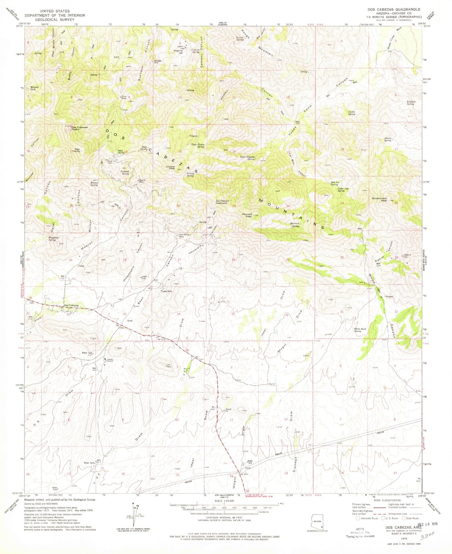
Classic USGS Dos Cabezas Arizona 7.5'x7.5' Topo Map
Couldn't load pickup availability
Historical USGS topographic quad map of Dos Cabezas in the state of Arizona. Typical map scale is 1:24,000, but may vary for certain years, if available. Print size: 24" x 27"
This quadrangle is in the following counties: Cochise.
The map contains contour lines, roads, rivers, towns, and lakes. Printed on high-quality waterproof paper with UV fade-resistant inks, and shipped rolled.
Contains the following named places: Alamo Spring, Bean Canyon, Bob Lee Spring, Bota Chiquita Spring, Buckeye Mine, Casa Piedra Spring, Cedar Log Spring, Cement Spring, Cooper Peak, Curtis Spring, Dos Cabezas, Dos Cabezas Catchment, Dos Cabezas Mountains, Dos Cabezas Peaks, Elefante Spring, Elma Mine, Gold Prince Mine, Government Peak, Happy Camp Canyon, Howard Canyon, Howard Peak, Howell Canyon, Ivanhoe Spring, Leroy Mine, Mascot Canyon, Mascot Mine, Mexican Spring, Mineral Park, Philadelphia Canyon, Rancho Sacatal, Rough Mountain, Siphon Canyon, Tar Box Canyon, Tunnel Spring, Turkey Spring, Virginia Hill, Walnut Canyon, Walnut Spring, Waughtal Spring, White Rock Spring, Cienega Spring, Iron Tower, Dos Cabezas Mountains Wilderness