MyTopo
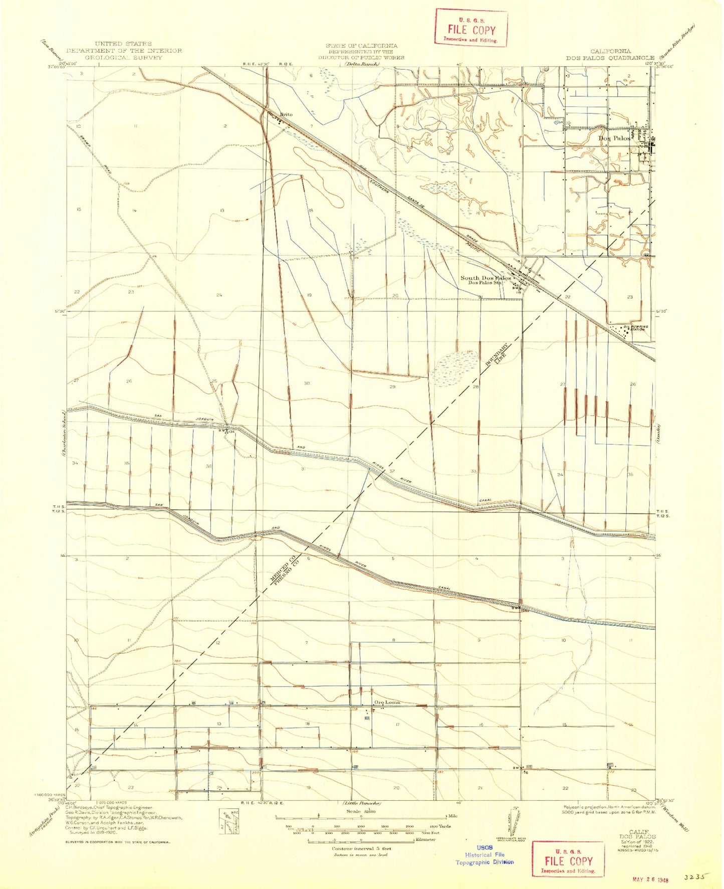
Classic USGS Dos Palos California 7.5'x7.5' Topo Map
Couldn't load pickup availability
Historical USGS topographic quad map of Dos Palos in the state of California. Map scale may vary for some years, but is generally around 1:24,000. Print size is approximately 24" x 27"
This quadrangle is in the following counties: Fresno, Merced.
The map contains contour lines, roads, rivers, towns, and lakes. Printed on high-quality waterproof paper with UV fade-resistant inks, and shipped rolled.
Contains the following named places: Agatha Gun Club, Brito, Chateau Duck Club, City of Dos Palos, Colony Branch Number Three Canal, Colony Branch Number Two Canal, Coon Duck Club, Dos Palos, Dos Palos Airport, Dos Palos Branch Merced County Library, Dos Palos Cemetery, Dos Palos City Hall, Dos Palos Elementary School, Dos Palos Memorial Hospital, Dos Palos Police Department, Dos Palos Post Office, Eagle Field, Gable Ranch, George Christian Elementary School, Laguna Canal, Merced County Fire Department Dos Palos Fire Station 76, New Hope Foundation School, Nine Old Men Hunt Club, Oro Loma, Rice Drain, Shain Drain, South Dos Palos, South Dos Palos Census Designated Place, South Dos Palos Post Office, Sunny Side-Rainbow Hunt Club, Vista Farms Duck Club, ZIP Code: 93665