MyTopo
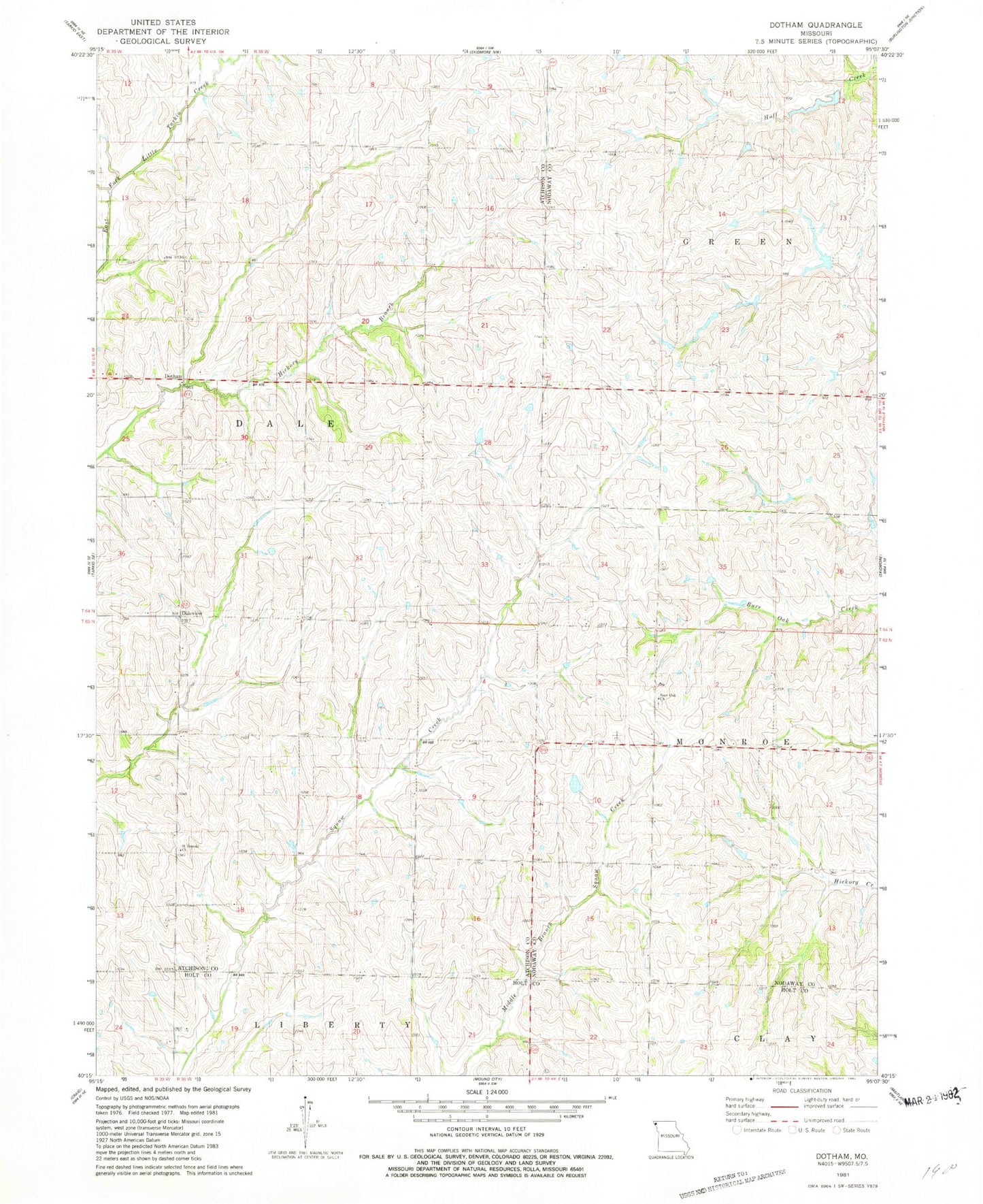
Classic USGS Dotham Missouri 7.5'x7.5' Topo Map
Couldn't load pickup availability
Historical USGS topographic quad map of Dotham in the state of Missouri. Map scale may vary for some years, but is generally around 1:24,000. Print size is approximately 24" x 27"
This quadrangle is in the following counties: Atchison, Holt, Nodaway.
The map contains contour lines, roads, rivers, towns, and lakes. Printed on high-quality waterproof paper with UV fade-resistant inks, and shipped rolled.
Contains the following named places: Burr Oak Church, Burr Oak School, Daleview School, Dotham, Goodwill School, Guy, Mount Hope School, Oswald, Oswald Post Office, Patterson Farms Lake Section 12, Patterson Farms Lake Section 12 Dam, Patterson Farms Lake Section 13, Patterson Farms Lake Section 13 Dam, Patterson Farms Lake Section 23, Patterson Farms Lake Section 23 Dam, Saint Oswold Church, Salem School, West Point School