MyTopo
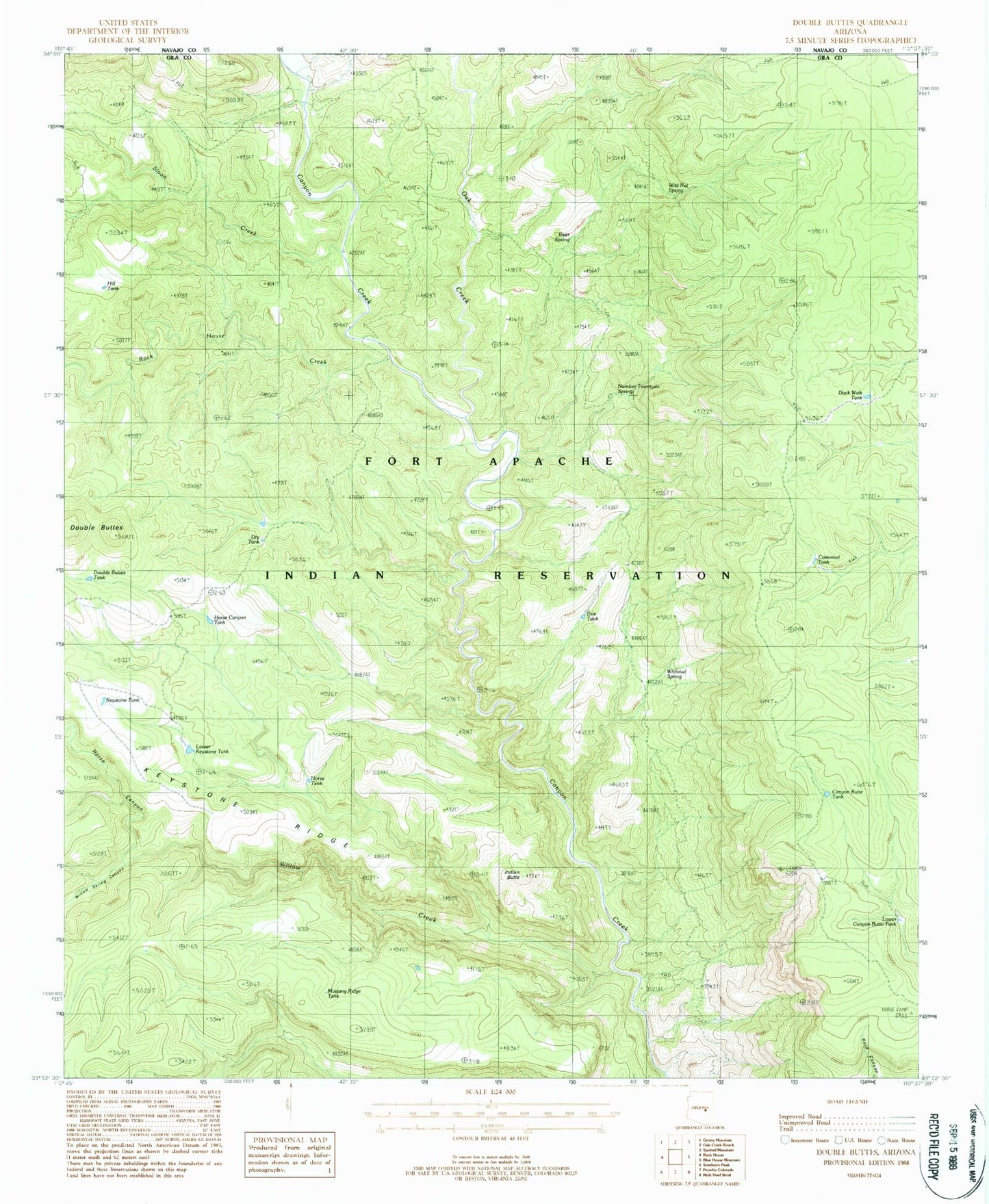
Classic USGS Double Buttes Arizona 7.5'x7.5' Topo Map
Couldn't load pickup availability
Historical USGS topographic quad map of Double Buttes in the state of Arizona. Map scale may vary for some years, but is generally around 1:24,000. Print size is approximately 24" x 27"
This quadrangle is in the following counties: Gila.
The map contains contour lines, roads, rivers, towns, and lakes. Printed on high-quality waterproof paper with UV fade-resistant inks, and shipped rolled.
Contains the following named places: Canyon Butte Tank, Cottontail Tank, Deer Spring, Doe Tank, Double Butte Tank, Dry Tank, Duck Walk Tank, Hill Tank, Horse Canyon, Horse Canyon Tank, Horse Tank, Indian Butte, Keystone Ridge, Keystone Tank, Lower Canyon Butte Tank, Lower Keystone Tank, Mustang Ridge Tank, Number Twentysix Spring, Oak Creek, Rock House Canyon, Rock House Creek, Sloan Creek, Whitetail Spring, Wild Nut Spring, Willow Creek, Willow Spring Canyon