MyTopo
Classic USGS Double Lakes Georgia 7.5'x7.5' Topo Map
Couldn't load pickup availability
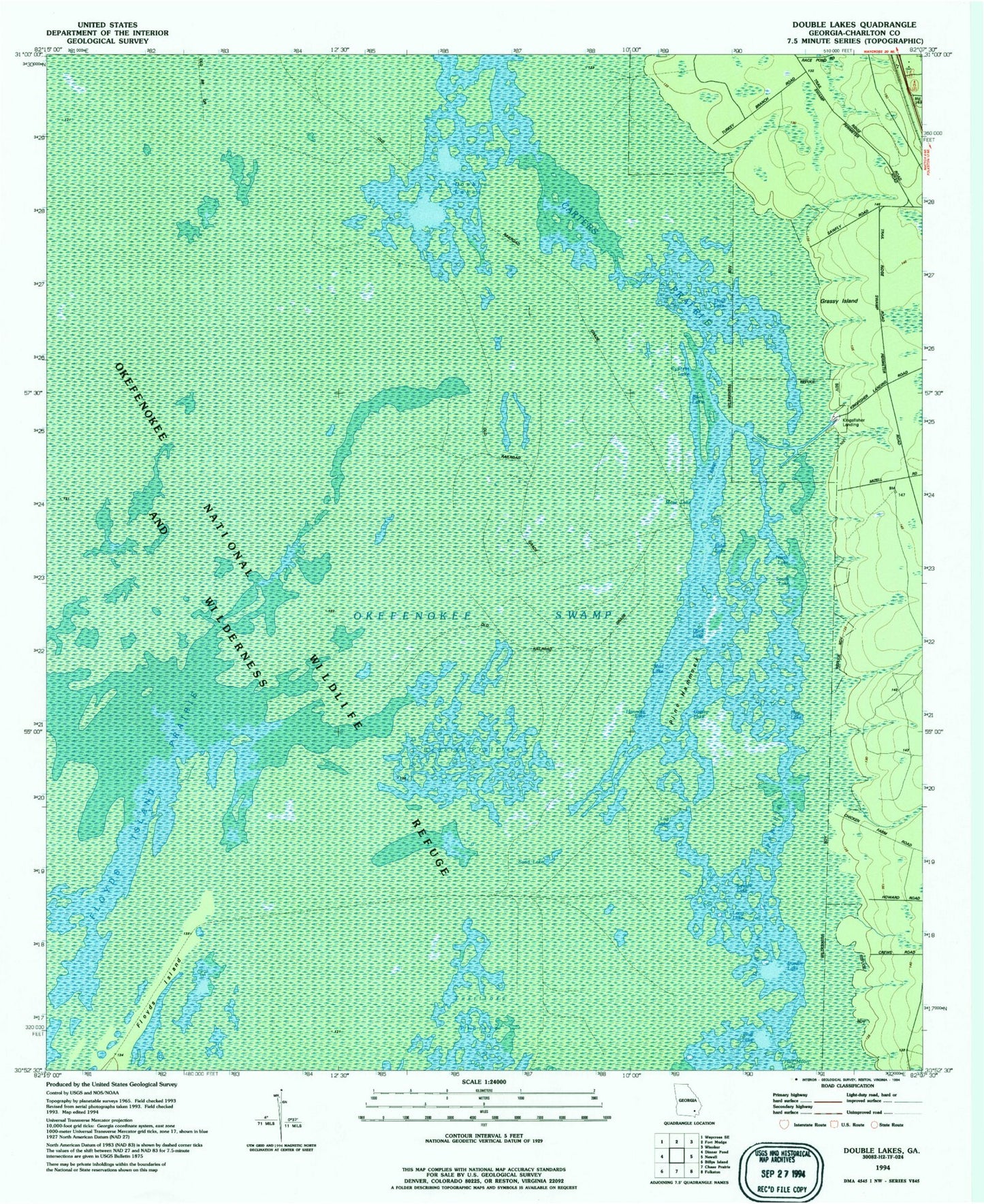
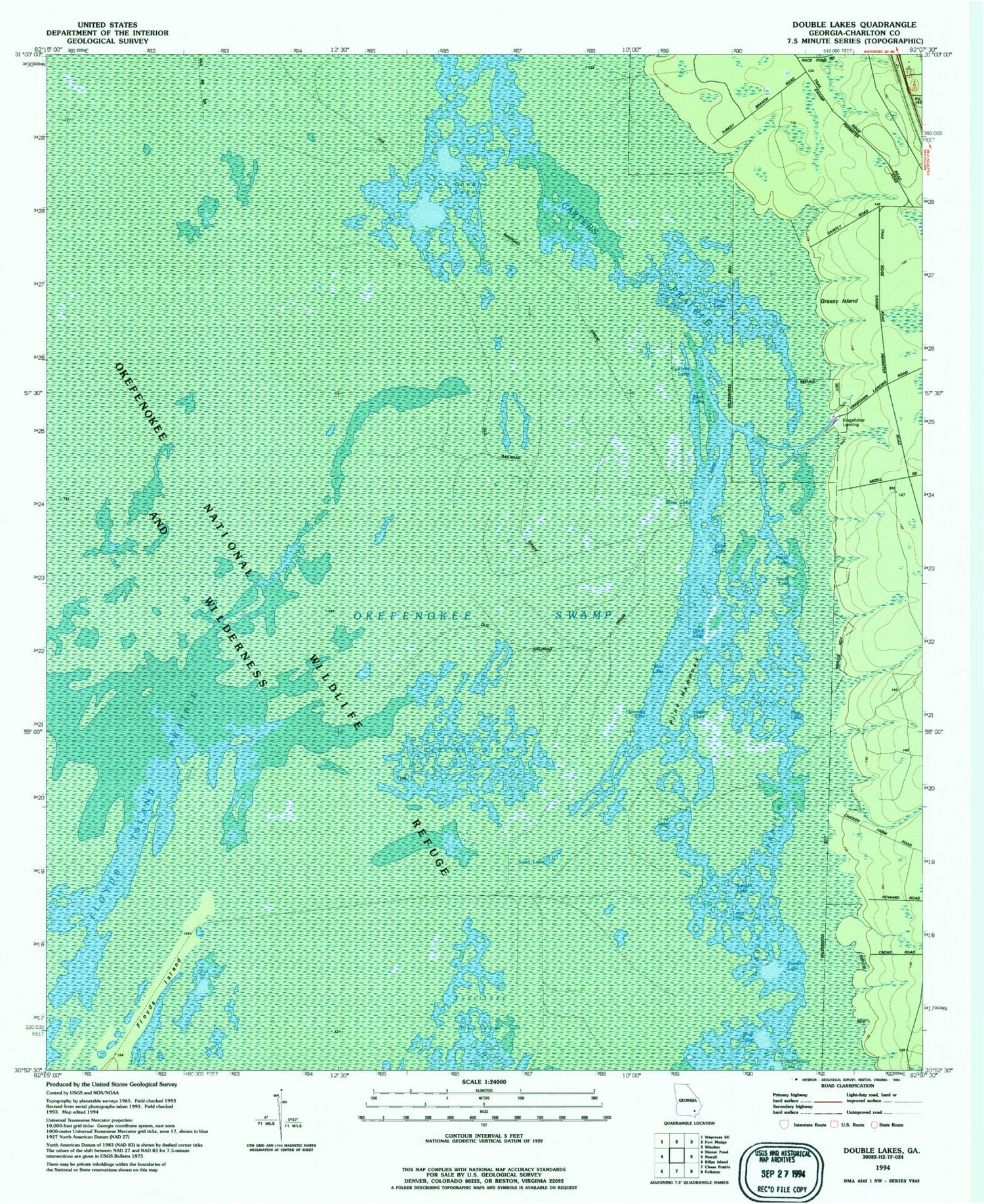
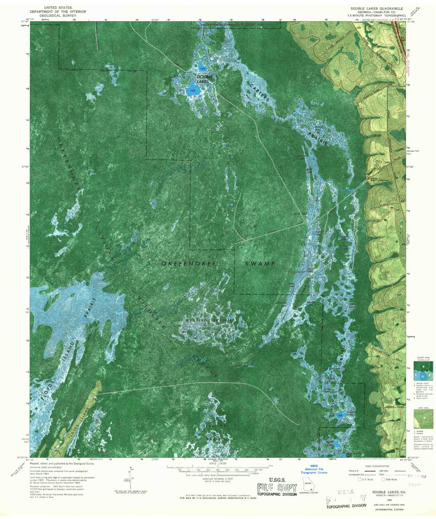
Historical USGS topographic quad map of Double Lakes in the state of Georgia. Map scale may vary for some years, but is generally around 1:24,000. Print size is approximately 24" x 27"
This quadrangle is in the following counties: Charlton.
The map contains contour lines, roads, rivers, towns, and lakes. Printed on high-quality waterproof paper with UV fade-resistant inks, and shipped rolled.
Contains the following named places: Bear Lake, Bluff Lake, Carters Prairie, Cypress Lake, Double Lakes, Duck Lake, Durdin Lake, Durdin Prairie, Elder Lake, Flag Lake, Folkston Division, Grassy Island, Grassy Lake, Hannom Lake, Kingfisher Landing, Log Lake, Long Lake, Mose Lake, Mud Lake, North Lake, Perch Lake, Pine Hammock, Redbird Prairie, Sand Lake, South Lake, Square Lake, Trout Lake