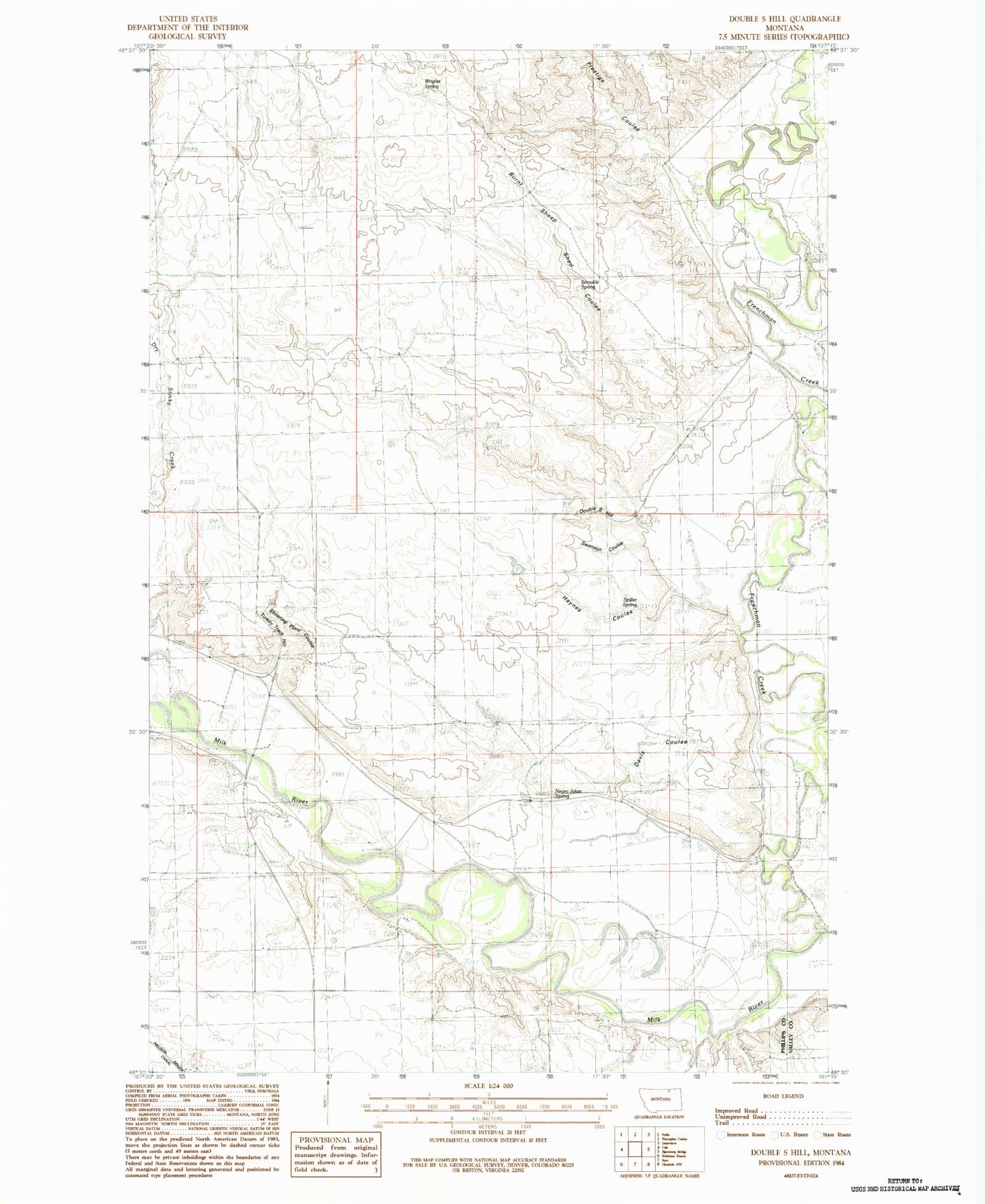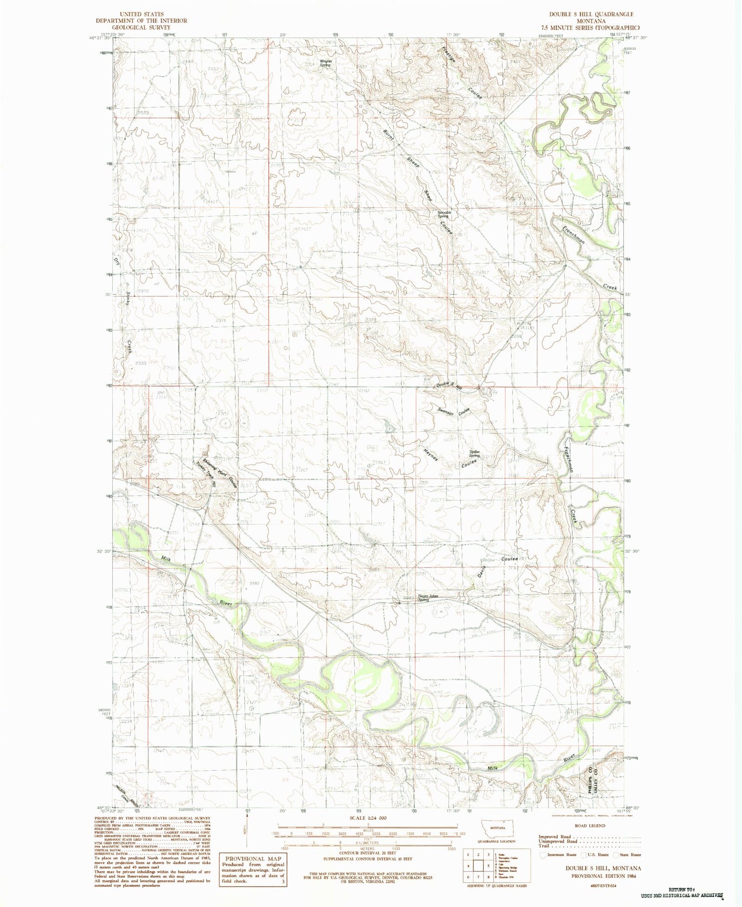
MyTopo
Classic USGS Double S Hill Montana 7.5'x7.5' Topo Map
Couldn't load pickup availability
Historical USGS topographic quad map of Double S Hill in the state of Montana. Map scale may vary for some years, but is generally around 1:24,000. Print size is approximately 24" x 27"
This quadrangle is in the following counties: Phillips, Valley.
The map contains contour lines, roads, rivers, towns, and lakes. Printed on high-quality waterproof paper with UV fade-resistant inks, and shipped rolled.
Contains the following named places: 32N34E07DCC_01 Well, Bench School, Bone Crossing, Burnt Sheep Shed Coulee, Callahan School, Davis Coulee, Davis Ranch, Double S Hill, Frenchman Creek, Galiger's Ranch, Gertrude Dam, Haynes Coulee, Hunter School, Hunter's Ranch, Jordan Crossing, Negro Jakes Spring, Prestige Coulee, Randall School, Randall's Ranch, River School, Shearing Plant Coulee, Spiller Spring, Strouble Spring, Swenson Coulee, Terrells Coulee, Turkey Track Hill, Whitford's Ranch, Wrights Spring