MyTopo
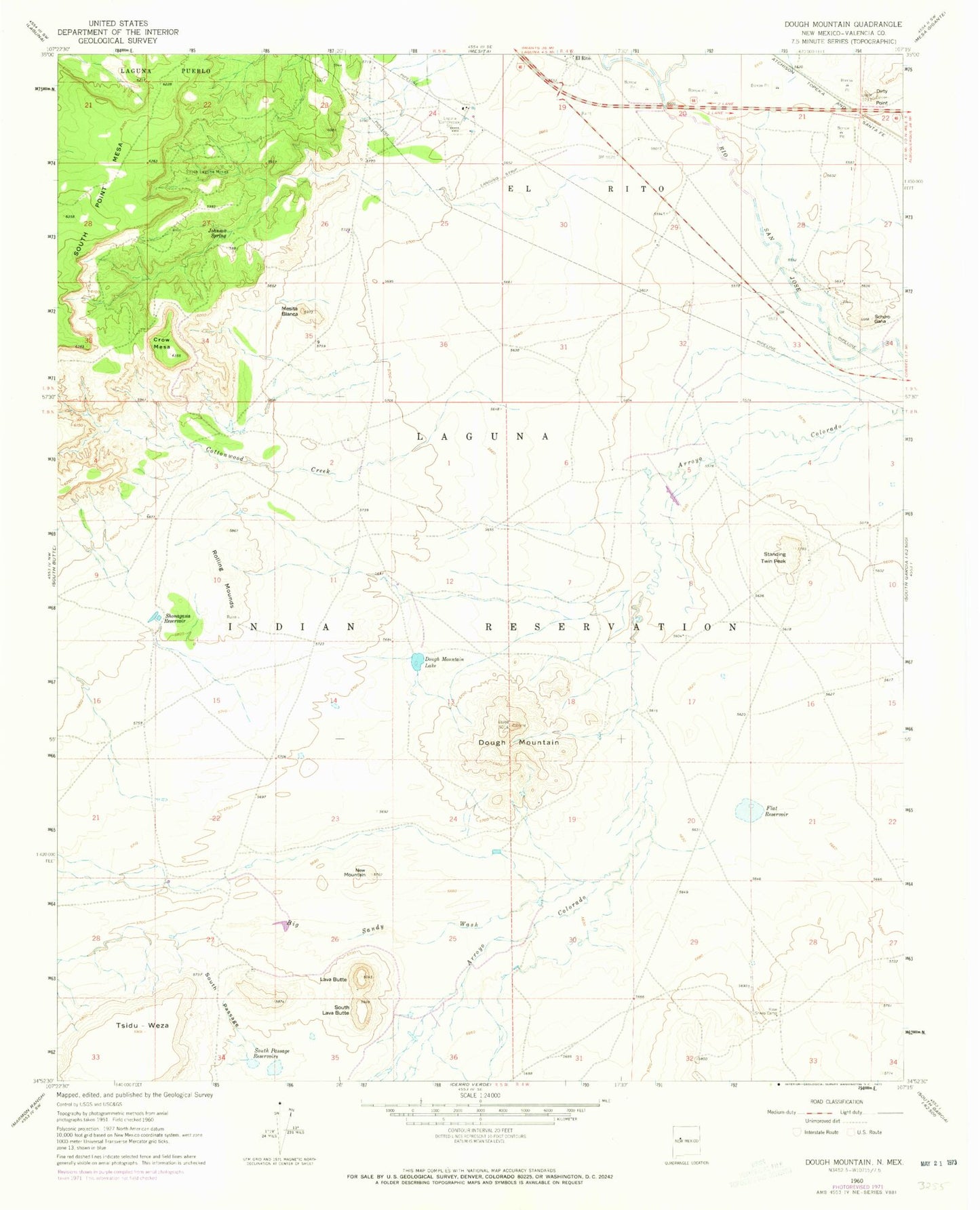
Classic USGS Dough Mountain New Mexico 7.5'x7.5' Topo Map
Couldn't load pickup availability
Historical USGS topographic quad map of Dough Mountain in the state of New Mexico. Map scale may vary for some years, but is generally around 1:24,000. Print size is approximately 24" x 27"
This quadrangle is in the following counties: Cibola.
The map contains contour lines, roads, rivers, towns, and lakes. Printed on high-quality waterproof paper with UV fade-resistant inks, and shipped rolled.
Contains the following named places: Arroyo Conchas, Big Sandy Wash, Cottonwood Creek, Crow Mesa, Dirty Point, Dough Mountain, Dough Mountain Lake, El Rito, Flat Reservoir, Johnson Spring, Kose Sheep Camp, Laguna 2 Water Well, Laguna 3 Water Well, Laguna Compressor Station, Lava Butte, Mesita Blanca, New Mountain, Rolling Mounds, S Pino 2 Water Well, Schcro Gana, Shonagana Reservoir, South Laguna Mines, South Lava Butte, South Passage, South Passage Reservoirs, Standing Twin Peak, Windmill Number 9