
MyTopo
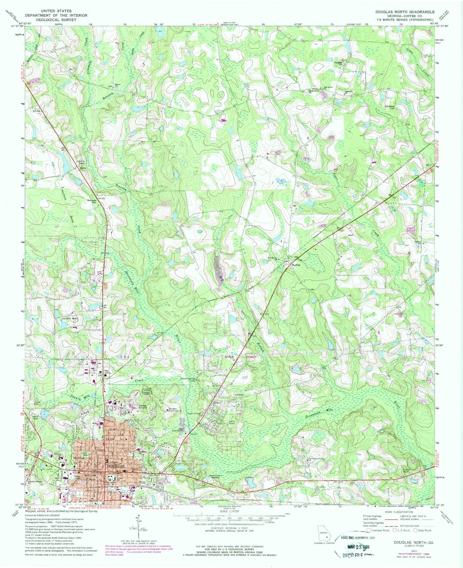
Classic USGS Douglas North Georgia 7.5'x7.5' Topo Map
Couldn't load pickup availability
Historical USGS topographic quad map of Douglas North in the state of Georgia. Map scale may vary for some years, but is generally around 1:24,000. Print size is approximately 24" x 27"
This quadrangle is in the following counties: Coffee.
The map contains contour lines, roads, rivers, towns, and lakes. Printed on high-quality waterproof paper with UV fade-resistant inks, and shipped rolled.
Contains the following named places: Beaver Creek Golf Course, Big Branch, Blystonel, Broxton Creek, Bushnell Chapel, Central Church, Central Church Cemetery, Central School, Cherokee Hills, Christian Faith Outreach Ministry, Church of Christ, Church of God in Unity, Church of God of Prophecy, Church of the Holy God, Church of the Kingdom of God, City of Douglas, Coffee County, Coffee County Courthouse, Coffee County Fire Rescue Department Station 6, Coffee Regional Medical Center, College Avenue Baptist Church, Deliverance Center Church, Douglas, Douglas City Cemetery, Douglas City Hall, Douglas Country Club, Douglas Fire Department Station 1, Douglas Fire Department Station 2, Douglas Police Department, Douglas Post Office, Eastside Park, Eastside School, Emma Wade Park, Faircloth Field, First Baptist Church, First Church of the Nazarene, First Congregational Christian Church, First Presbyterian Church, First United Methodist Church, Gaines Chapel Methodist Church, Gaskin Springs Camp, General Coffee State Park, Grace Baptist Church, Harrel Church, Harvest Time Church of God, Hebron Baptist Church, Higgs Lake, Hinson Lake, Hinson Lake Dam, Hispanic Baptist Mission, Holiness Church, House of Prayer Church, Huffer, Jardine Stadium, Last Days True Holiness Mission, Lone Hill Church, Lone Hill Church Cemetery, Lott Lake, Lott Lake Dam, Lotts, Mount Calvary Church, Ninemile Creek, North Madison Park, Northside Baptist Church, Northwest Industrial Park, Oak Grove Cemetery, Oak Grove Church, Oak Park, Oak Park Church, Old Wayfare Cemetery, Parkview Church, Pickerton Church, Pine Grove Church, Saint Andrews Episcopal Church, Saint John Baptist Church, Saint Mark United Methodist Church, Saint Pauls Roman Catholic Church, Satilla Regional Library, Seal Methodist Church, Seven Creek, Shady Grove Church, Sinai Pentecostal Holiness Church, The Church of Jesus Christ of Latter Day Saints, Twenty Mile Creek, Unity Park, Wade Field, Walter R Wilson Agricultural Arena, Ward Cemetery, WDMG-AM (Douglas), WDMG-FM (Douglas), West Ward Street Church of God, Westside Holiness Church, Westside School, Wheeler Park, Whispering Pines Park, WOKA-AM (Douglas), WOKA-FM (Douglas), ZIP Code: 31533


