MyTopo
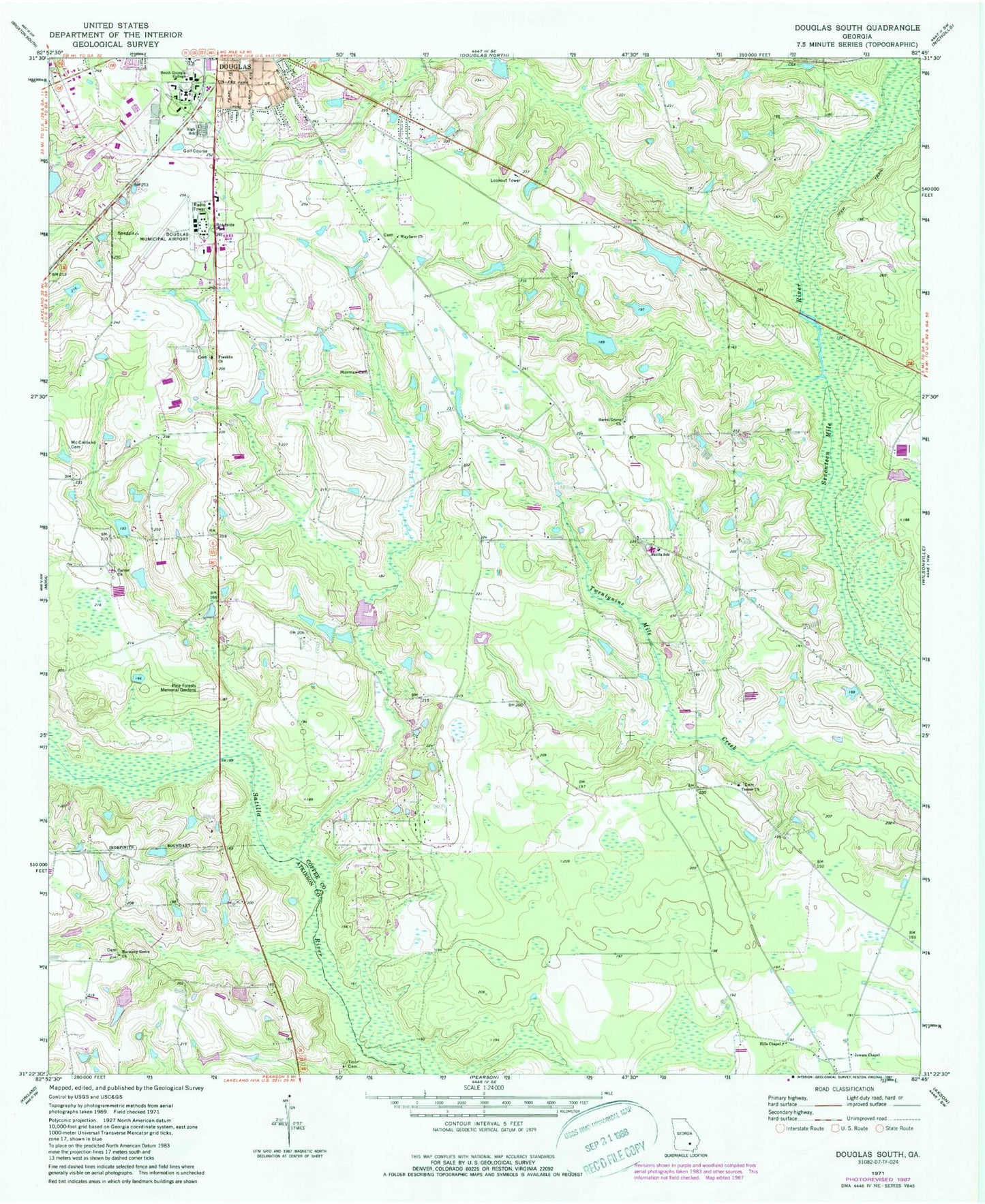
Classic USGS Douglas South Georgia 7.5'x7.5' Topo Map
Couldn't load pickup availability
Historical USGS topographic quad map of Douglas South in the state of Georgia. Map scale may vary for some years, but is generally around 1:24,000. Print size is approximately 24" x 27"
This quadrangle is in the following counties: Atkinson, Coffee.
The map contains contour lines, roads, rivers, towns, and lakes. Printed on high-quality waterproof paper with UV fade-resistant inks, and shipped rolled.
Contains the following named places: Ashley Yoemans Cemetery, Bell Lake Park, Carver Cemetery, Carver Church, Church of God, Coffee County Fire and Rescue Department Station 20, Coffee County Fire and Rescue Department Station 9, Coffee County High School, Coffee Junior High School, Douglas Division, Douglas Municipal Airport, Everette Chapel Christian Methodist Episcopal Church, First Assembly of God Church, Franklin Cemetery, Franklin Church, George Washington Carver High School, Georgia State Patrol Troop H Post 36 Douglas, Harmony Grove Church, Harrel Grove Church, Harrell Grove Cemetery, Haskin Lake, Haskin Lake Dam, Hills Chapel, Johnson Lake, Johnson Lake Dam, Johnson Lake Dam North, Johnson Lake North, Jowers Chapel, Macedonia Baptist Church, McClelland Cemetery, Morman Cemetery, New Harmony Grove Missionary Baptist Church Cemetery, Pine Street Church of God, Pine Street Park, Roundtree Center Park, Saints Temple Church of God in Christ, Satilla Memorial Gardens, Satilla School, Shiloh Missionary Baptist Church, South Georgia College, South Georgia State College Police Department, Southwest Industrial Park, Tanner Cemetery, Tanner Church, Tison Cemetery, Wayfare Cemetery, Wayfarer Church, William S Smith Library, ZIP Code: 31535