MyTopo
Classic USGS Dove Spring California 7.5'x7.5' Topo Map
Regular price
$16.95
Regular price
Sale price
$16.95
Unit price
per
Couldn't load pickup availability
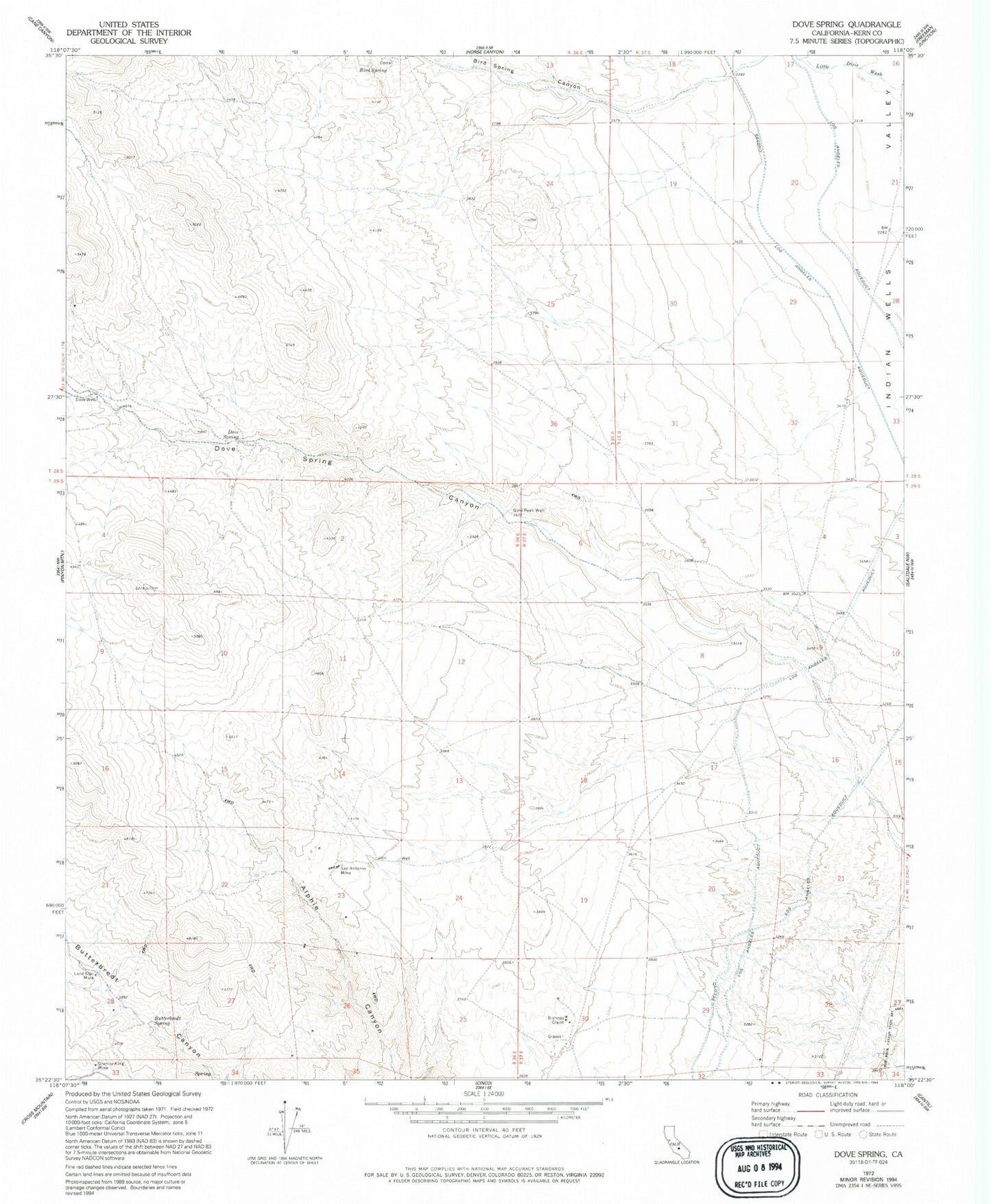
Historical USGS topographic quad map of Dove Spring in the state of California. Typical map scale is 1:24,000, but may vary for certain years, if available. Print size: 24" x 27"
This quadrangle is in the following counties: Kern.
The map contains contour lines, roads, rivers, towns, and lakes. Printed on high-quality waterproof paper with UV fade-resistant inks, and shipped rolled.
Contains the following named places: Bird Spring, Bishops Claim, Dove Spring, Dove Spring Canyon, Dove Well, Gold Peak Well, Granite King Mine, Lone Star Mine, San Antonio Mine, Butterbredt Spring, Bird Spring Canyon, Dove Spring Mill (historical), Dove Spring Ranch (historical), Little Dixie (historical)