MyTopo
Classic USGS Dover Arkansas 7.5'x7.5' Topo Map
Couldn't load pickup availability
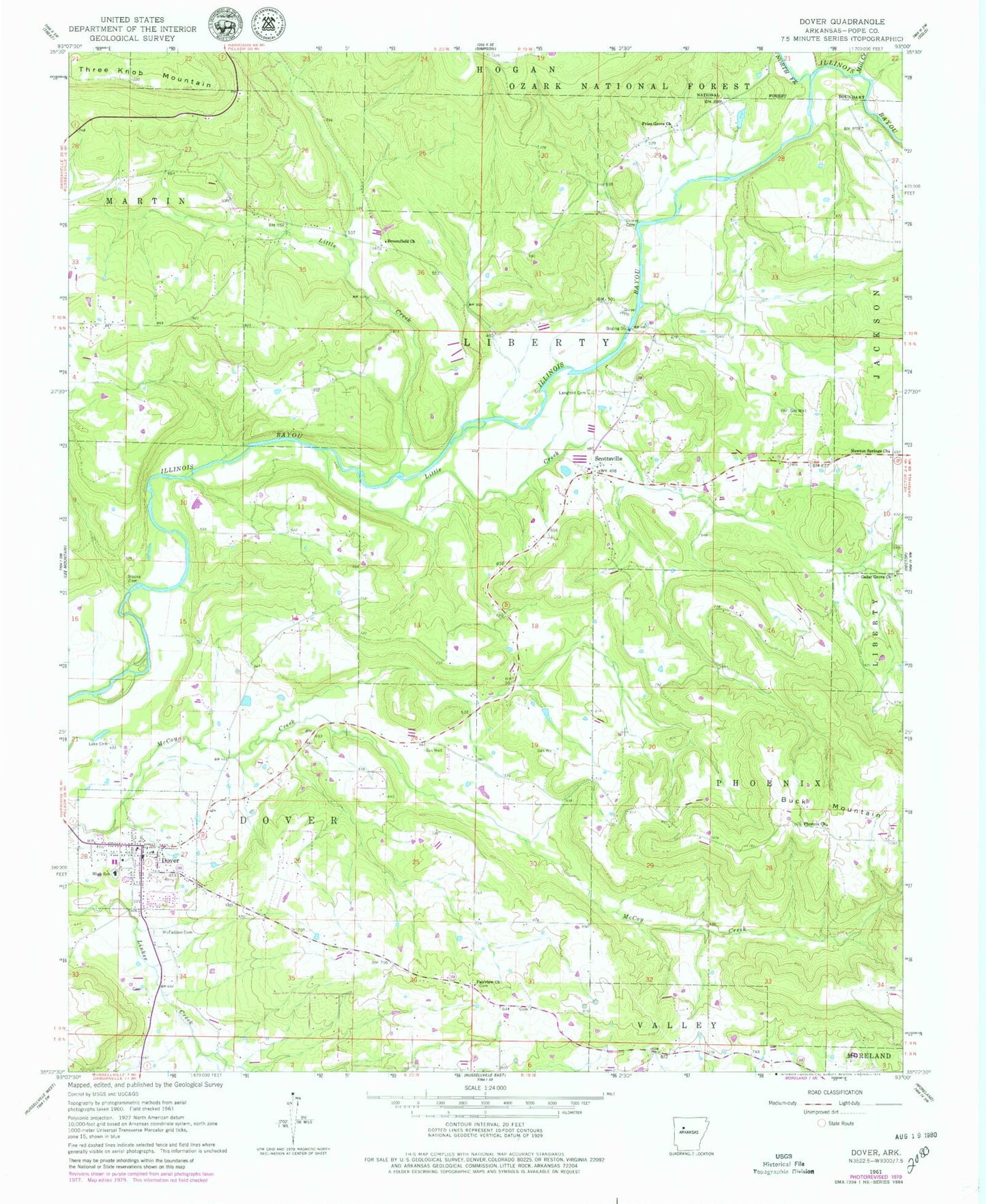
Historical USGS topographic quad map of Dover in the state of Arkansas. Map scale may vary for some years, but is generally around 1:24,000. Print size is approximately 24" x 27"
This quadrangle is in the following counties: Pope.
The map contains contour lines, roads, rivers, towns, and lakes. Printed on high-quality waterproof paper with UV fade-resistant inks, and shipped rolled.
Contains the following named places: Brooks Cemetery, Broomfield, Broomfield Church, Cedar Grove Assembly of God Church, City of Dover, College Hill, Cottonwood School, Dover, Dover City Fire and Rescue, Dover College, Dover Elementary School, Dover Gas Field, Dover High School, Dover Middle School, Dover Police Department, Dover Post Office, Dover Primary School, Dover Rural Fire Department, Dover Work Center, Fairview Church Cemetery, Goates Cemetery, Gum Creek, Hatley Baptist Church, Hatley Cemetery, Hatley School, Hatley Volunteer Fire Department, Jamison Cemetery, Lake Cemetery, Landers Loop Airport, Langford Cemetery, Little Creek, McFadden Cemetery, Mill Creek, Mud Creek, Newton School, Newton Springs Church, North Fork Illinois Bayou, Phoenix Church, Phoenix School, Pine Hill Chapel, Pine Hill School, Pope County, Pope County Emergency Medical Service Station 4, Price Grove Church, Prices Grove School, Scottsville, Scottsville Gas Field, Stout Cemetery, Three Knob Mountain, Township of Dover, Township of Phoenix