
MyTopo
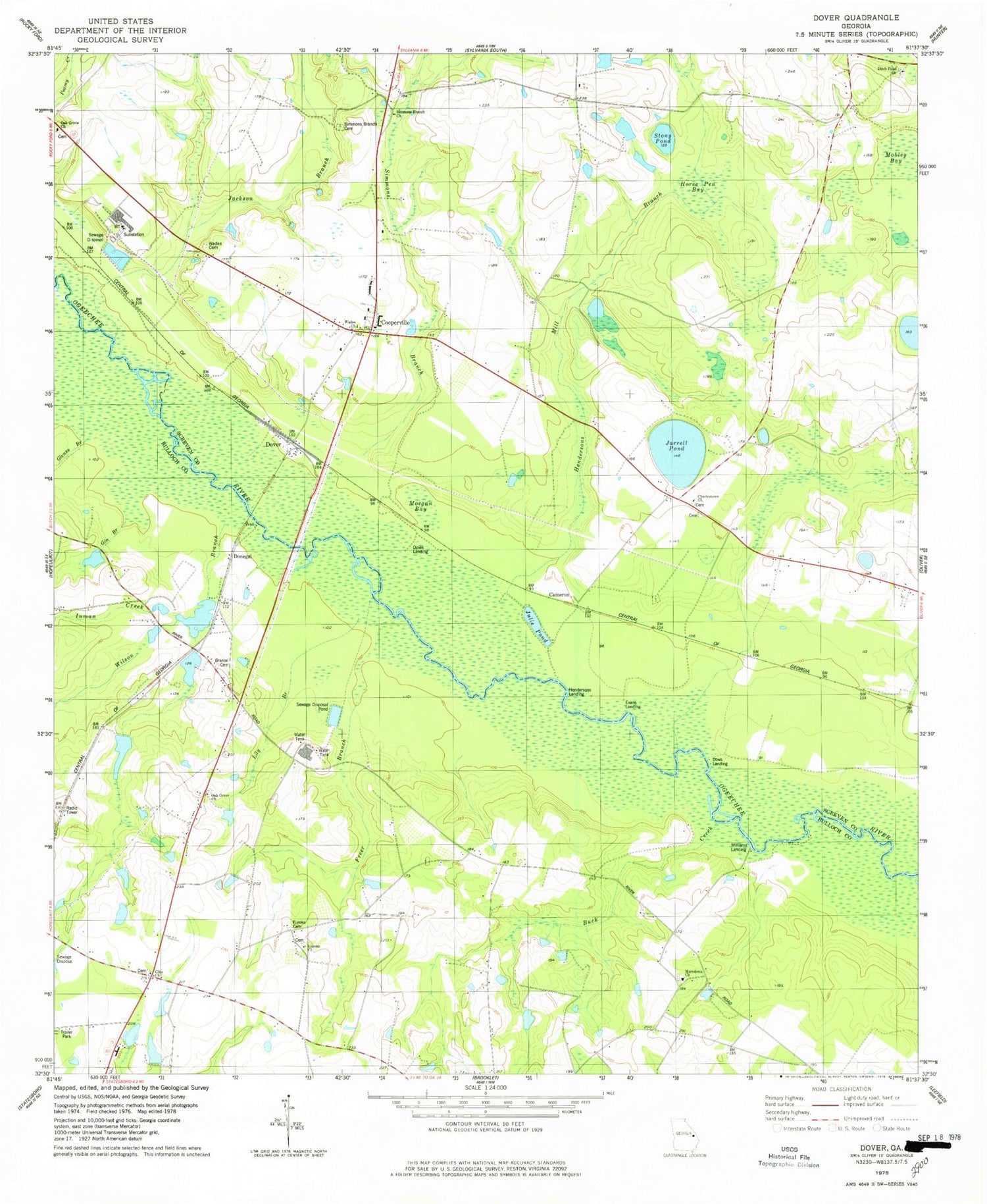
Classic USGS Dover Georgia 7.5'x7.5' Topo Map
Couldn't load pickup availability
Historical USGS topographic quad map of Dover in the state of Georgia. Map scale may vary for some years, but is generally around 1:24,000. Print size is approximately 24" x 27"
This quadrangle is in the following counties: Bulloch, Screven.
The map contains contour lines, roads, rivers, towns, and lakes. Printed on high-quality waterproof paper with UV fade-resistant inks, and shipped rolled.
Contains the following named places: Big Branch, Branon Cemetery, Brook Instruments Company Pond Dam, Brooks Instruments Company Pond, Buck Creek, Cameron, Cameron Cemetery, Charlestown Church, Clito Cemetery, Clito Church, Clito School, Clito Volunteer Fire Department, Cooperville, Cooperville Census Designated Place, Cooperville School, Ditch Pond Church, Donegal, Dover, Dover Post Office, Dows Landing, Eagle Village Mobile Home Park, Eureka, Eureka Cemetery, Eureka Church, Eureka Church Cemetery, Evans Landing, Freer Branch, Gin Branch, Glenns Branch, Henderson Mill Branch, Hendersons Landing, Hendersons Mill Branch, Hope Community Church Cemetery, Horse Pen Bay, Inman Creek, Jackson Branch, Jarrell Pond, Julie Pond, Landing Number One, Lily Branch, Macedonia Church, Macedonia Church Cemetery, Mobley Bay, Morgan Bay, Oak Grove Cemetery, Oak Grove Church, Oak Grove United Methodist Church Cemetery, Opies Landing, Ricklighter Pond, Ricklighter Pond Dam, Robinson Pond, Screven County Fire Department Station 3, Simmons Branch, Simmons Branch Cemetery, Simmons Branch Church, Story Pond, Wades Cemetery, Wades Church, Williams Landing, Wilson Branch, ZIP Code: 30461


