MyTopo
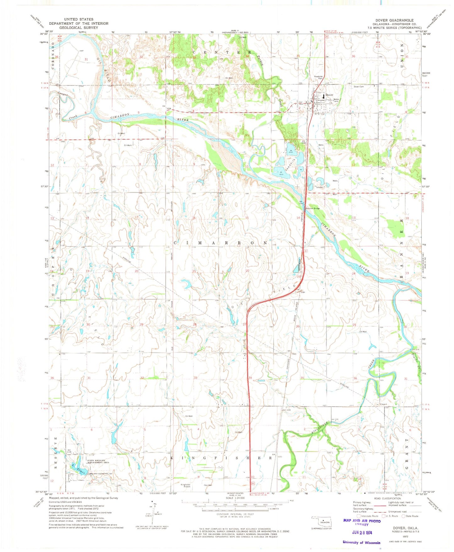
Classic USGS Dover Oklahoma 7.5'x7.5' Topo Map
Couldn't load pickup availability
Historical USGS topographic quad map of Dover in the state of Oklahoma. Map scale may vary for some years, but is generally around 1:24,000. Print size is approximately 24" x 27"
This quadrangle is in the following counties: Kingfisher.
The map contains contour lines, roads, rivers, towns, and lakes. Printed on high-quality waterproof paper with UV fade-resistant inks, and shipped rolled.
Contains the following named places: Boecher Bridge, Cooper Creek, Dover, Dover Cemetery, Dover Elementary School, Dover High School, Dover Police Department, Dover Post Office, Dover Volunteer Fire Department, Elmer Lake Dam, Kingfisher County, Kingfisher Creek, Lake Elmer, Lou Anna Creek, Oknoname 07308 Dam, Oknoname 07308 Reservoir, Oknoname 07312 Dam, Oknoname 07312 Reservoir, Oknoname 083028 Dam, Oknoname 083028 Reservoir, Town of Dover, Township of Cimarron, Trail Creek, Treaty Creek, Turkey Creek, White Airport