MyTopo
Classic USGS Dovesville South Carolina 7.5'x7.5' Topo Map
Couldn't load pickup availability
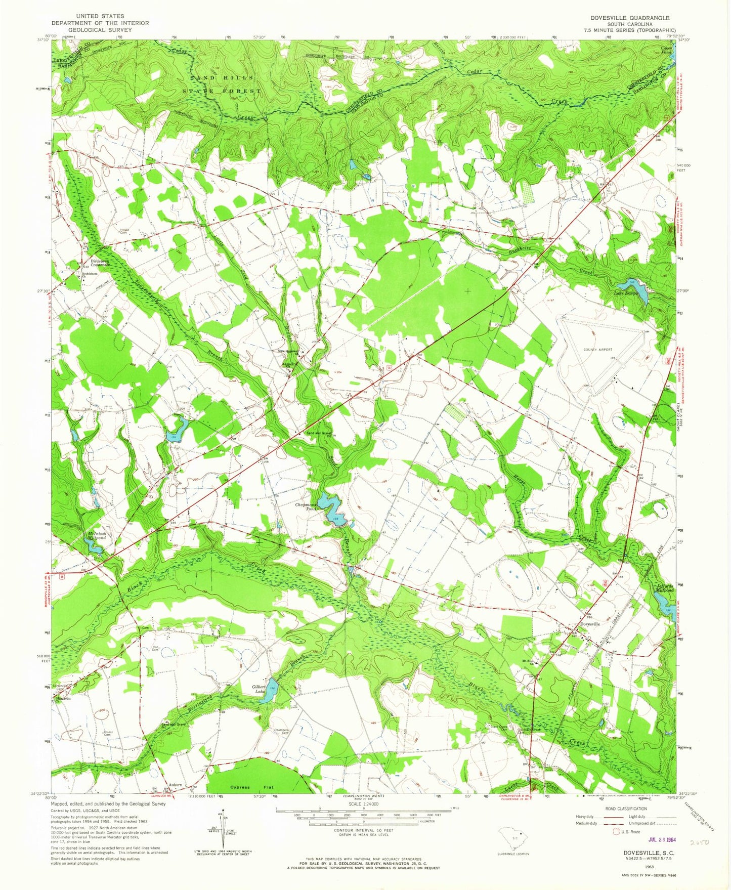
Historical USGS topographic quad map of Dovesville in the state of South Carolina. Map scale may vary for some years, but is generally around 1:24,000. Print size is approximately 24" x 27"
This quadrangle is in the following counties: Chesterfield, Darlington.
The map contains contour lines, roads, rivers, towns, and lakes. Printed on high-quality waterproof paper with UV fade-resistant inks, and shipped rolled.
Contains the following named places: Adurndale Farms Pond, Antioch, Antioch Church, Auburn, Bethlehem Cemetery, Bethlehem Church, Birdstown Crossroads, Black Creek Academy, Black Creek Baptist Church, Black Creek Cemetery, Boggy Swamp, Carroll Chapman Pond Dam D-3531, Centerville Cemetery, Centerville Church, Centerville School, Chambers Cemetery, Chapmans Pond, Cokers Mill, Darlington County Airport, Darlington County Fire Department Byrdtown, Darlington County Fire Department Centerville Station, Darlington County Fire Department Station 13, Darlington County Fire District Station 16 - Jetport, Darlington Pond Dam D-3529, Dovesville, Dovesville Baptist Church, Dovesville Census Designated Place, Dovesville Church of God, Evans Mill, Everlasting Branch, Farm Service Agency Interest of South Carolina, Fraser Cemetery, Gilbert Lake, Greenplains, Harris Creek, Hartsville Army Air Field, Horse Creek, Howle Cemetery, Lake Darpo, Leavensworth, Leavenworth Branch, Little Boggy Swamp, Little Seed Branch, McIntosh Mill, McIntosh Millpond, Mount Zion Church, Mount Zion School, New Hopewell Church, Old Black Creek Cemetery, Robinson School, Ross Strip, Seed Branch, South Carolina Noname 16006 D-3533 Dam, South Carolina Noname 16009 D-3534 Dam, South Carolina Noname 16023 D-3530 Dam, South Carolina Noname 16108 D-3532 Dam, Sumpayrac Mill, Van Cemetery, White Plains School


