MyTopo
Classic USGS Downs Mountain Wyoming 7.5'x7.5' Topo Map
Couldn't load pickup availability
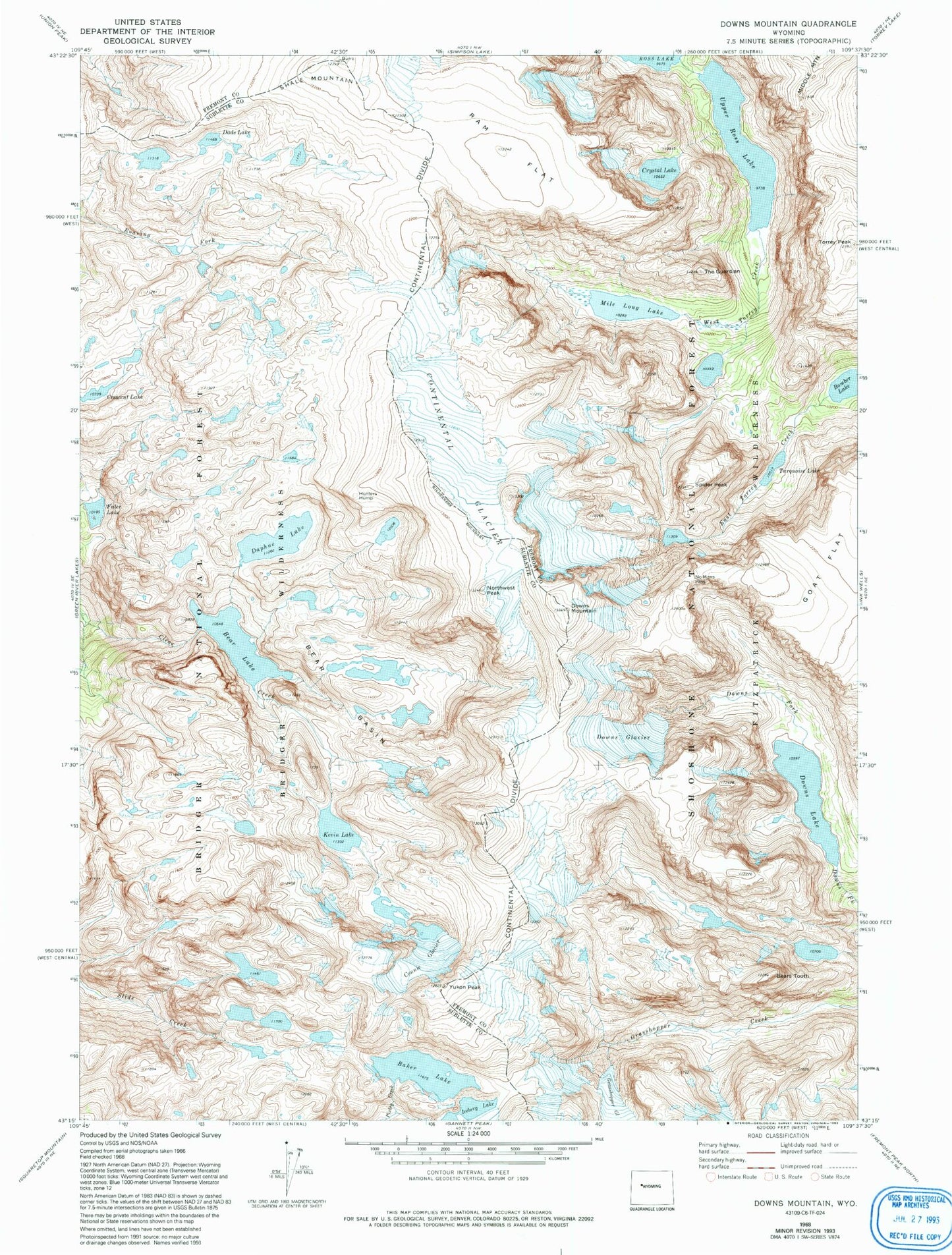
Historical USGS topographic quad map of Downs Mountain in the state of Wyoming. Typical map scale is 1:24,000, but may vary for certain years, if available. Print size: 24" x 27"
This quadrangle is in the following counties: Fremont, Sublette.
The map contains contour lines, roads, rivers, towns, and lakes. Printed on high-quality waterproof paper with UV fade-resistant inks, and shipped rolled.
Contains the following named places: Baker Lake, Bear Basin, Bear Lake, Connie Glacier, Continental Glacier, Crystal Lake, Dads Lake, Daphne Lake, Downs Glacier, Downs Lake, Downs Mountain, Faler Lake, Hunters Hump, Kevin Lake, Mile Long Lake, No Mans Pass, Northwest Peak, Ram Flat, Spider Peak, The Guardian, Torrey Peak, Turquoise Lake, Upper Ross Lake, Yukon Peak, Bomber Lake, Crescent Lake, Iceberg Lake, Shale Mountain, Bears Tooth, Clear Creek Mine