MyTopo
Classic USGS Downs North Kansas 7.5'x7.5' Topo Map
Couldn't load pickup availability
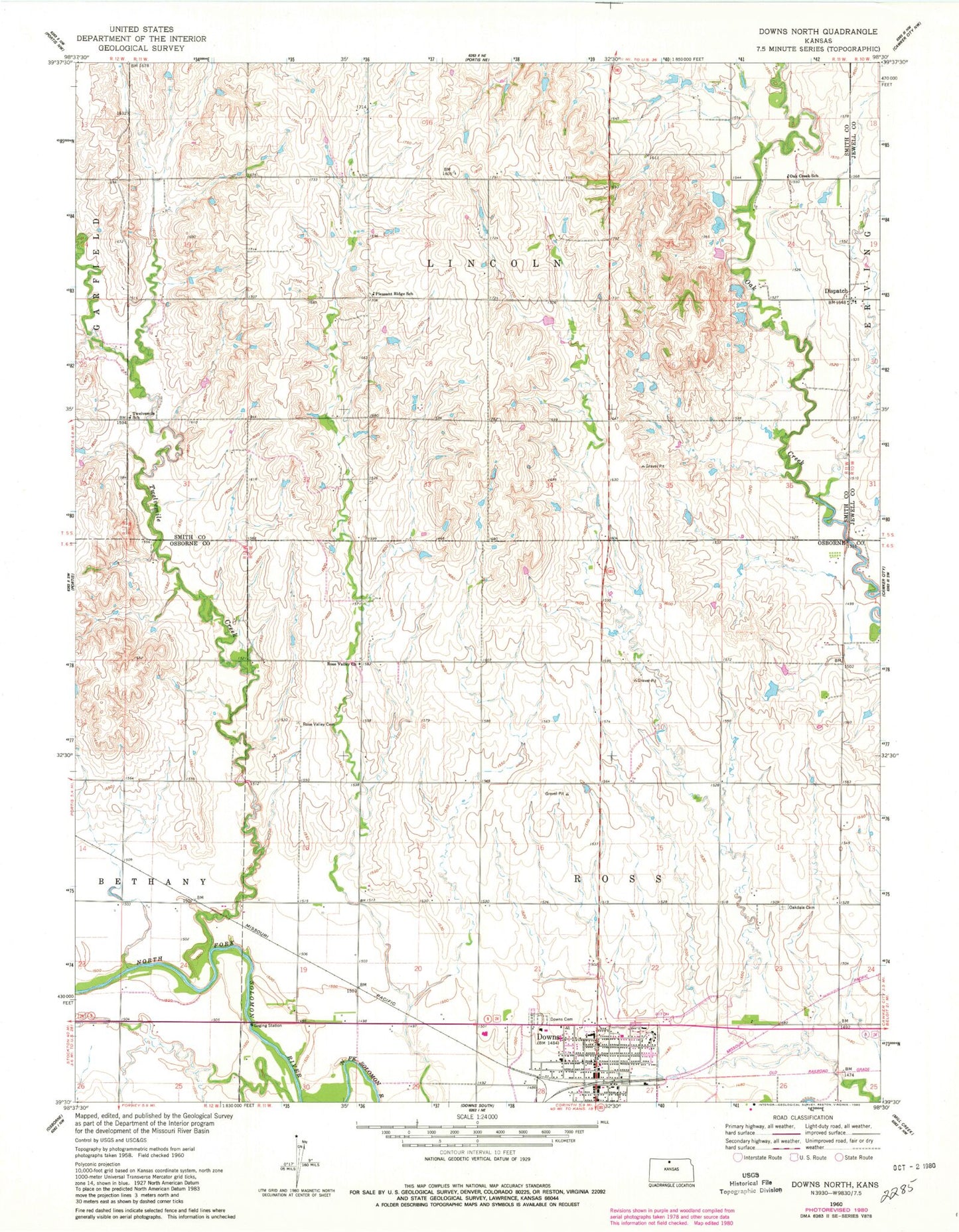
Historical USGS topographic quad map of Downs North in the state of Kansas. Map scale may vary for some years, but is generally around 1:24,000. Print size is approximately 24" x 27"
This quadrangle is in the following counties: Jewell, Osborne, Smith.
The map contains contour lines, roads, rivers, towns, and lakes. Printed on high-quality waterproof paper with UV fade-resistant inks, and shipped rolled.
Contains the following named places: City of Downs, Dispatch, Dispatch Christian Reformed Church, Downs Carnegie Library, Downs Cemetery, Downs City Hall, Downs Fire Department, Downs Golf Course, Downs High School, Downs Post Office, Downs Seventh Day Adventist Church, Downs United Methodist Church, First Christian Church, Griffith Field, Higgins Bluff, Lakeside Elementary School - Downs, Lakeside High School, Lighthouse Community Church, Midway Co - Operative Association Grain Elevator Number 7, Oak Creek School, Oakdale Cemetery, Orange, Pleasant Ridge School, Rose Valley Cemetery, Rose Valley United Methodist Church, Saint Mary's Catholic Church, Scoular Company Grain Elevator Number 3, Township of Lincoln, Township of Ross, Twelvemile Creek, Twelvemile School, Zion Lutheran Church, ZIP Code: 67437