MyTopo
Classic USGS Downs South Kansas 7.5'x7.5' Topo Map
Couldn't load pickup availability
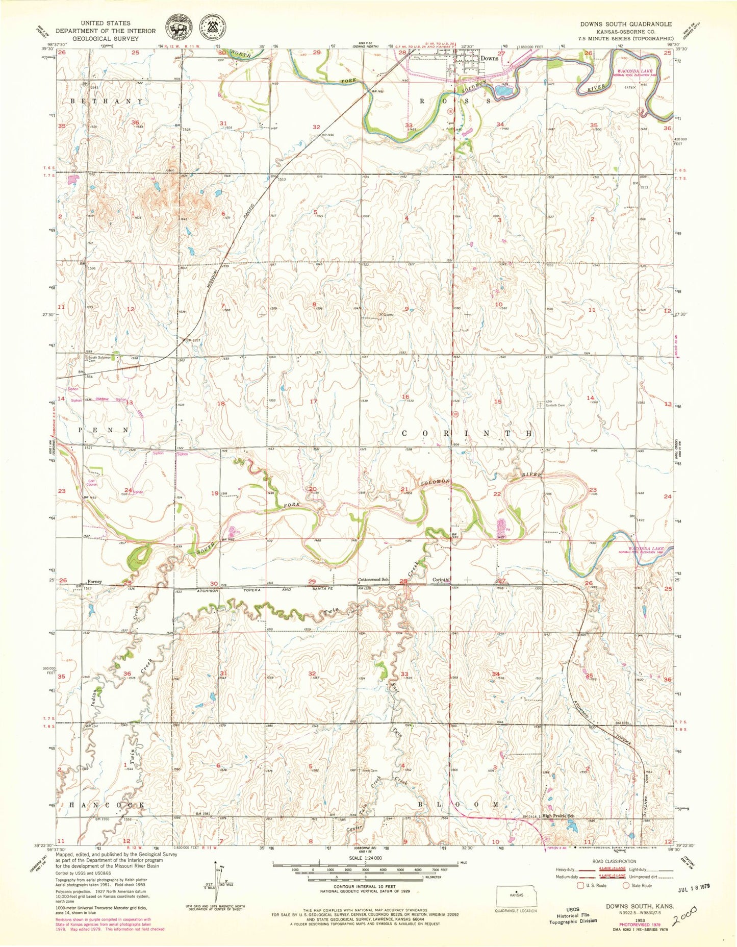
Historical USGS topographic quad map of Downs South in the state of Kansas. Map scale may vary for some years, but is generally around 1:24,000. Print size is approximately 24" x 27"
This quadrangle is in the following counties: Osborne.
The map contains contour lines, roads, rivers, towns, and lakes. Printed on high-quality waterproof paper with UV fade-resistant inks, and shipped rolled.
Contains the following named places: Center Twin Creek, Corinth, Corinth Cemetery, Cottonwood School, Downs, Downs Wastewater Treatment Facility, Dry Creek, East Twin Creek, Forney, Handy, High Prairie School, Indian Creek, Iowa Cemetery, Midway Co - Operative Association Grain Elevator Number 6, South Solomon Cemetery, Township of Corinth, Twin Creek