MyTopo
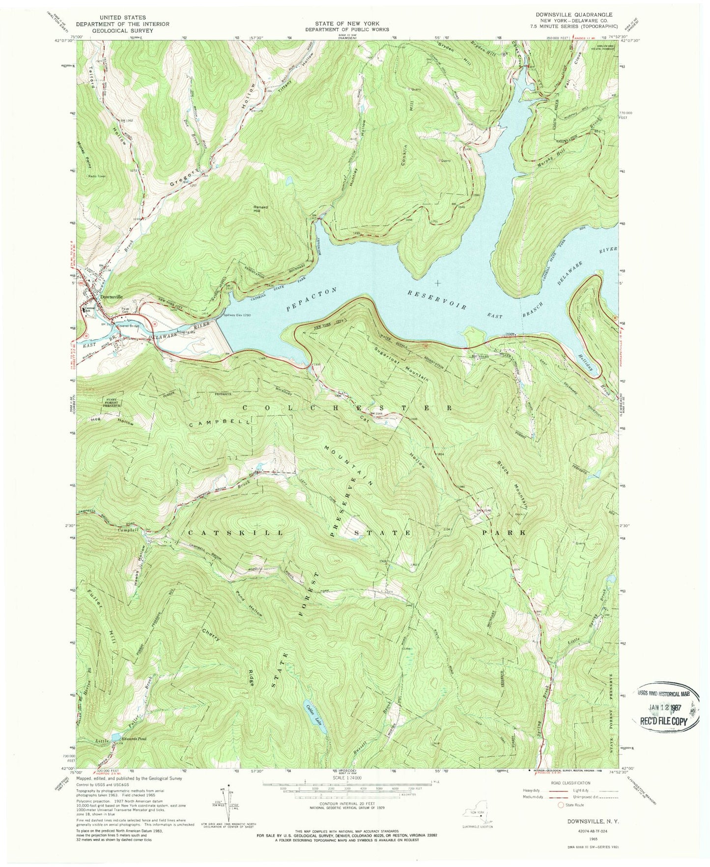
Classic USGS Downsville New York 7.5'x7.5' Topo Map
Couldn't load pickup availability
Historical USGS topographic quad map of Downsville in the state of New York. Typical map scale is 1:24,000, but may vary for certain years, if available. Print size: 24" x 27"
This quadrangle is in the following counties: Delaware.
The map contains contour lines, roads, rivers, towns, and lakes. Printed on high-quality waterproof paper with UV fade-resistant inks, and shipped rolled.
Contains the following named places: Brock Mountain, Bryden Hill Brook, Cables Lake, Campbell Mountain, Cat Hollow, Central School, Cherry Ridge, Coles Clove, Conklin Hill, Doe Brook, Downs Brook, Downsville, Edwards Pond, Fall Clove, Fuller Hill, Gregory Hollow, Hawks Hollow, Holliday Brook, Huntley Hollow, Little Spring Brook, Money Point, Murphy Hill Brook, Paige Cemetery, Pepacton Reservoir, Pond Hollow, Renard Hill, Sugarloaf Mountain, Telford Hollow, Tiffany Hollow, Wilson Hollow, Wilson Hollow Brook, Town of Colchester, Downsville Covered Bridge, Downsville Census Designated Place, Downsville Fire Station, Downsville Post Office