MyTopo
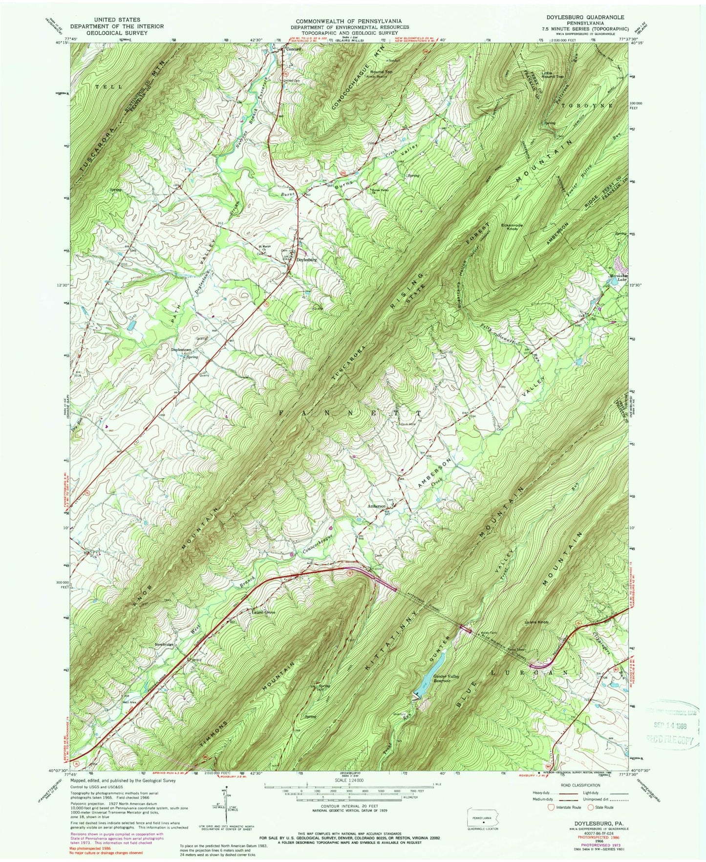
Classic USGS Doylesburg Pennsylvania 7.5'x7.5' Topo Map
Couldn't load pickup availability
Historical USGS topographic quad map of Doylesburg in the state of Pennsylvania. Map scale may vary for some years, but is generally around 1:24,000. Print size is approximately 24" x 27"
This quadrangle is in the following counties: Cumberland, Franklin, Huntingdon, Perry.
The map contains contour lines, roads, rivers, towns, and lakes. Printed on high-quality waterproof paper with UV fade-resistant inks, and shipped rolled.
Contains the following named places: Amberson, Amberson Post Office, Amberson Union Cemetery, Amberson Valley, Amberson Valley Estates, Barnhart Trail, Bear Pond Trail, Blue Mountain Tunnel, Burns Creek, Burns School, Burns Valley, Burns Valley Church, Catholic Path, Clay Hill School, Concord Post Office, Concord Union Cemetery, Doylesburg, Doylesburg United Methodist Cemetery, Doylestown, Doylestown Stream, Drillmore Acres Airport, Eckenrode Knob, Felty Stewart Run, Gunter Valley Dam, Gunter Valley Reservoir, Hayes School, Hemlocks Natural Area, Horseshoe Lake, Kittatinny Tunnel, Knob Mountain, Laurel Grove, Linns Point, Little Round Top, Mill Run School, Newbridge, Our Lady of Refuge Cemetery, Patterson Run Trail, Rising Mountain, Round Top, Saint Marys Church, Stewart Narrows Trail, Sugarcamp Hollow, Township of Fannett, Tuscarora Mountain, United Presbyterian Cemetery, Wolfe School, ZIP Codes: 17210, 17217, 17219, 17220, 17251, 17262