
MyTopo
Classic USGS Dragon Utah 7.5'x7.5' Topo Map
Regular price
$16.95
Regular price
Sale price
$16.95
Unit price
per
Couldn't load pickup availability
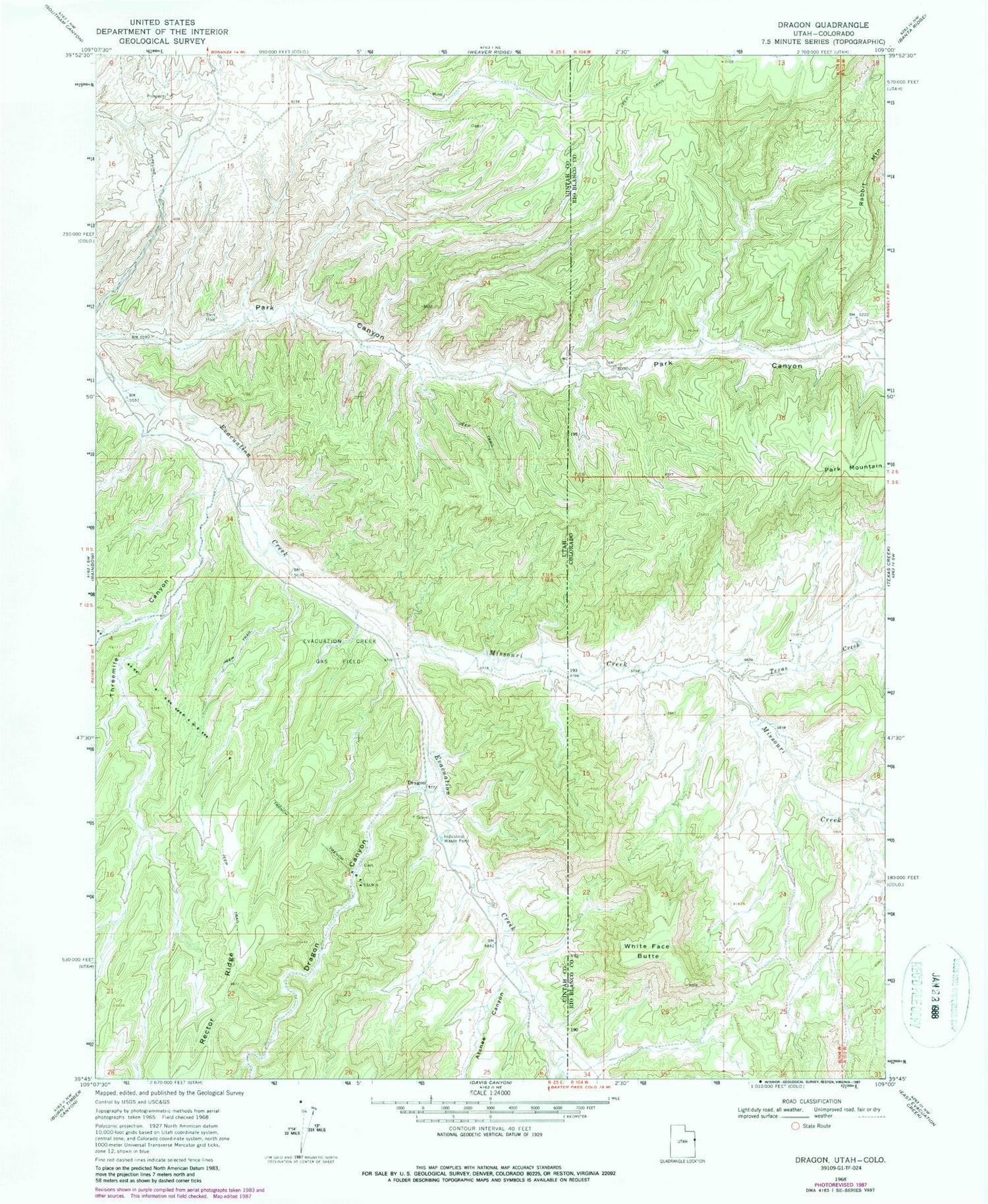
Historical USGS topographic quad map of Dragon in the states of Utah, Colorado. Map scale may vary for some years, but is generally around 1:24,000. Print size is approximately 24" x 27"
This quadrangle is in the following counties: Rio Blanco, Uintah.
The map contains contour lines, roads, rivers, towns, and lakes. Printed on high-quality waterproof paper with UV fade-resistant inks, and shipped rolled.
Contains the following named places: Atchee Canyon, Berkeley School, Dragon, Dragon Canyon, Dragon Cemetery, Evacuation Creek, Evacuation Creek Gas Field, Missouri Creek, Rector Ridge, Texas Creek, Threemile Canyon, White Face Butte


