MyTopo
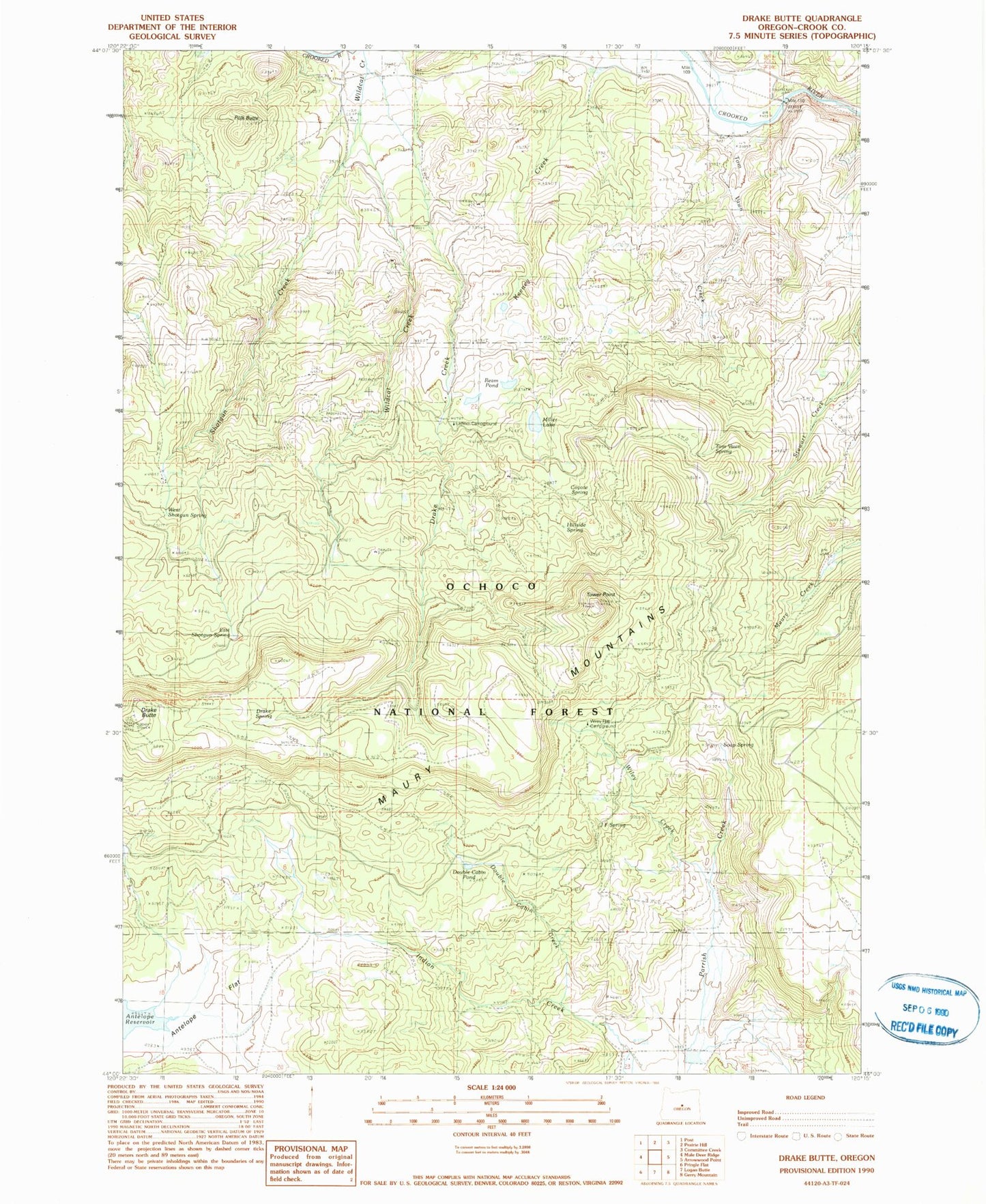
Classic USGS Drake Butte Oregon 7.5'x7.5' Topo Map
Couldn't load pickup availability
Historical USGS topographic quad map of Drake Butte in the state of Oregon. Map scale may vary for some years, but is generally around 1:24,000. Print size is approximately 24" x 27"
This quadrangle is in the following counties: Crook.
The map contains contour lines, roads, rivers, towns, and lakes. Printed on high-quality waterproof paper with UV fade-resistant inks, and shipped rolled.
Contains the following named places: Antelope Flat, CCC Spring, Coyote Spring, Double Cabin Creek, Double Cabin Pond, Double Cabin Recreation Site, Drake Creek, Drake Spring, East Shotgun Spring, Elkhorn Recreation Site, Frank Reservoir, Hillside Spring, Houston Ranch, J F Spring, Maury Guard Station, Miller Lake, Peterson Reservoir, Polk Butte, Reams Reservoir, Shotgun Creek, Soap Spring, Sunrise Valley Ranch Lodge Airport, Telephone Flat, Tom Vawn Creek, Tom Vawn Spring, Tower Point, West Shotgun Spring, Wildcat Creek, Wiley Creek, Wiley Flat, Wiley Flat Recreation Site