MyTopo
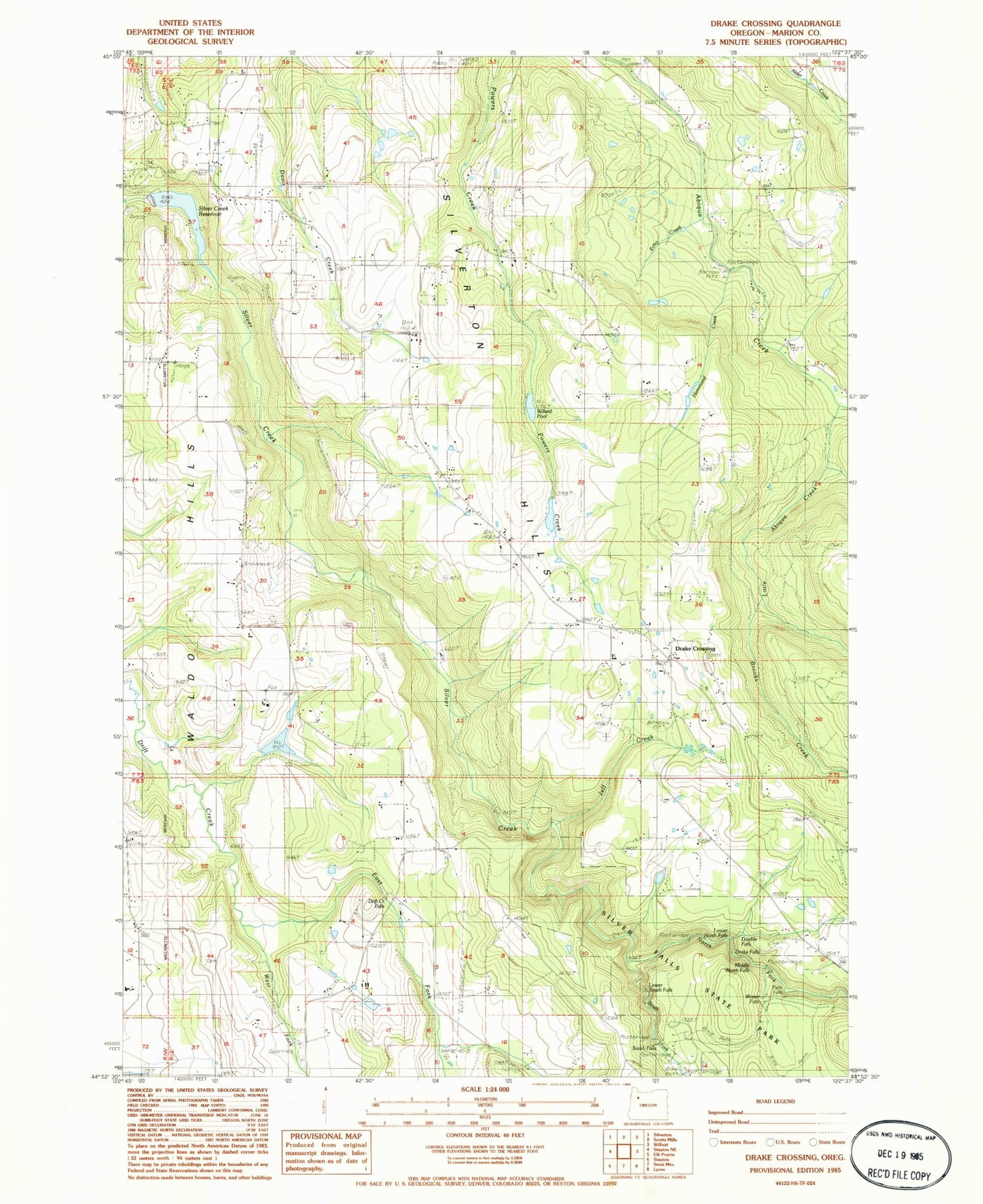
Classic USGS Drake Crossing Oregon 7.5'x7.5' Topo Map
Couldn't load pickup availability
Historical USGS topographic quad map of Drake Crossing in the state of Oregon. Map scale may vary for some years, but is generally around 1:24,000. Print size is approximately 24" x 27"
This quadrangle is in the following counties: Marion.
The map contains contour lines, roads, rivers, towns, and lakes. Printed on high-quality waterproof paper with UV fade-resistant inks, and shipped rolled.
Contains the following named places: Argenti Post Office, Brooks Creek, Double Falls, Drake Crossing, Drake Falls, Drakes Crossing Rural Fire Protection District, Drift Creek Falls, East Fork Drift Creek, Echo Creek, Fox Dam, Fox Reservoir, Hammond Creek, Hullt, Hullt Post Office, Jeff Creek, KECH-TV, Knight Post Office, Koehler Reservoir, KSKD-FM, Lewis Cemetery, Little Abiqua Creek, Lower North Falls, Lower South Falls, Middle North Falls, Mountain View Cemetery, North Fork Silver Creek, North Silver Creek Youth Camp, Pichette Reservoir, Silver Creek Dam, Silver Creek Reservoir, Silver Crest Elementary School, Silverton Division, Silverton Hills, Silverton Hills Grange, Silverton Reservoir City Marine Park Boat Docks, Silverton Reservoir City Marine Park Boat Ramp, Skookum Tum Tum Park, South Falls, South Fork Silver Creek, Sublimity Fire District Station 52 Substation, Twin Falls, Union Hill Cemetery, Union Hill Grange, West Fork Drift Creek, Willards Dam, Willards Pool, Winter Falls, ZIP Code: 97381