
MyTopo
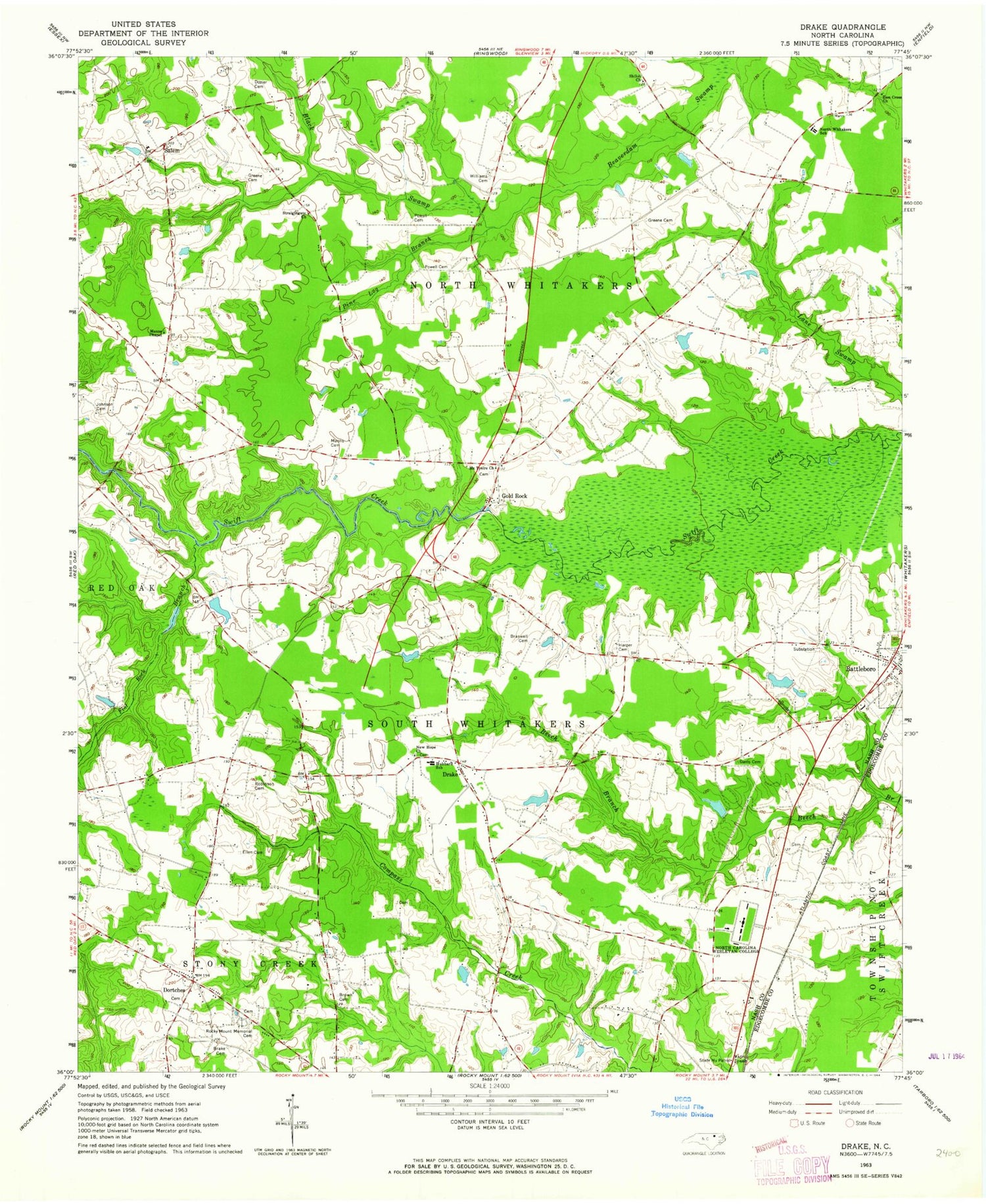
Classic USGS Drake North Carolina 7.5'x7.5' Topo Map
Couldn't load pickup availability
Historical USGS topographic quad map of Drake in the state of North Carolina. Map scale may vary for some years, but is generally around 1:24,000. Print size is approximately 24" x 27"
This quadrangle is in the following counties: Edgecombe, Nash.
The map contains contour lines, roads, rivers, towns, and lakes. Printed on high-quality waterproof paper with UV fade-resistant inks, and shipped rolled.
Contains the following named places: Battleboro Cemetery, Battleboro Community Volunteer Fire Department, Battleboro Post Office, Belmont, Black Swamp, Brake Cemetery, Braswell Cemetery, Braswell Lake Dam, Braswells Lake, Brown Cemetery, Davis Cemetery, Dortch School, Dortches, Dozier Cemetery, Drake, Ellen Cemetery, Fenners Pond, Fenners Pond Dam, Flat Rock Branch, Gold Rock, Greene Cemetery, Harper Cemetery, Hilliards Grove Church, Hornes Mill, Hubbard School, Johnson Cemetery, Manns Cemetery, Manns Chapel, McTyeire Church, New Hope Church, North Carolina State Highway Patrol Troop C District 1, North Carolina Wesleyan College, North Whitakers School, Pine Log Branch, Powell Cemetery, Powell School, Red Oak District Volunteer Fire Department, Ricks Place, Robinson Cemetery, Rocky Mount Fire Department Station 4, Rocky Mount Fire Department Station 7, Rocky Mount Memorial Cemetery, Salem, Salem Church, Salem District Volunteer Fire Department, Salem School, Shady Grove School, Shiloh Church, Shiloh School, Stony Creek Church, Straightgate Church, Taylors Store, Town of Dortches, Township of North Whitakers, Township of South Whitakers, Wadfords Store, Wesleyan College Post Office, Williams Cemetery, Zion Cross Church


