
MyTopo
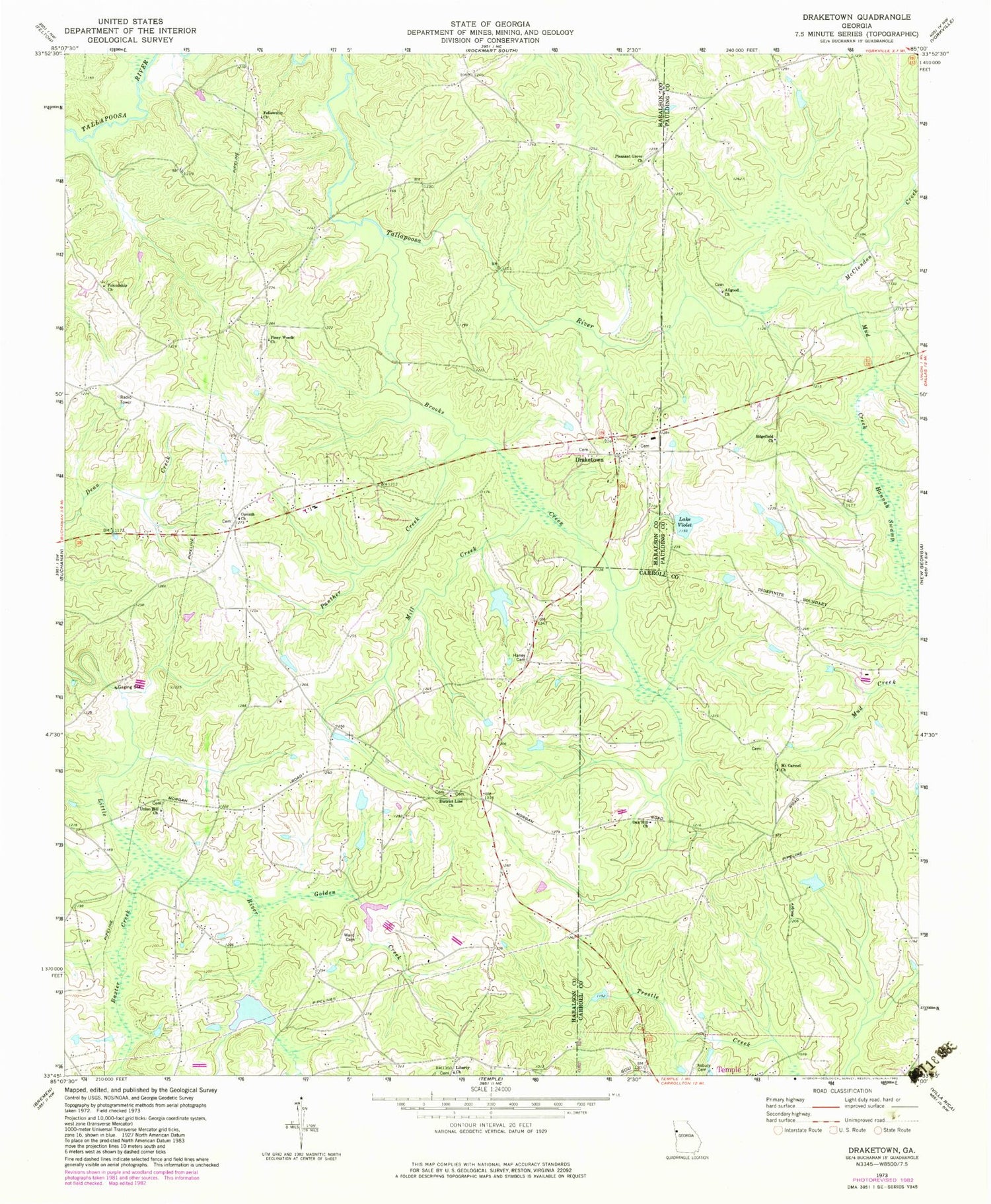
Classic USGS Draketown Georgia 7.5'x7.5' Topo Map
Couldn't load pickup availability
Historical USGS topographic quad map of Draketown in the state of Georgia. Map scale may vary for some years, but is generally around 1:24,000. Print size is approximately 24" x 27"
This quadrangle is in the following counties: Carroll, Haralson, Paulding.
The map contains contour lines, roads, rivers, towns, and lakes. Printed on high-quality waterproof paper with UV fade-resistant inks, and shipped rolled.
Contains the following named places: Allgood Church, Asbury Cemetery, Ayresouth Airport, Baxter Creek, Brooks Creek, Corinth Cemetery, Corinth Church, District Line Church, Draketown, Draketown Baptist Church, Draketown Cemetery, Draketown School, Eaves Bridge, Edgefield Church, Eulenfield Lake, Fellowship Church, Foster Lake, Foster Lake Dam, Friendship Church, Garrett Lake, Golden Creek, Haney Cemetery, Haralson County Fire Department Station 14, Haralson County Fire Department Station 2, Hatfields Lake, Lake Violet, Lake Violet Dam, Liberty Church, Little River Structure Number Eight Dam, Little River Structure Number Seven Dam, Little Tallapoosa Watershed Dam Number One, McClendon Creek, Mill Creek, Mount Carmel Cemetery, Mount Carmel Church, Mud Creek, Oak Hill Church, Old Union Hill Cemetery, Panther Creek, Piney Woods, Piney Woods Cemetery, Piney Woods Church, Pleasant Grove Church, Suburban Estates, Ton Wiggins Dam, Union Hill Church, Union Hill Methodist Church Cemetery, Ward Cemetery, Wiggins Dam, Wiggins Lake, ZIP Code: 30179


