MyTopo
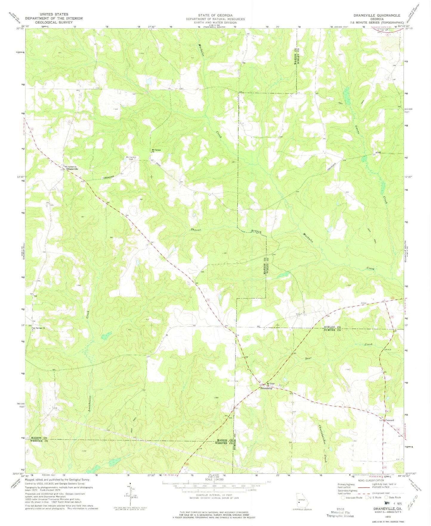
Classic USGS Draneville Georgia 7.5'x7.5' Topo Map
Couldn't load pickup availability
Historical USGS topographic quad map of Draneville in the state of Georgia. Map scale may vary for some years, but is generally around 1:24,000. Print size is approximately 24" x 27"
This quadrangle is in the following counties: Marion, Schley, Sumter, Webster.
The map contains contour lines, roads, rivers, towns, and lakes. Printed on high-quality waterproof paper with UV fade-resistant inks, and shipped rolled.
Contains the following named places: Concord, Concord Church, Cool Springs Church, David Gwest Lake, David Gwest Lake Dam, Draneville, Frasier - Smith Cemetery, Friendship, Friendship Baptist Church, Friendship Cemetery, Ira Kelly Bridge, Mount Carmel Cemetery, Mount Carmel Church, Mount Carmen Church, Mount Tabor Church, Owens Creek, Saint Luke Church, Shaver Branch, Tri-County High School