MyTopo
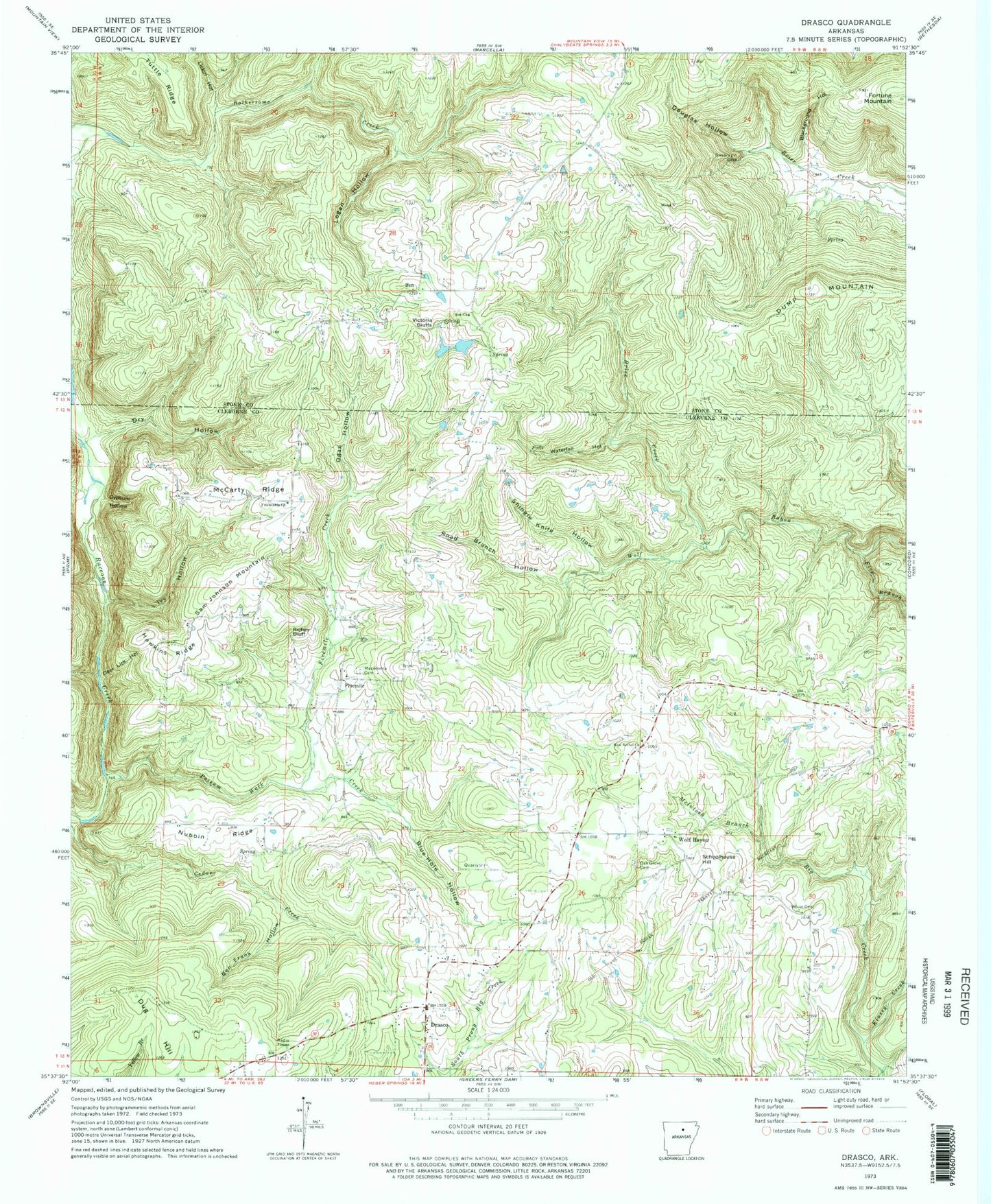
Classic USGS Drasco Arkansas 7.5'x7.5' Topo Map
Couldn't load pickup availability
Historical USGS topographic quad map of Drasco in the state of Arkansas. Map scale may vary for some years, but is generally around 1:24,000. Print size is approximately 24" x 27"
This quadrangle is in the following counties: Cleburne, Stone.
The map contains contour lines, roads, rivers, towns, and lakes. Printed on high-quality waterproof paper with UV fade-resistant inks, and shipped rolled.
Contains the following named places: Ben, Ben Church, Ben Fire Department, Ben Frank Hollow, Blackground Hollow, Blue Hole Hollow, Bothersome, Brier Creek, Comfort School, Deer Lick Hollow, Douglas Hollow, Drasco, Drasco Baptist Church, Drasco Census Designated Place, Drasco Post Office, Drasco School, Drasco Volunteer Fire Department, Dry Hollow, Dug Hill, Dump Mountain, Five Branch, Fivemile, Fivemile Creek, Fortune Mountain, Friendship Church, Gypsum Hollow, Hawkins Ridge, Ivy Hollow, Kinsey Creek, Lickin Hollow, Logan Hollow, Longview School, Macedonia Baptist Church, Macedonia Cemetery, McCarty Ridge, McIntosh Branch Big Creek, New Bethel Church of God, Nubbin Ridge, Oak Grove Cemetery, Oak Grove Church of God, Oak Grove Methodist Church, Ogan Hollow, Possum Walk Creek, Richey Bluff, Road Branch Hollow, Sam Johnson Mountain, Schoolhouse Hill, Shingle Knife Hollow, Stair Lake, Stair Lake Dam, Township of Bellmore, Township of Healing Springs, Township of Marcella, Township of Wilson, Victoria Bluffs, Waterfall Hollow, White Cemetery, Wolf Bayou, Wolf Bayou Post Office, Wolf Bayou School