MyTopo
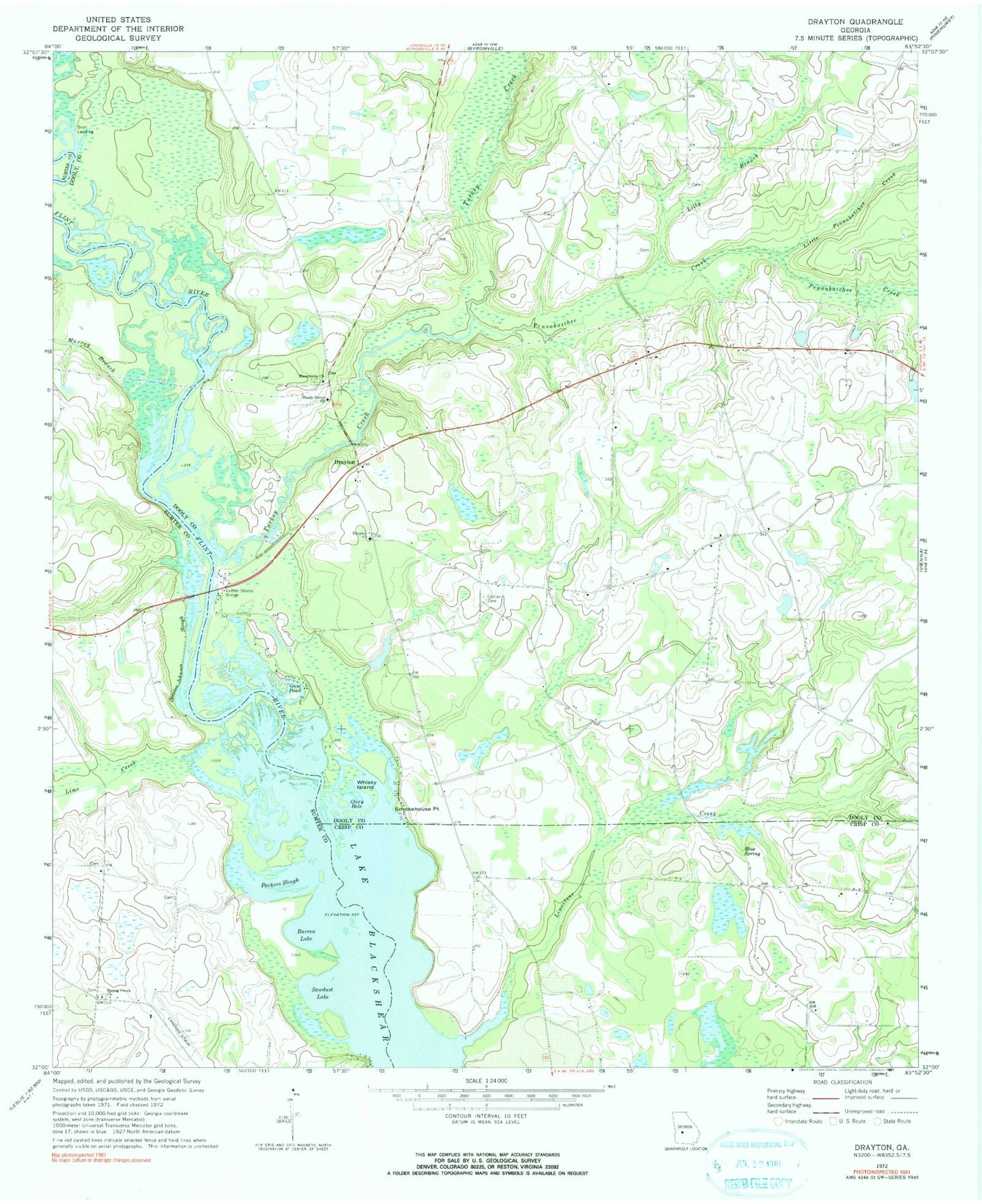
Classic USGS Drayton Georgia 7.5'x7.5' Topo Map
Couldn't load pickup availability
Historical USGS topographic quad map of Drayton in the state of Georgia. Map scale may vary for some years, but is generally around 1:24,000. Print size is approximately 24" x 27"
This quadrangle is in the following counties: Crisp, Dooly, Sumter.
The map contains contour lines, roads, rivers, towns, and lakes. Printed on high-quality waterproof paper with UV fade-resistant inks, and shipped rolled.
Contains the following named places: Barren Lake, Bethel Church, Blue Spring, Collier Cemetery, Collier Spring, Danville, Danville Bluff, Dooly County Fire Department Drayton Station, Drayton, Drayton Baptist Church, Drayton Methodist Church, Franklin School, Gleaton-Johnson Slough, Glory Hole, Gum Pond, Holland Park, Lake Sawdust, Lilly Branch, Lime Creek, Limestone Creek, Little Pennahatchee Creek, Luther Storey Bridge, Macedonia Cemetery, Macedonia Methodist Church, Morgan Grove School, Murray Branch, Murrys Ferry, Parkers Slough, Pennahatchee Creek, Shady Grove Church, Smokehouse Point, Spring Creek Church, Springhill Cemetery, Taylor Lake Dam North, Taylor Lake North, Turkey Creek, Whisky Island