MyTopo
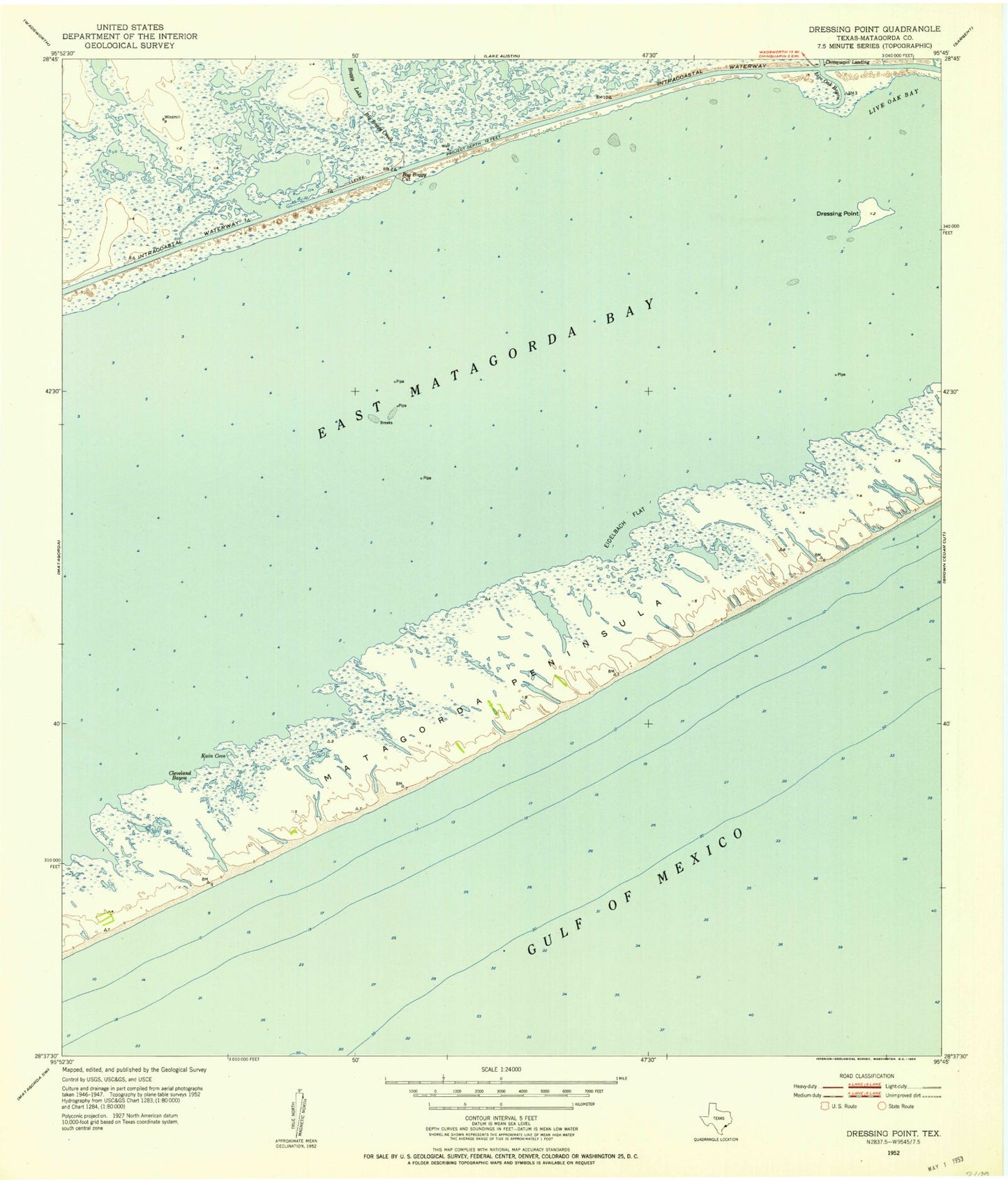
Classic USGS Dressing Point Texas 7.5'x7.5' Topo Map
Regular price
$16.95
Regular price
Sale price
$16.95
Unit price
per
Couldn't load pickup availability
Historical USGS topographic quad map of Dressing Point in the state of Texas. Map scale may vary for some years, but is generally around 1:24,000. Print size is approximately 24" x 27"
This quadrangle is in the following counties: Matagorda.
The map contains contour lines, roads, rivers, towns, and lakes. Printed on high-quality waterproof paper with UV fade-resistant inks, and shipped rolled.
Contains the following named places: Big Boggy Creek, Big Boggy Cut, Boggy Lake, Chinquapin Landing, Cleveland Bayou, Dressing Point, East Matagorda Bay, Eidelbach Flat, Kain Cove, Live Oak Bay, Live Oak Bayou, Matagorda Shore Facility Heliport, Oyster Farm Drain