MyTopo
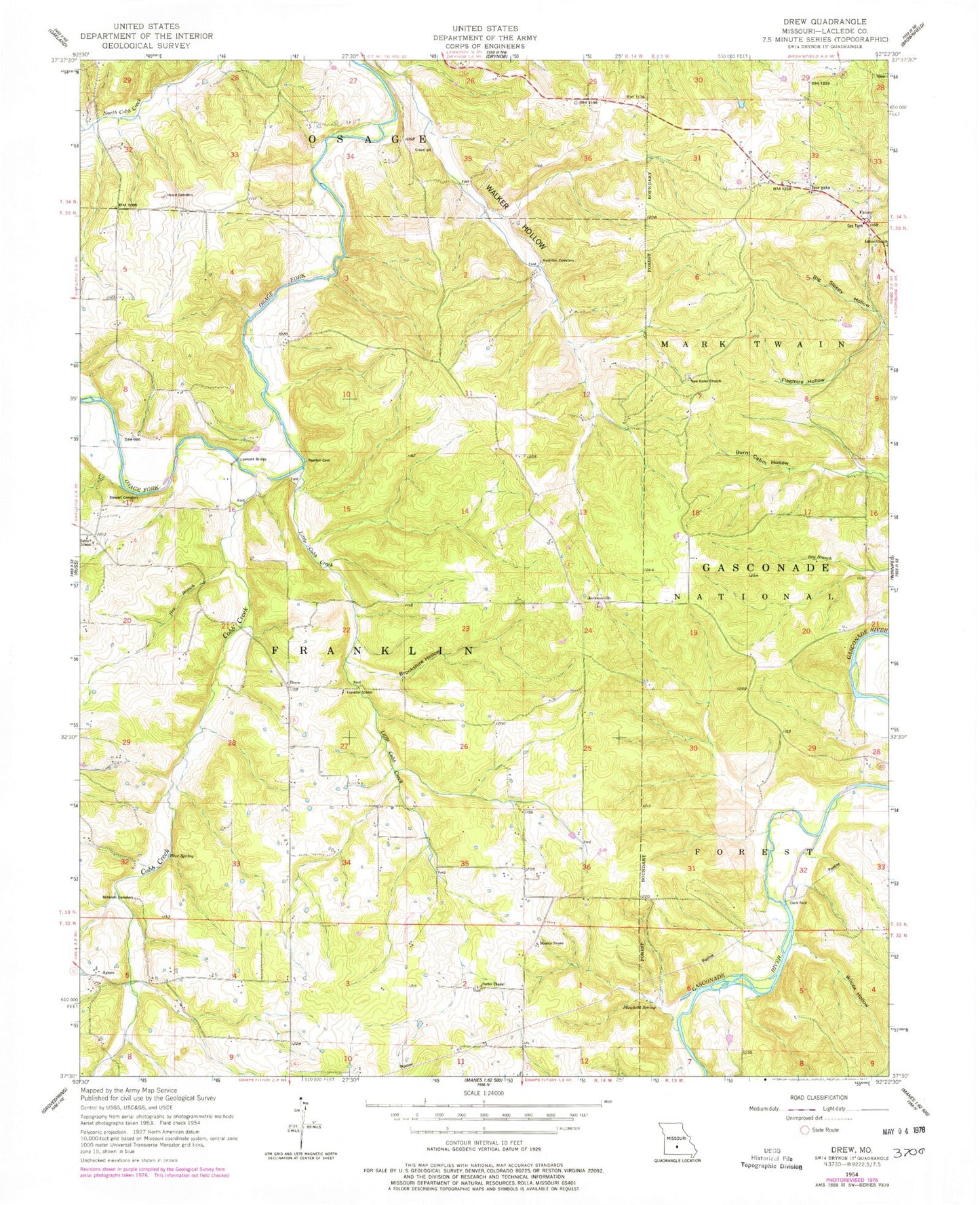
Classic USGS Drew Missouri 7.5'x7.5' Topo Map
Couldn't load pickup availability
Historical USGS topographic quad map of Drew in the state of Missouri. Map scale may vary for some years, but is generally around 1:24,000. Print size is approximately 24" x 27"
This quadrangle is in the following counties: Laclede.
The map contains contour lines, roads, rivers, towns, and lakes. Printed on high-quality waterproof paper with UV fade-resistant inks, and shipped rolled.
Contains the following named places: Agnes, Barnett School, Bee Branch, Big Sleepy Hollow, Blue Spring, Bohanon Cemetery, Brookshire Hollow, Burnt Cabin Hollow, Clark Ford, Cobb Creek, Competition Volunteer Fire Department Station 1, Delto School, Drew, Fairnob School, Falcon, Falcon Church, Falcon Post Office, Flagmire Hollow, Franklin School, Hamilton Cemetery, Harmony Church, Harmony School, Hay Branch, Heard Cemetery, Heard School, Jacksonville, Lambeth Bridge, Little Cobb Creek, Lyons, Mayfield Spring, Moots Store, Morris Lake Dam, New Home Church, Nurse School, Porter Chapel, Stewart Cemetery, Township of Franklin, Wilcox Hollow, Winter Store, ZIP Code: 65470