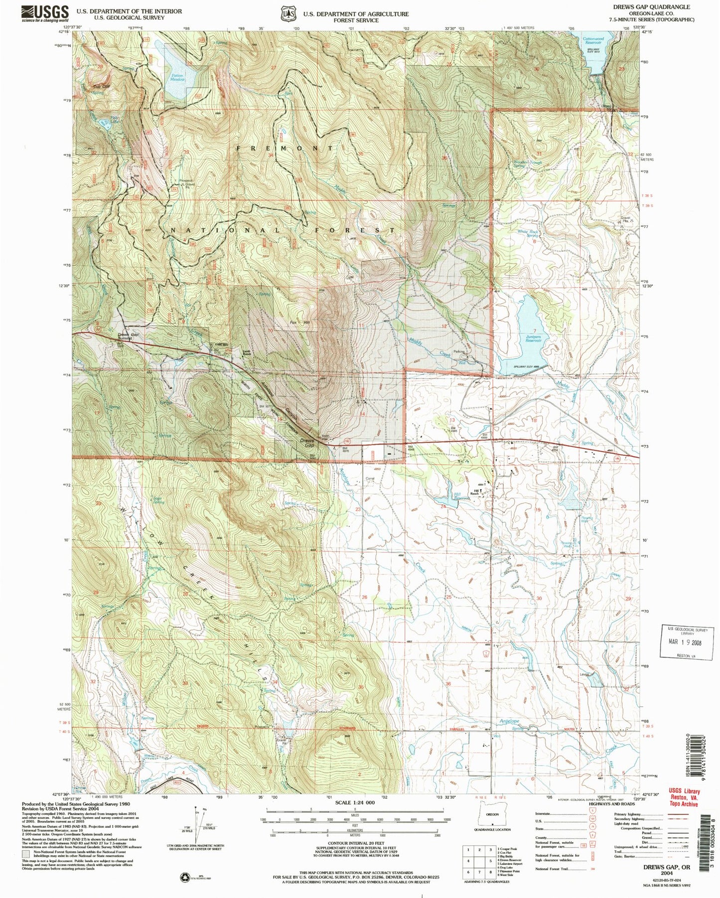
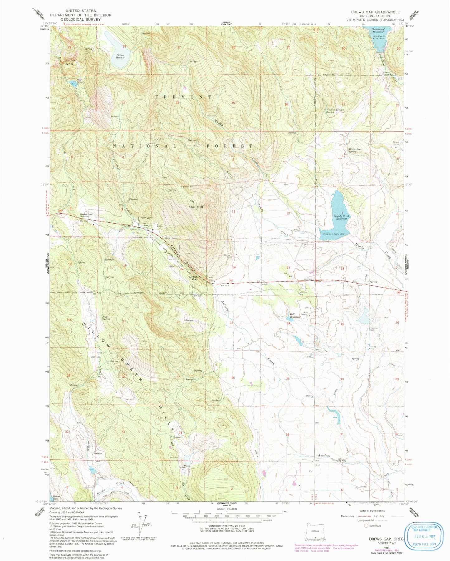
MyTopo
Classic USGS Drews Gap Oregon 7.5'x7.5' Topo Map
Couldn't load pickup availability
Historical USGS topographic quad map of Drews Gap in the state of Oregon. Map scale may vary for some years, but is generally around 1:24,000. Print size is approximately 24" x 27"
This quadrangle is in the following counties: Lake.
The map contains contour lines, roads, rivers, towns, and lakes. Printed on high-quality waterproof paper with UV fade-resistant inks, and shipped rolled.
Contains the following named places: Andy Hill Dam, Andy Hill Reservoir, Antelope Canyon, Booth State Scenic Corridor, Clyde Fenimore Reservoir, Cottonwood Dam, Cub Cliff, Drews Gap, Drews Gap Summit, Fenmore Dam, Fish Lake, Fox Hill, Hill Ranch, Junipers Reservoir, Lakeview Division, Lamb Ranch, Little Muddy Creek, Muddy Creek Dam, North Canal, North Canal Flume, Number Six Canal, Patton Meadow, White Rock Spring, Willow Creek, Willow Creek Dam, Willow Creek Hills, Willow Creek Reservoir, Wooden Trough Spring