MyTopo
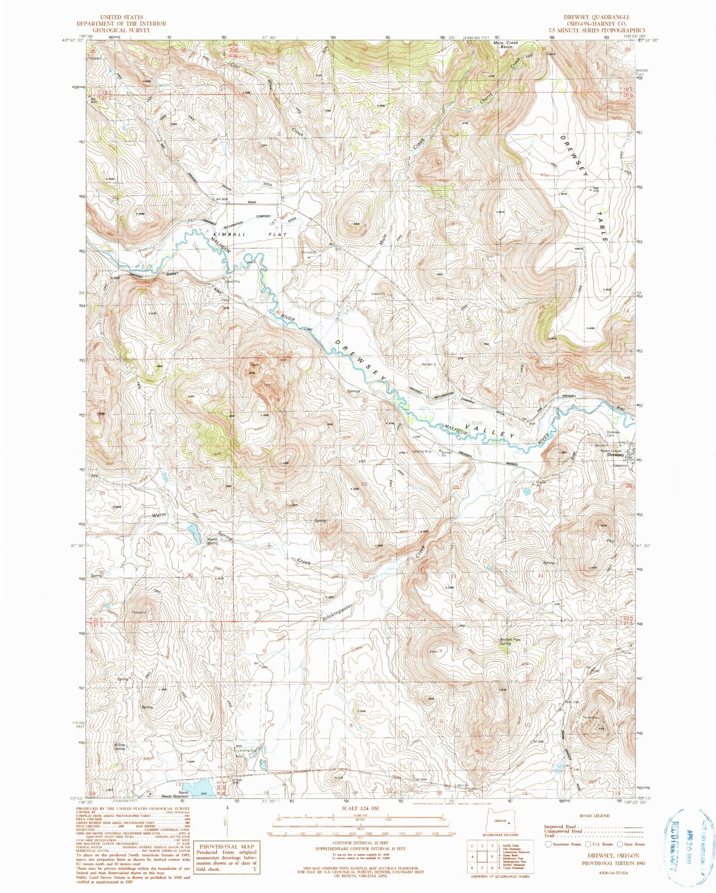
Classic USGS Drewsey Oregon 7.5'x7.5' Topo Map
Couldn't load pickup availability
Historical USGS topographic quad map of Drewsey in the state of Oregon. Map scale may vary for some years, but is generally around 1:24,000. Print size is approximately 24" x 27"
This quadrangle is in the following counties: Harney.
The map contains contour lines, roads, rivers, towns, and lakes. Printed on high-quality waterproof paper with UV fade-resistant inks, and shipped rolled.
Contains the following named places: Broken Pipe Spring, Cherry Creek, Coal Mine Creek, Cronin Ranch, Drewsey, Drewsey Cemetery, Drewsey Elementary School, Drewsey Post Office, Drewsey Reclamation Company Ditch, Drewsey Rodeo Ground, Drewsey Table, Howard Ranch, Kimball Flat, Miller Ditch, Mule Creek, Sheep Spring, Sitz Dam, Sitz Ditch, Stinkingwater Creek, Warm Spring, Warm Spring Creek, Willow Spring