MyTopo
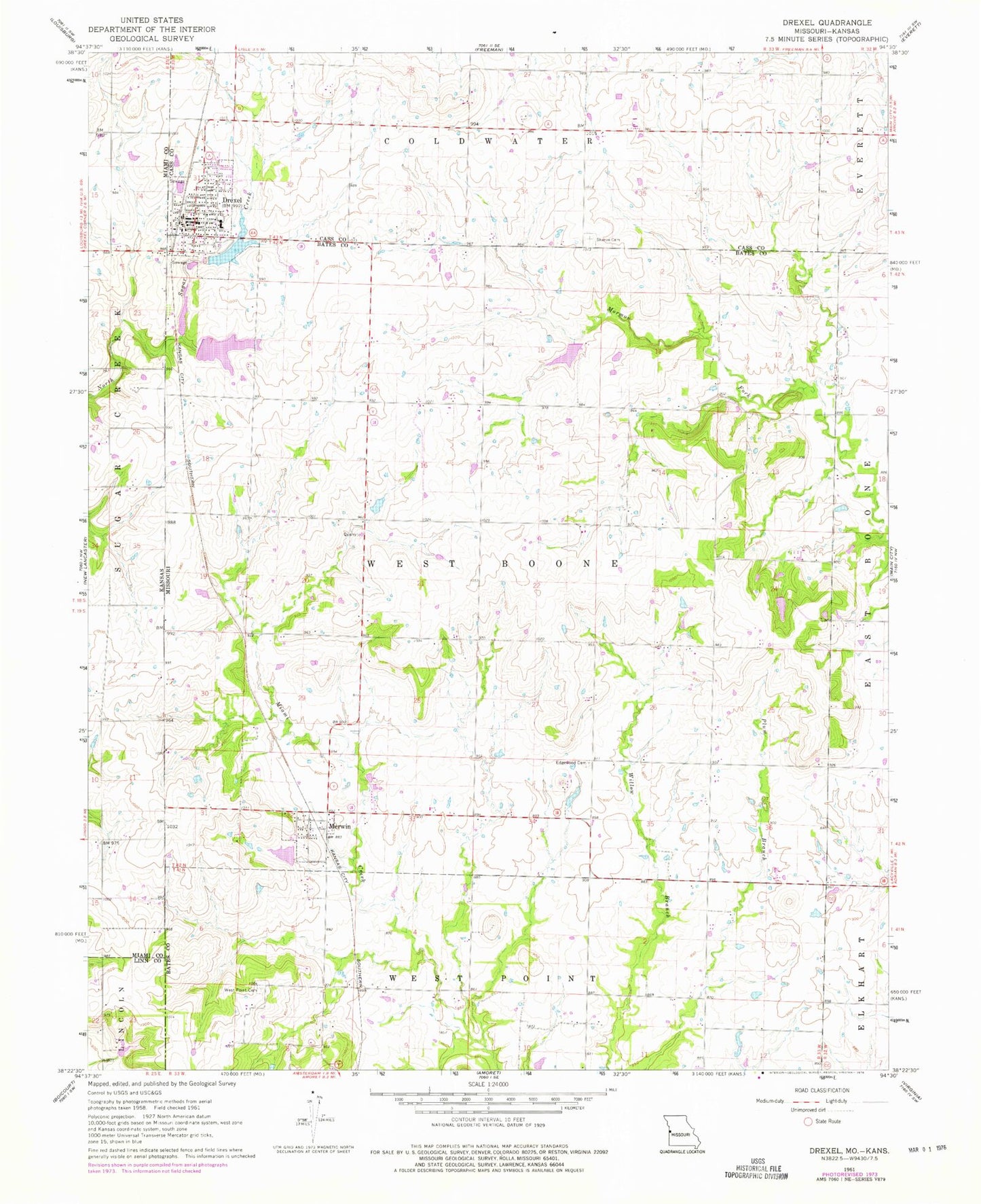
Classic USGS Drexel Missouri 7.5'x7.5' Topo Map
Couldn't load pickup availability
Historical USGS topographic quad map of Drexel in the state of Missouri. Map scale may vary for some years, but is generally around 1:24,000. Print size is approximately 24" x 27"
This quadrangle is in the following counties: Bates, Cass, Linn, Miami.
The map contains contour lines, roads, rivers, towns, and lakes. Printed on high-quality waterproof paper with UV fade-resistant inks, and shipped rolled.
Contains the following named places: Arvin Ranch Airport, Boone Lake Dam, Drexel, Drexel City Reservoir South, Drexel City Reservoir South Dam, Drexel Community Fire Protection Association, Drexel Elementary School, Drexel High School, Drexel Lake, Drexel Lake Dam, Drexel North Wastewater Treatment Facility, Drexel Post Office, Drexel South Wastewater Treatment Facility, Edgewood Cemetery, Edgewood School, Hodges Lake Dam, Maple Grove School, May Airport, May Lake, May Lake Dam, Merwin, Rocking Chair Ranch Lake Dam, Shannon Circle S Ranch Lake Dam, Sharon Cemetery, South Drexel, Township of West Boone, Village of Merwin, West Point Cemetery, Woodland School