MyTopo
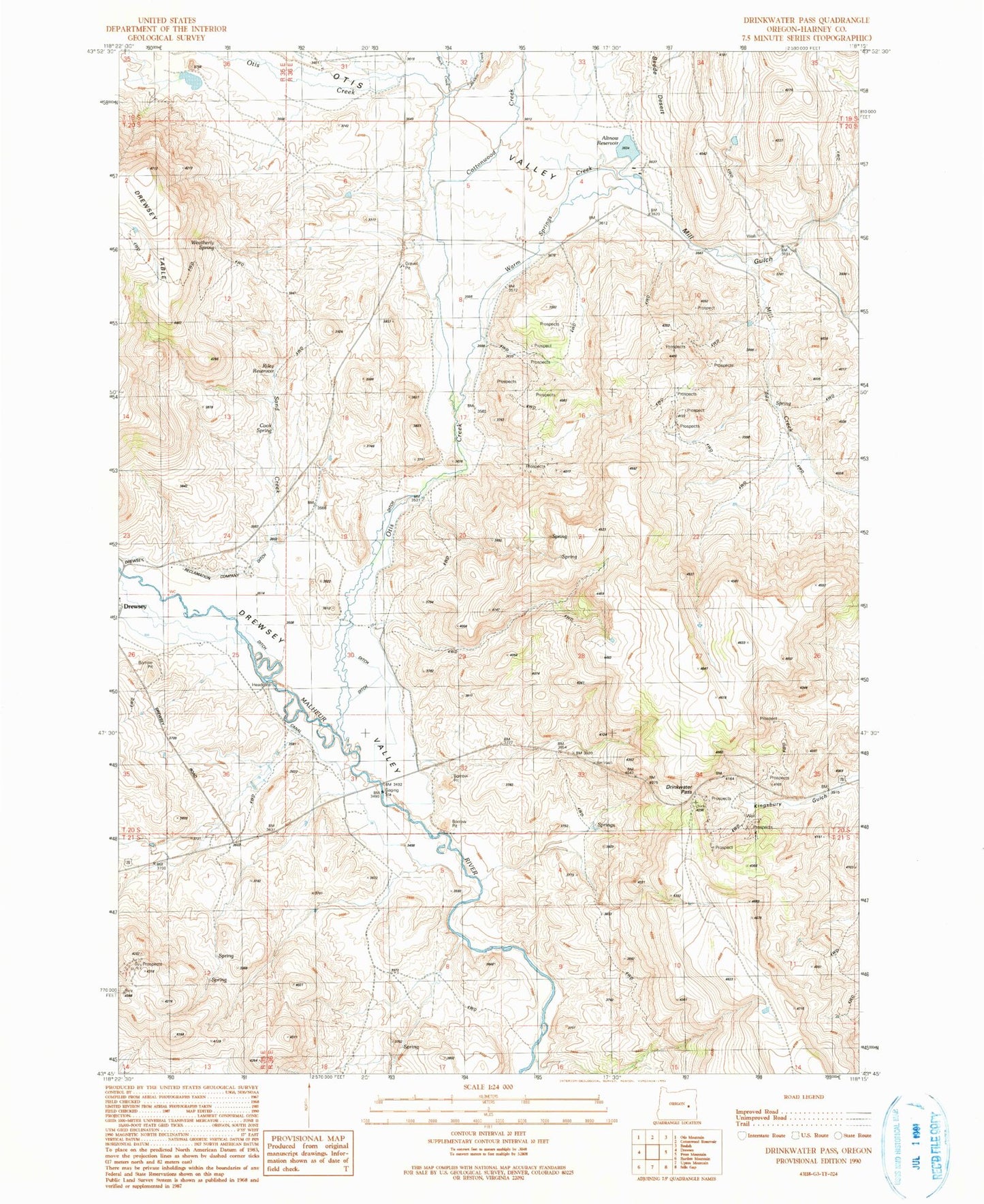
Classic USGS Drinkwater Pass Oregon 7.5'x7.5' Topo Map
Couldn't load pickup availability
Historical USGS topographic quad map of Drinkwater Pass in the state of Oregon. Map scale may vary for some years, but is generally around 1:24,000. Print size is approximately 24" x 27"
This quadrangle is in the following counties: Harney.
The map contains contour lines, roads, rivers, towns, and lakes. Printed on high-quality waterproof paper with UV fade-resistant inks, and shipped rolled.
Contains the following named places: Altnow Dam, Altnow Ranch, Altnow Reservoir, Birch Creek, Cook Spring, Cottonwood Creek, Drewsey Valley, Drinkwater Pass, Jackson Creek, Mill Creek, Mill Gulch, Otis Creek, Otis Valley, Riley Dam, Riley Reservoir, Sand Creek, Stallard Ditch, Stallard Ranch, Warm Springs Creek, Weatherly Spring, Willams Ditch