MyTopo
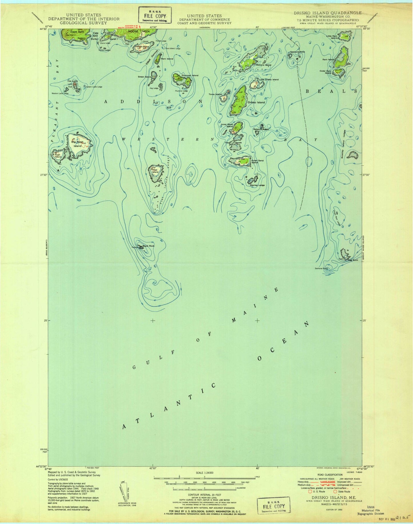
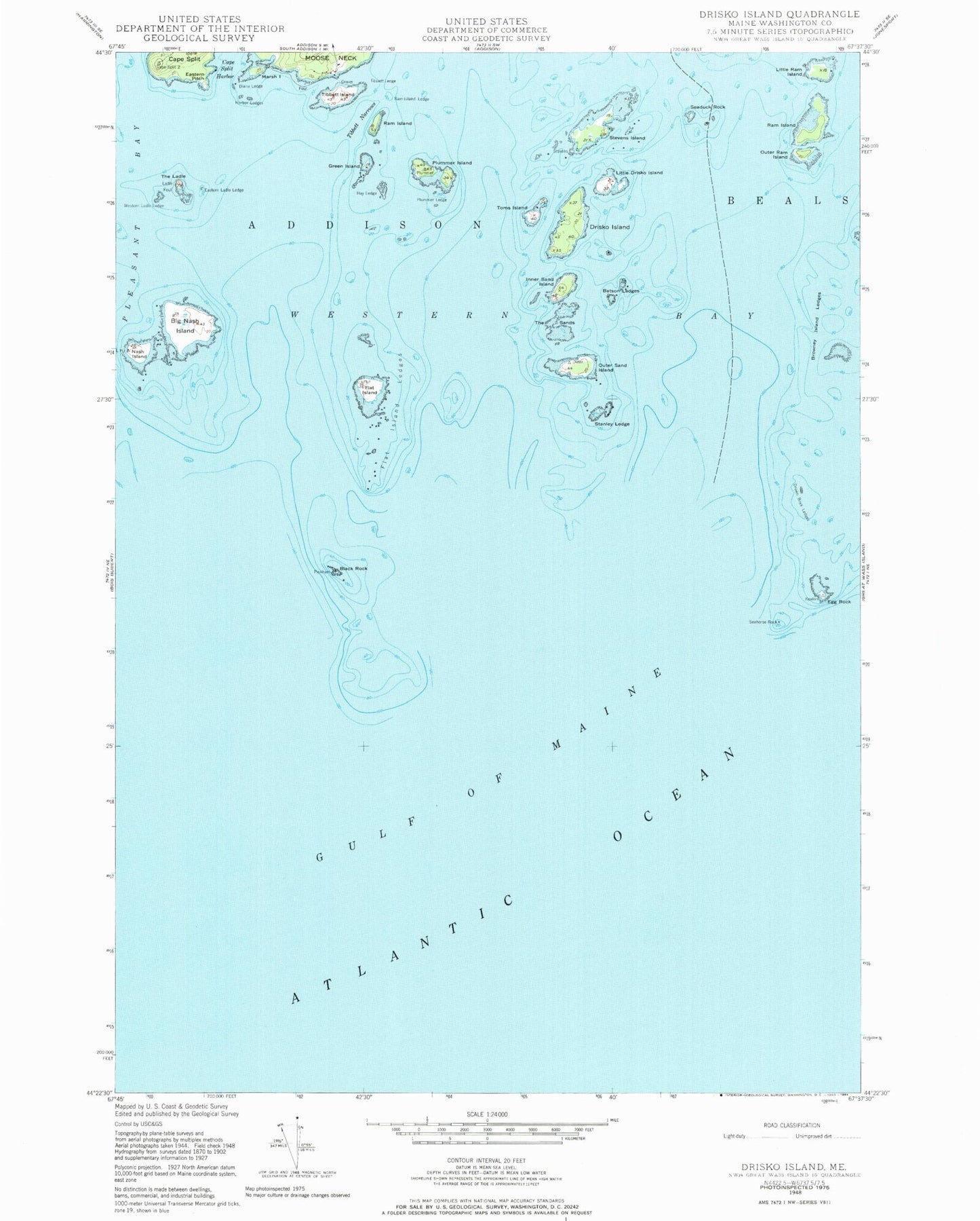
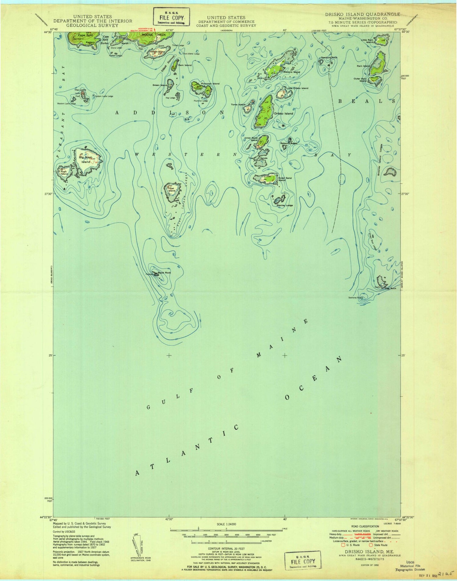
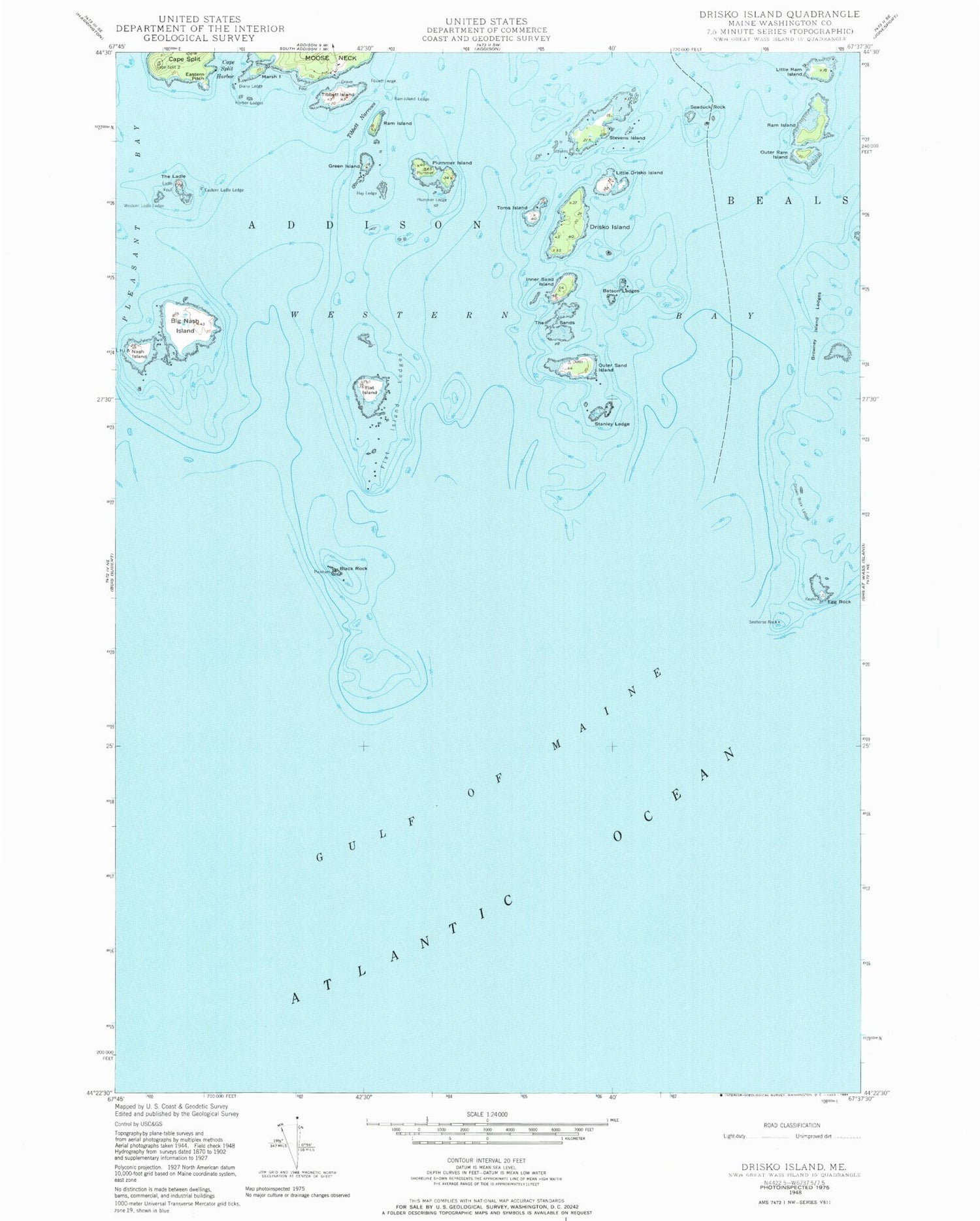
Classic USGS Drisko Island Maine 7.5'x7.5' Topo Map
Couldn't load pickup availability
Historical USGS topographic quad map of Drisko Island in the state of Maine. Map scale may vary for some years, but is generally around 1:24,000. Print size is approximately 24" x 27"
This quadrangle is in the following counties: Washington.
The map contains contour lines, roads, rivers, towns, and lakes. Printed on high-quality waterproof paper with UV fade-resistant inks, and shipped rolled.
Contains the following named places: Batson Ledges, Big Nash Island, Black Rock, Browney Island Ledge, Cape Split Harbor, Diana Ledge, Drisko Island, Drown Boys Ledges, Eastern Ladle Ledge, Eastern Pitch, Egg Rock, Flat Island, Flat Island Ledges, Green Island, Harbor Ledge, Hay Ledge, Inner Sand Island, Little Drisko Island, Little Ram Island, Marsh Island, Nash Island, Nash Island Light, Outer Ram Island, Outer Sand Island, Plummer Island, Plummer Ledge, Ram Island, Ram Island Ledge, Seaduck Rock, Seahorse Rock, Stanley Ledge, Stevens Island, The Ladle, The Sands, Tibbett Island, Tibbett Ledge, Tibbett Narrows, Toms Island, Western Bay, Western Ladle Ledge