MyTopo
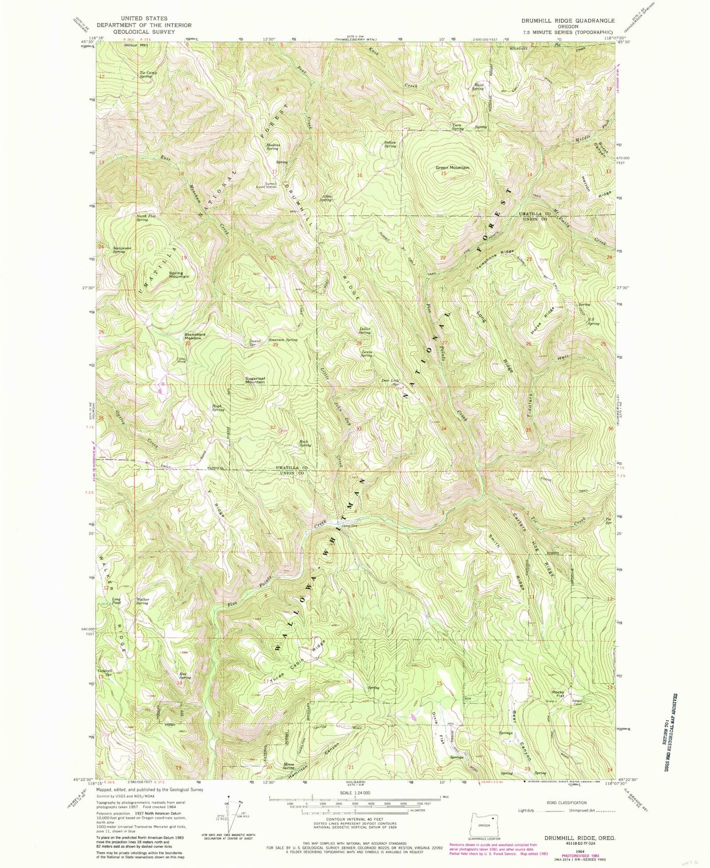
Classic USGS Drumhill Ridge Oregon 7.5'x7.5' Topo Map
Couldn't load pickup availability
Historical USGS topographic quad map of Drumhill Ridge in the state of Oregon. Typical map scale is 1:24,000, but may vary for certain years, if available. Print size: 24" x 27"
This quadrangle is in the following counties: Umatilla, Union.
The map contains contour lines, roads, rivers, towns, and lakes. Printed on high-quality waterproof paper with UV fade-resistant inks, and shipped rolled.
Contains the following named places: Tie Camp Spring, Allen Spring, Burnt Canyon, Camp One, Camp Three, Cantrell Spring, Carters Hog Ridge, Daniel Spring, Deer Lick Spring, Dixie Flat, Dollar Spring, Drumhill Ridge, End Spring, Fiddlers Hell, Five Points Trail, Green Mountain, Horse Ridge, Hoskins Spring, Hugh Spring, Indian Spring, Kellers Cabin, Knob Creek, Lewis Spring, Little John Day Creek, Long Pond, Long Ridge, Middle Fork Mount Emily Creek, Mount Emily Creek, Mouse Spring, North Flat Spring, Rock Spring, Rocky Flat, S S Spring, Sacajawea Spring, Simerson Spring, Smith Ridge, Spring Mountain, Standfield Meadow, Sugarloaf Mountain, Summit Guard Station, Summit Mount Emily Trail, Telephone Ridge, Three Cabin Ridge, Tie Creek, Tie Spring, Walker Spring, Weed Spring, Y Ridge, Yarn Spring, Summit Spring, Fox Hill