
MyTopo
Classic USGS Drumm Summit Nevada 7.5'x7.5' Topo Map
Couldn't load pickup availability
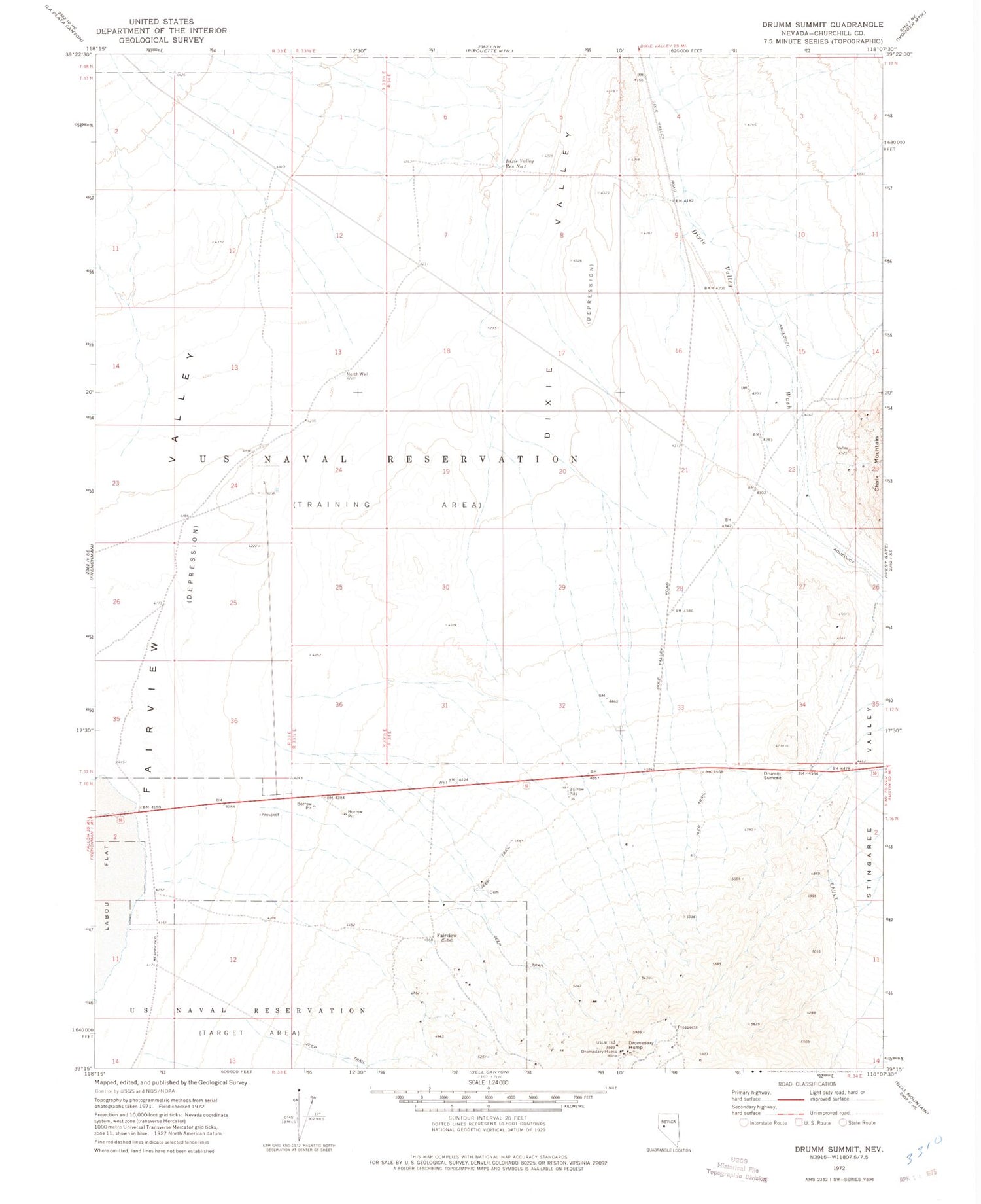
Historical USGS topographic quad map of Drumm Summit in the state of Nevada. Map scale may vary for some years, but is generally around 1:24,000. Print size is approximately 24" x 27"
This quadrangle is in the following counties: Churchill.
The map contains contour lines, roads, rivers, towns, and lakes. Printed on high-quality waterproof paper with UV fade-resistant inks, and shipped rolled.
Contains the following named places: Cyclone Mine, Dixie Valley Reservoir Number One, Dixie Valley Reservoir Number Two, Dromedary Hump, Dromedary Hump Mine, Dromedary Mill, Drumm Summit, Eagles Nest Fairview Mine, Fairfield, Fairfield Post Office, Fairview, Fairview Cemetery, Fairview Consolidated Mine, Fairview Eagle Mine, Fairview Golden Boulder Mine, Fairview Post Office, Fairview Station, Ida Mines, Lena Fairview Mine, Lena Nevada Mine, North Well, Sand Dune Pass, Wonder Wash


