MyTopo
Classic USGS Drummond SE Michigan 7.5'x7.5' Topo Map
Regular price
$16.95
Regular price
Sale price
$16.95
Unit price
per
Couldn't load pickup availability
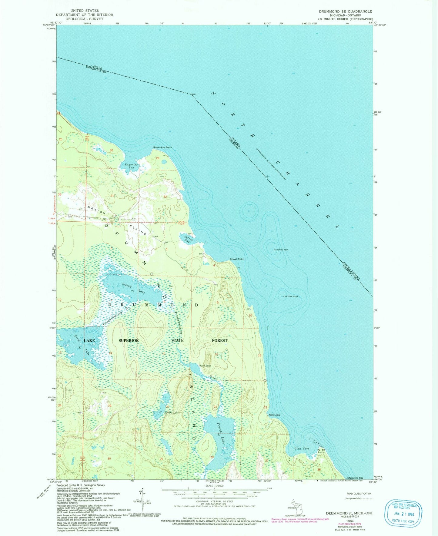
Historical USGS topographic quad map of Drummond SE in the state of Michigan. Map scale may vary for some years, but is generally around 1:24,000. Print size is approximately 24" x 27"
This quadrangle is in the following counties: Chippewa.
The map contains contour lines, roads, rivers, towns, and lakes. Printed on high-quality waterproof paper with UV fade-resistant inks, and shipped rolled.
Contains the following named places: Colton Bay, First Lake, Fourth Lake, Glen Cove, Glen Cove Beach, Glen Point, Humphrey Rock, Lindsay Bank, North Channel, Raynolds Bay, Raynolds Point, Sand Bay, Second Lake, Shoal Point, Stevens Lake, Third Lake, ZIP Code: 49726