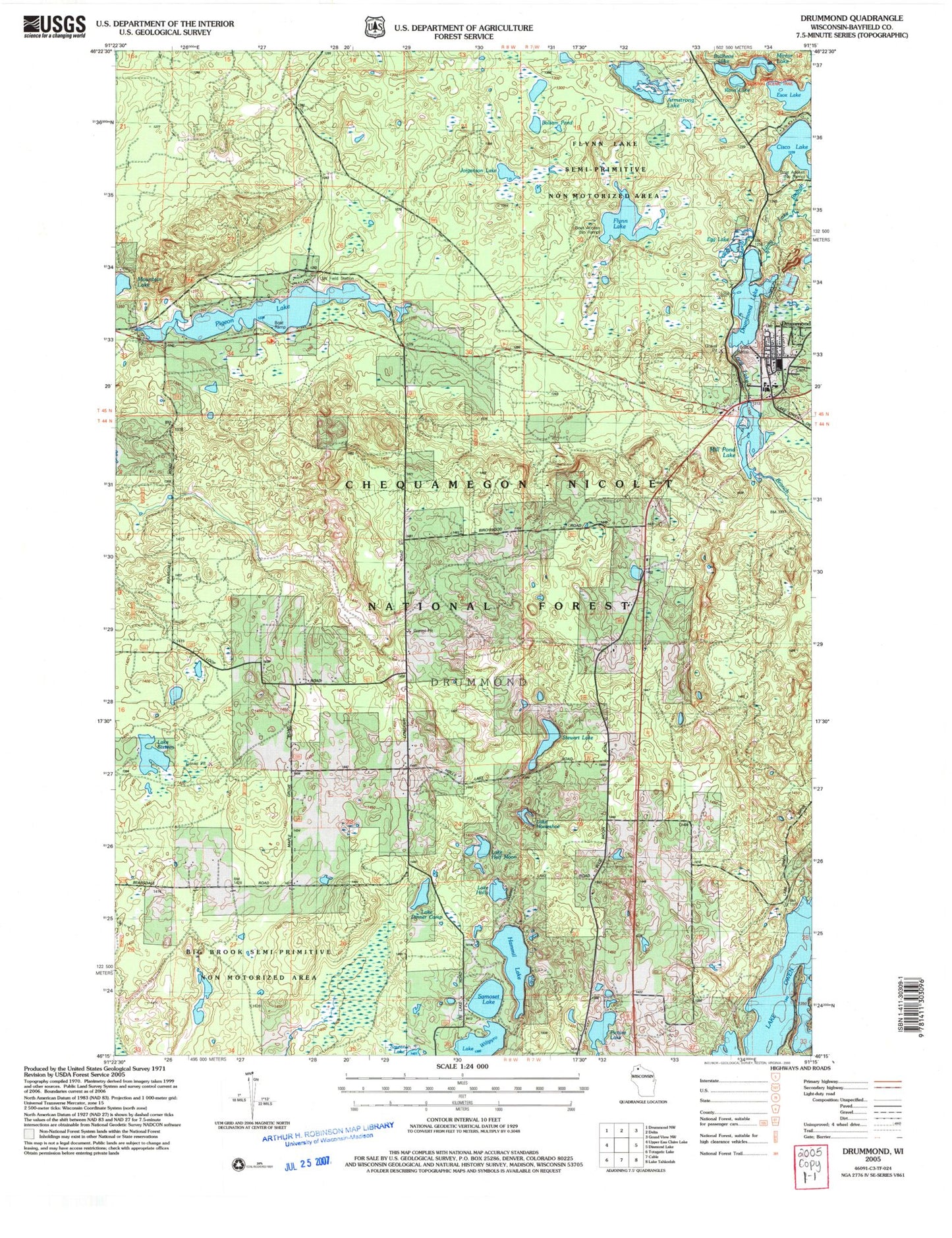
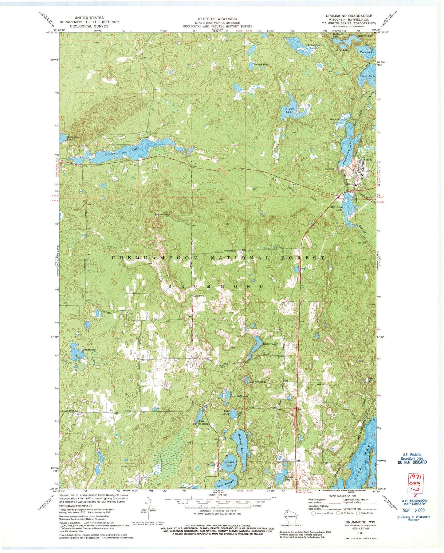
MyTopo
Classic USGS Drummond Wisconsin 7.5'x7.5' Topo Map
Couldn't load pickup availability
Historical USGS topographic quad map of Drummond in the state of Wisconsin. Map scale may vary for some years, but is generally around 1:24,000. Print size is approximately 24" x 27"
This quadrangle is in the following counties: Bayfield.
The map contains contour lines, roads, rivers, towns, and lakes. Printed on high-quality waterproof paper with UV fade-resistant inks, and shipped rolled.
Contains the following named places: Armstrong Lake, Ascend Academy, Balsam Pond, Bullhead Lake, Cisco Lake, Cisco Lake 0.41, Cisco Lake Dam, Cisco Lake Summer Homes, Drummond, Drummond Dam, Drummond Elementary School, Drummond Fire and Rescue, Drummond High School, Drummond Junior High School, Drummond Lake, Drummond Lake 2WP1339 Dam, Drummond Lake 50, Drummond Post Office, Egg Lake, Esox Lake, Flynn Lake, Hammil Lake, Jorgenson Lake, Lake Dinner Camp, Lake Half Moon, Lake Holly, Lake Horseshoe, Lake Owen, Lake Sixteen, Lake Wilipyro, Maple Grove School, Mill Pond Lake, Mill Pond Lake 45, Mirror Lake, Mountain Lake, Old Chippewa Camp Ground, Pigeon Lake, Pigeon Lake Trail, Rana Lake, Samoset Lake, Stewart Lake, Town of Drummond, University of Wisconsin Field Station, ZIP Code: 54832