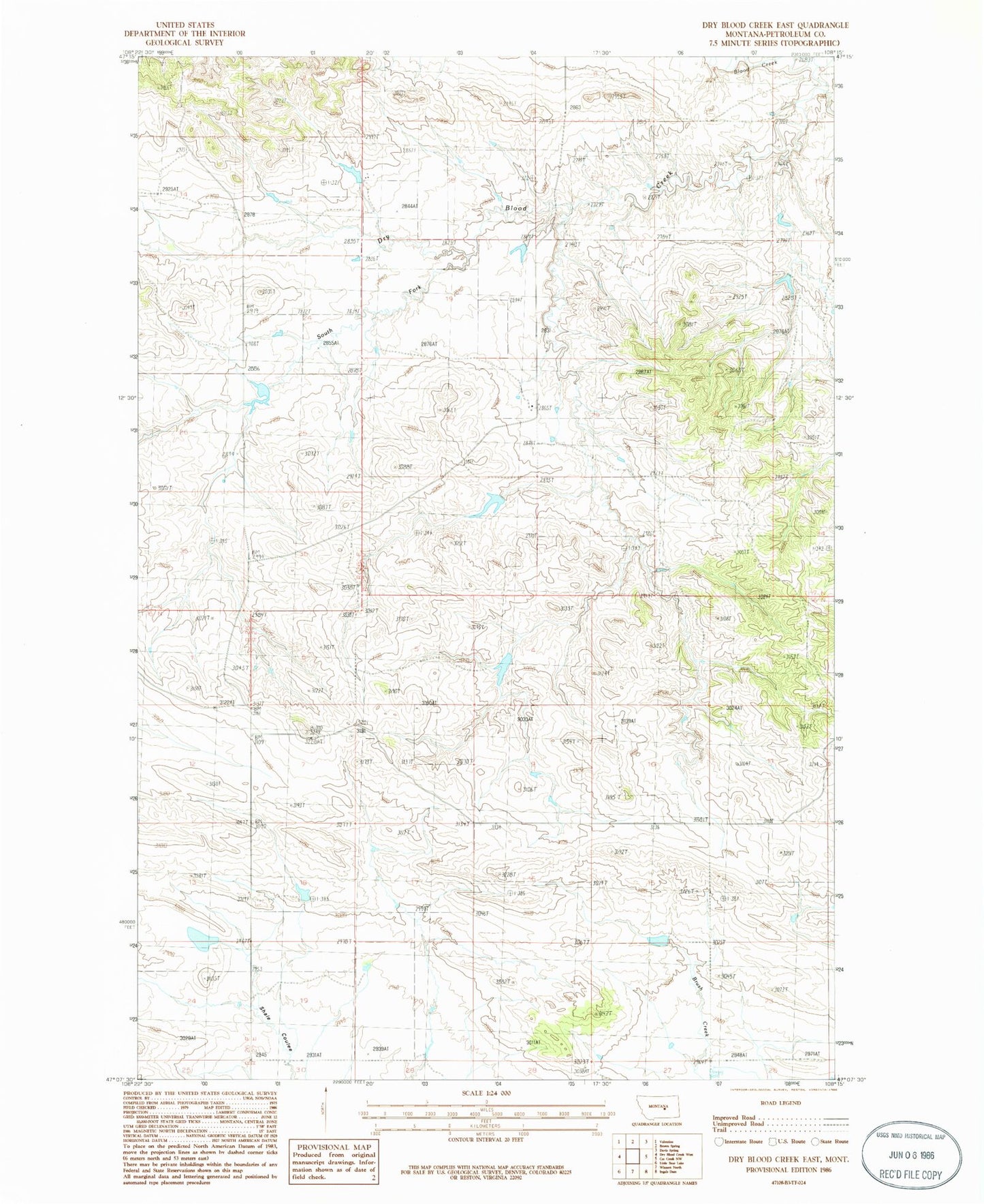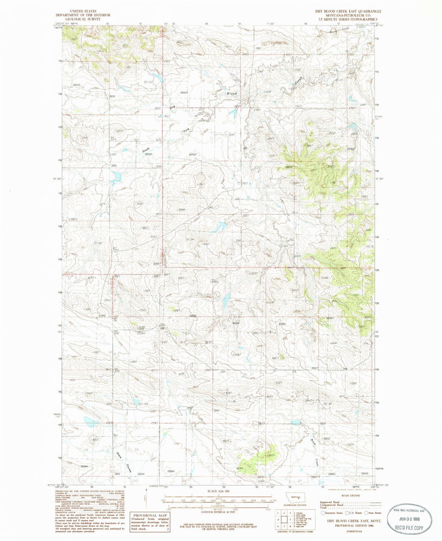
MyTopo
Classic USGS Dry Blood Creek East Montana 7.5'x7.5' Topo Map
Couldn't load pickup availability
Historical USGS topographic quad map of Dry Blood Creek East in the state of Montana. Map scale may vary for some years, but is generally around 1:24,000. Print size is approximately 24" x 27"
This quadrangle is in the following counties: Petroleum.
The map contains contour lines, roads, rivers, towns, and lakes. Printed on high-quality waterproof paper with UV fade-resistant inks, and shipped rolled.
Contains the following named places: 17N27E30CAC_01 Well, 17N27E34AAD_01 Well, Ashley Cemetery, Brady Number 2 Dam, Brady Number 4 Dam, Brady School, Dry Blood Creek, Dry Blood Dam, Quigg-Sutton School, Remley School, Resettlement FSA Number 3 Dam, South Fork Dry Blood Creek, South Fork Dry Blood Creek Dam, Weingart Lane and Livestock Number 1 Dam