MyTopo
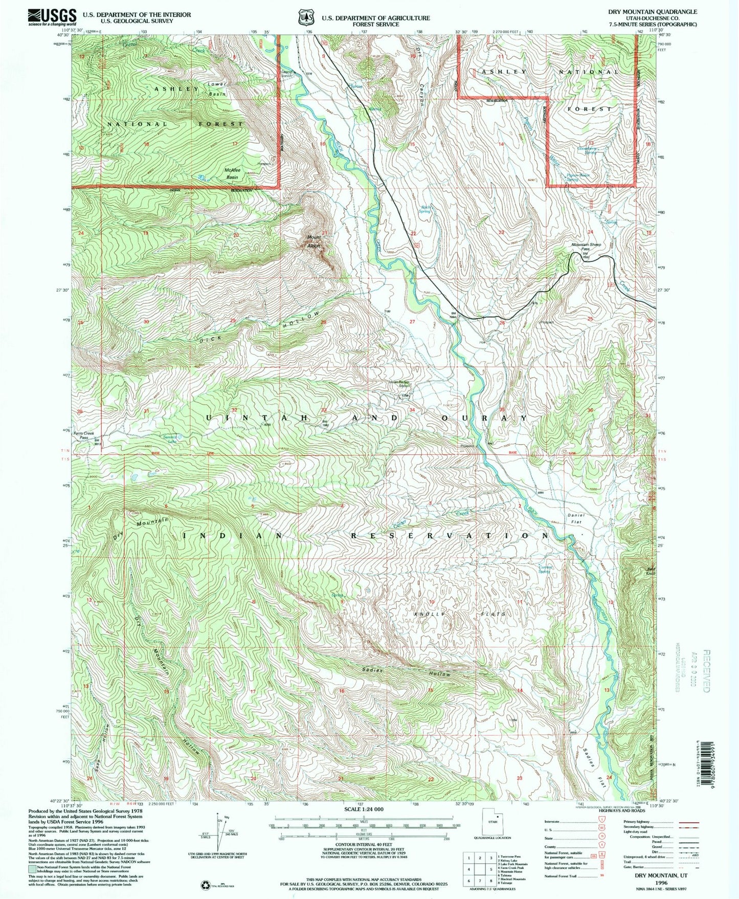
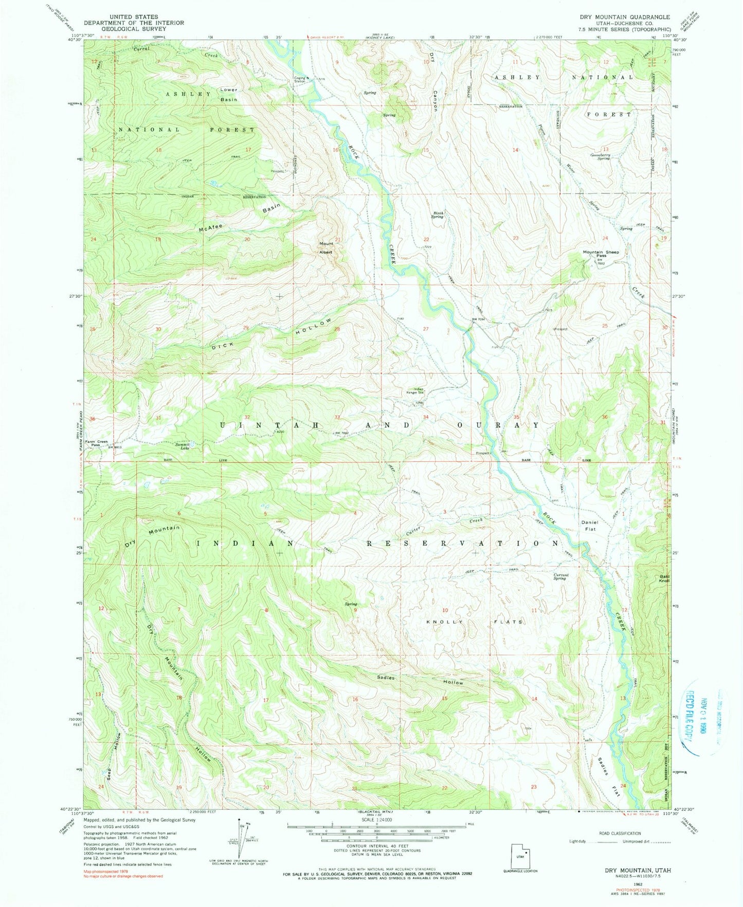
Classic USGS Dry Mountain Utah 7.5'x7.5' Topo Map
Couldn't load pickup availability
Historical USGS topographic quad map of Dry Mountain in the state of Utah. Map scale may vary for some years, but is generally around 1:24,000. Print size is approximately 24" x 27"
This quadrangle is in the following counties: Duchesne.
The map contains contour lines, roads, rivers, towns, and lakes. Printed on high-quality waterproof paper with UV fade-resistant inks, and shipped rolled.
Contains the following named places: Birch Spring, Carter Creek, Corral Creek, Currant Spring, Daniel Flat, Dick Hollow, Dry Canyon, Dry Mountain, Farm Creek Pass, Gooseberry Spring, Indian Ranger Station, Knolly Flats, Lower Basin, McAfee Basin, Mount Albert, Mountain Sheep Pass, Pigeon Water Spring, Sadies Flat, Sadies Hollow, Summit Lake