MyTopo
Classic USGS Dry Valley Idaho 7.5'x7.5' Topo Map
Regular price
$16.95
Regular price
Sale price
$16.95
Unit price
per
Couldn't load pickup availability
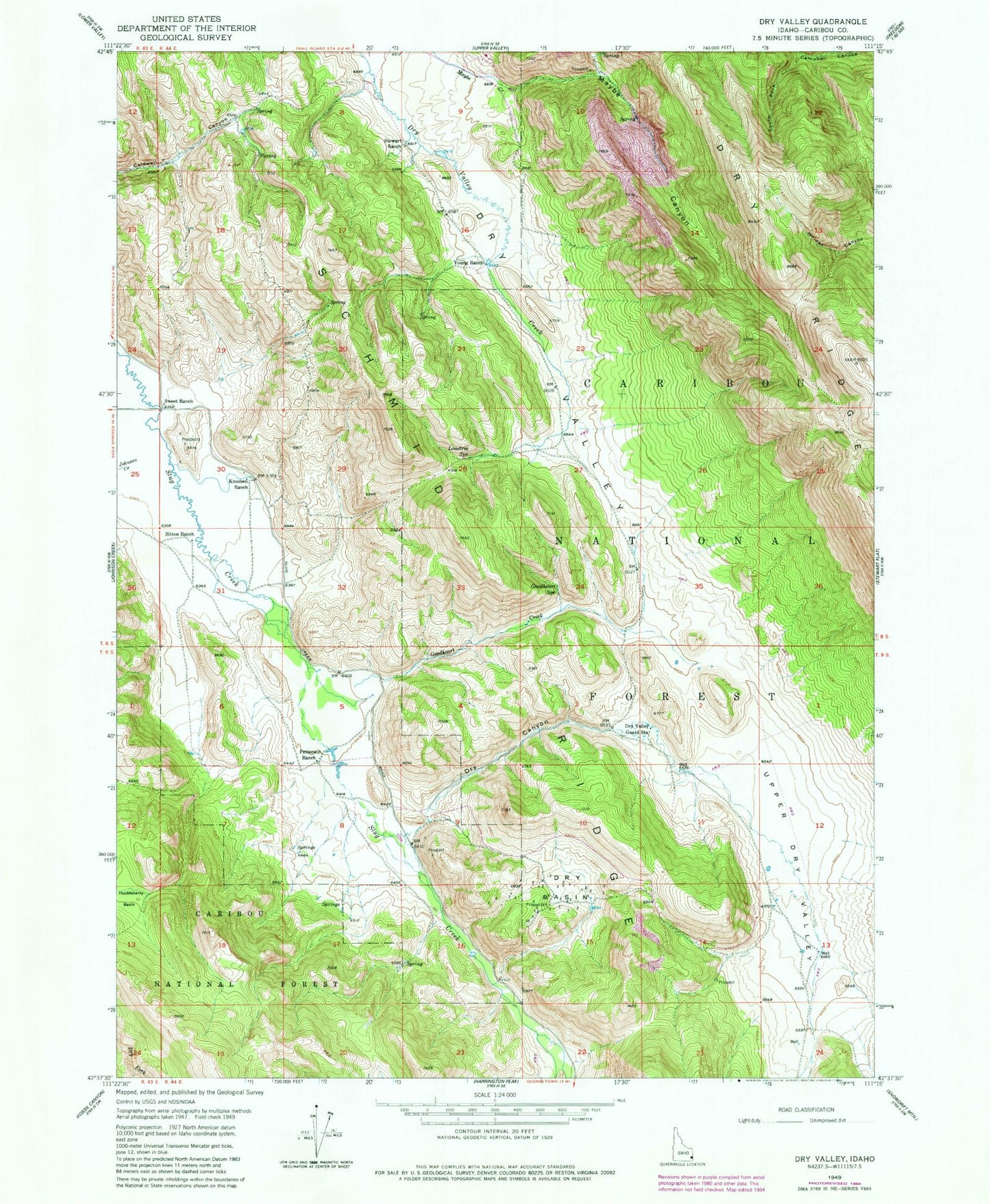
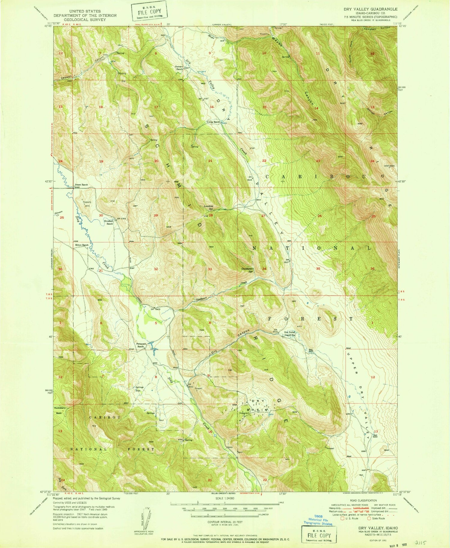
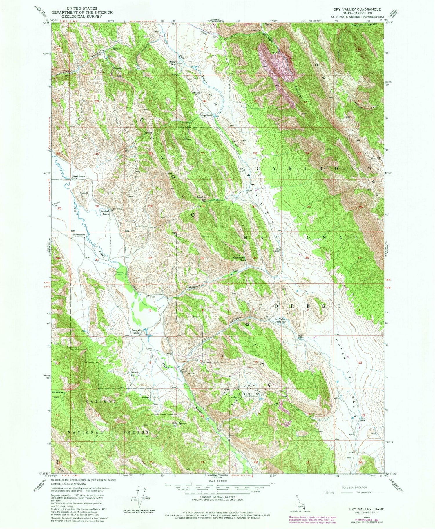
Historical USGS topographic quad map of Dry Valley in the state of Idaho. Map scale may vary for some years, but is generally around 1:24,000. Print size is approximately 24" x 27"
This quadrangle is in the following counties: Caribou.
The map contains contour lines, roads, rivers, towns, and lakes. Printed on high-quality waterproof paper with UV fade-resistant inks, and shipped rolled.
Contains the following named places: Bitton Ranch, Dry Basin, Dry Canyon, Dry Valley Guard Station, Goodheart Creek, Goodheart Spring, Huckleberry Basin, Johnson Creek, Knudsen Ranch, Lonetree Spring, Mabey Canyon, Petterson Ranch, Schmid Ridge, Stewart Ranch, Sweet Ranch, Upper Dry Valley, Young Ranch