
MyTopo
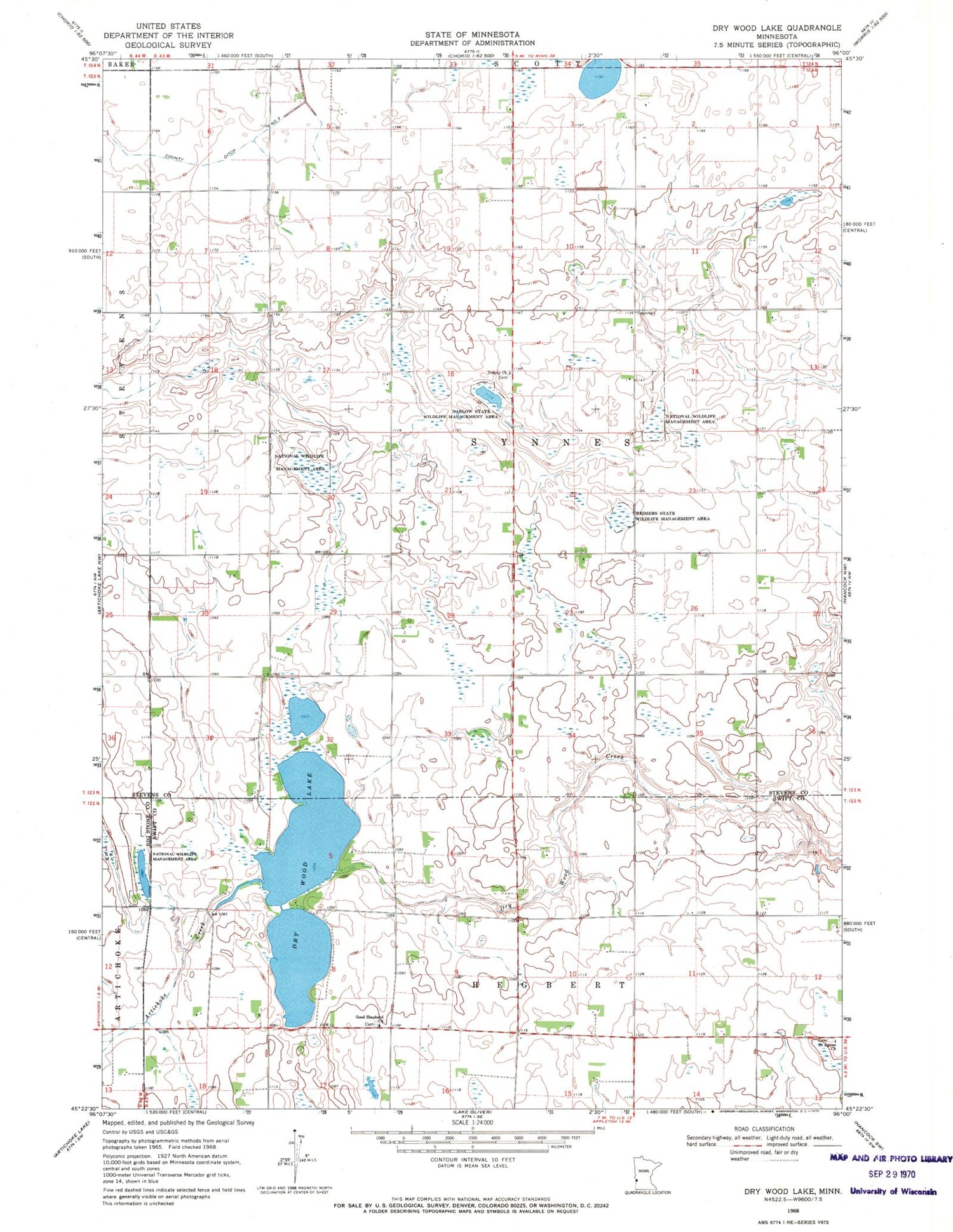
Classic USGS Dry Wood Lake Minnesota 7.5'x7.5' Topo Map
Couldn't load pickup availability
Historical USGS topographic quad map of Dry Wood Lake in the state of Minnesota. Map scale may vary for some years, but is generally around 1:24,000. Print size is approximately 24" x 27"
This quadrangle is in the following counties: Big Stone, Stevens, Swift.
The map contains contour lines, roads, rivers, towns, and lakes. Printed on high-quality waterproof paper with UV fade-resistant inks, and shipped rolled.
Contains the following named places: Artichoke Creek, County Ditch Number Three, Dablow State Wildlife Management Area, Dry Wood Lake, Drywood Creek Fish Barrier Dam, Good Shepherd Cemetery, Good Shepherd Church, Reimers State Wildlife Management Area, Saint Agnes Cemetery, Saint Agnes Church, Synnes Cemetery, Township of Synnes, Trinity Church, ZIP Code: 56207


