MyTopo
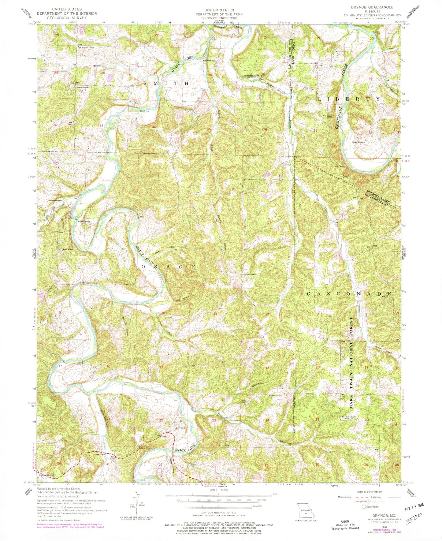
Classic USGS Drynob Missouri 7.5'x7.5' Topo Map
Couldn't load pickup availability
Historical USGS topographic quad map of Drynob in the state of Missouri. Map scale may vary for some years, but is generally around 1:24,000. Print size is approximately 24" x 27"
This quadrangle is in the following counties: Laclede, Pulaski.
The map contains contour lines, roads, rivers, towns, and lakes. Printed on high-quality waterproof paper with UV fade-resistant inks, and shipped rolled.
Contains the following named places: Abo, Abo Post Office, Atoka, Atoka Post Office, Basin Hollow, Bell Branch, Brandon Cemetery, Celeste, Celeste Post Office, Cole Creek, Core Creek, Crooked Creek, Crossroads Church, Crossroads School, Dry Hollow, Drynob, Dunlap Lake Dam, Elam Hollow, Flynn, Harrill Ford, Hull Ford Bridge, Joe Branch, Matzie Airport, McGee Lake Dam, Mill Creek, Millstone Hollow, Mount Pleasant Church, Mount Salem Church, Mount Salem School, Murrell Hollow, Nebo Falcon Rural Volunteer Fire Department Station 2, Nebo Falcon Rural Volunteer Fire Department Station 4, North Cobb Creek, North Fork Crooked Creek, Number 55 Lake, Oakland School, Prairie Creek, Prairie Creek School, Rippy Cemetery, Rippy School, Similin Cemetery, Similin Creek, Similin School, South Fork Crooked Creek, Stockade Church, Stockdale School, Stohr Lake Dam, Sunny View Church, Township of Osage, Walker Hollow, Wilson Cemetery, Wood Creek, Wrinkle Cemetery