
MyTopo
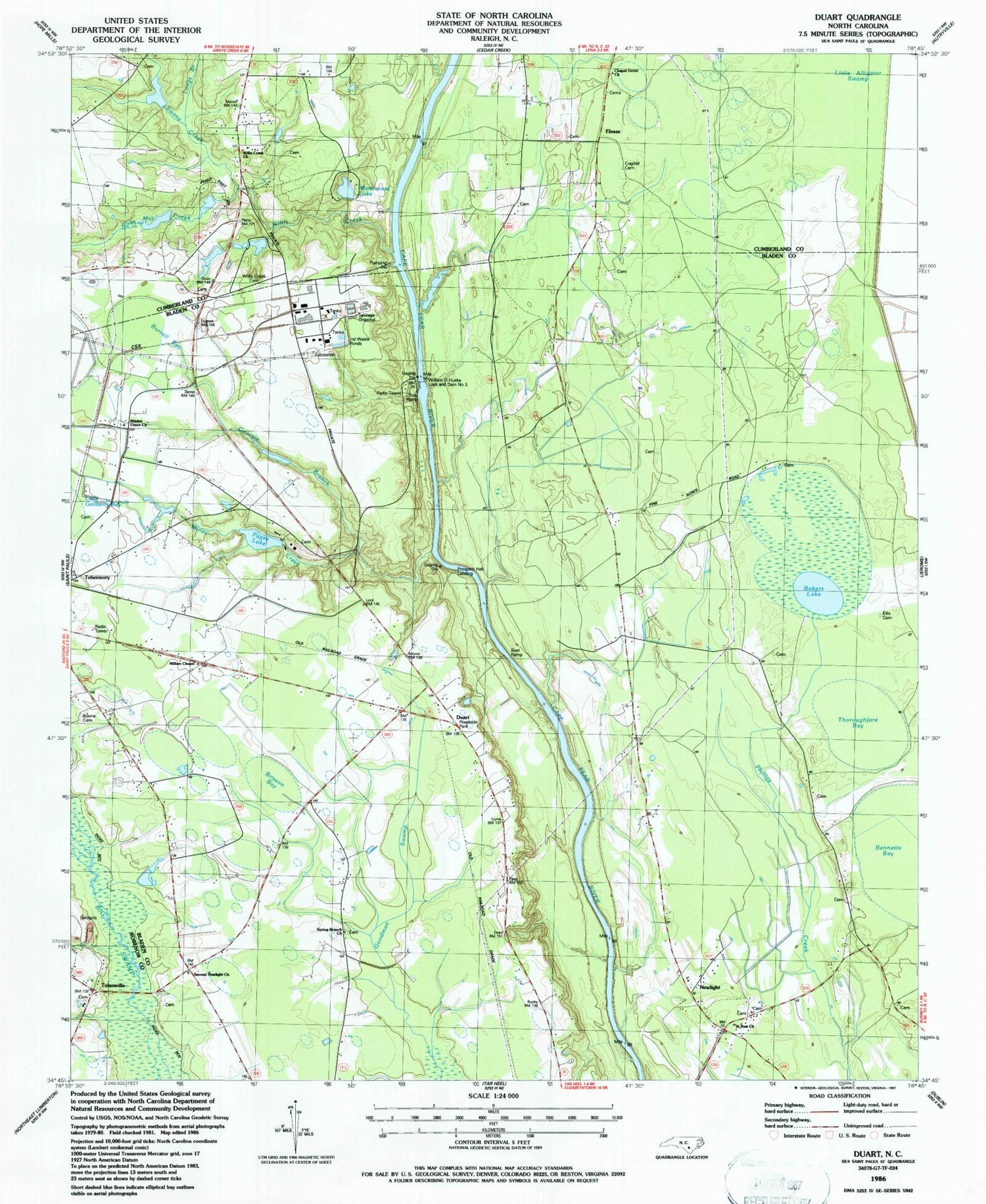
Classic USGS Duart North Carolina 7.5'x7.5' Topo Map
Couldn't load pickup availability
Historical USGS topographic quad map of Duart in the state of North Carolina. Map scale may vary for some years, but is generally around 1:24,000. Print size is approximately 24" x 27"
This quadrangle is in the following counties: Bladen, Cumberland, Robeson.
The map contains contour lines, roads, rivers, towns, and lakes. Printed on high-quality waterproof paper with UV fade-resistant inks, and shipped rolled.
Contains the following named places: Bakers Lake, Big Marsh Swamp, Bladen Union Church, Boone Cemetery, Brisson Bay, Burrell Bay, Cedar Creek Fish Farm, Chapel Grove Church, Cogdell Cemetery, Duart, Elease, Ellis Cemetery, Gallberry Swamp, Georgia Branch, Kirks Mill Creek, Little Alligator Swamp, Longs Branch, Marsh Wood Lake, Marsh Wood Lake Dam, Millars Chapel, Miller Chapel, Mines Creek, Newlight, Newlight School, Pages Lake, Pages Lake Dam, Prospect Hall Landing, Saint Rest Church, Second Newlight Church, Spring Branch Church, Swans Creek, Thoroughfare Bay, Tolar Landing, Tolarsville, Township of Hollow, Verdery Pond, Verdery Pond Dam, William O Huske Lock and Dam Number 3, Willis Creek, Willis Creek Cemetery, Willis Creek Church


