MyTopo
Classic USGS Dubach Louisiana 7.5'x7.5' Topo Map
Couldn't load pickup availability
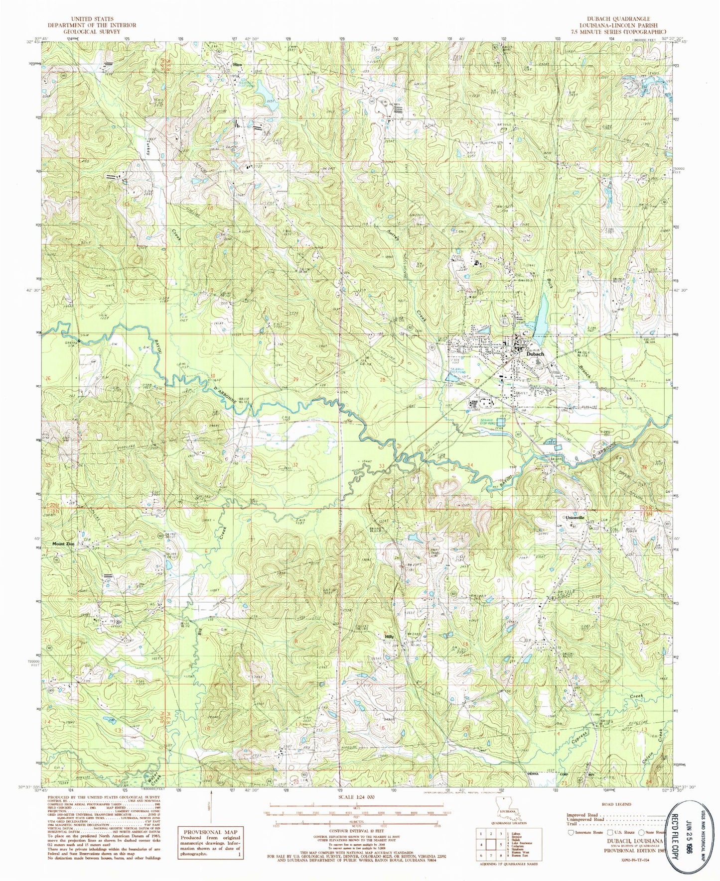
Historical USGS topographic quad map of Dubach in the state of Louisiana. Map scale may vary for some years, but is generally around 1:24,000. Print size is approximately 24" x 27"
This quadrangle is in the following counties: Lincoln.
The map contains contour lines, roads, rivers, towns, and lakes. Printed on high-quality waterproof paper with UV fade-resistant inks, and shipped rolled.
Contains the following named places: Autrey Cemetery, Big Creek, Buck Branch, Dubach, Dubach High School, Dubach Police Department, Dubach Post Office, Dubach United Methodist Church, First Baptist Church, Grace Baptist Church, Greensboro, Henry, Henry Cemetery, Hico, Hico Baptist Church, Hico Elementary School, Hico Gas Field, Hico School, Hilly, Hilly Lookout Tower, Hopewell Cemetery, Hopewell Church, Knowles Oil and Gas Field, KPCH-FM (Dubach), Lake Dubach Dam, Larance Ferry, Macedonia School, Mays Bridge, Middlefork Gas Field, Mount Zion, Mount Zion Number 2 Baptist Church, New Prospect Baptist Church, Parish Governing Authority District 4, Pine Grove Cemetery, Providence Cemetery, Town of Dubach, Turkey Creek, Unionville, Vining Mills, Wafer Creek, Ward Four, Wise, ZIP Code: 71235