MyTopo
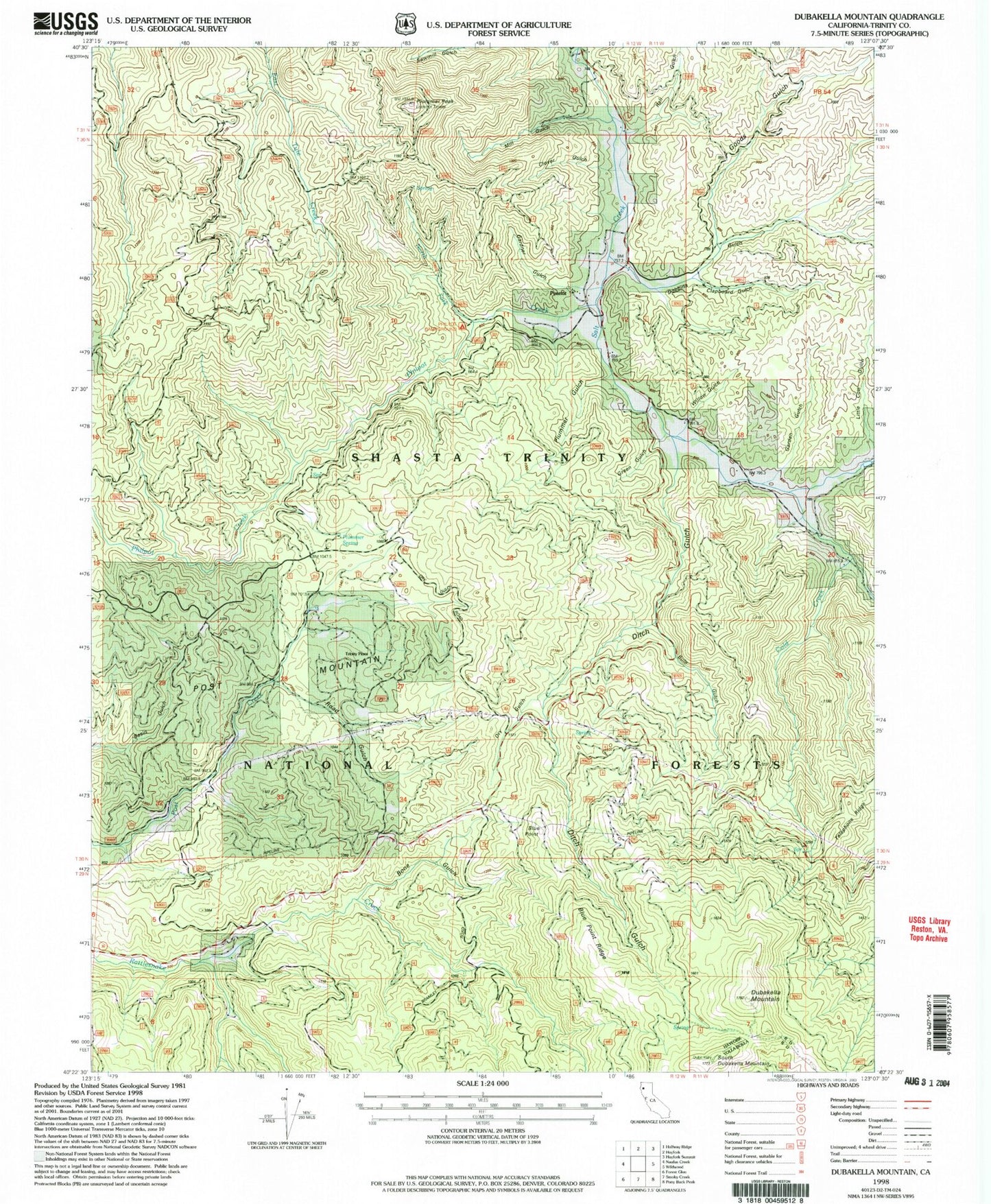
Classic USGS Dubakella Mountain California 7.5'x7.5' Topo Map
Couldn't load pickup availability
Historical USGS topographic quad map of Dubakella Mountain in the state of California. Map scale may vary for some years, but is generally around 1:24,000. Print size is approximately 24" x 27"
This quadrangle is in the following counties: Trinity.
The map contains contour lines, roads, rivers, towns, and lakes. Printed on high-quality waterproof paper with UV fade-resistant inks, and shipped rolled.
Contains the following named places: Blue Point, Blue Point Ridge, Bone Gulch, Bule Gulch, Clapboard Gulch, Clover Gulch, Cold Creek, Cold Springs Campground, Ditch Gulch, Dobbins Gulch, Dry Gulch, Dubakella Mountain, Garden Gulch, Gardner Gulch, Goods Gulch, Hayfork Volunteer Fire Department, Little Cow Gulch, Mill Gulch, North Fork Philpot Creek, Peanut, Philpot Campground, Philpot Creek, Plummer Gulch, Plummer Peak, Plummer Spring, Post Mountain, Post Mountain Census Designated Place, Post Mountain Volunteer Fire Department, Post Ranger Station, Rail Gulch, Road Gulch, Salt Creek School, Salt Gulch, Sawmill Gulch, South Dubakella Mountain, Telephone Ridge, Trinity Pines, Willow Gulch